Acknowledgement
The processing of these artefacts will not be possible without funding and support from the National Heritage Board as well as the contribution of Michael Ng, Fazleen Karlan, Abdul Latiff, and Vivi Lim.
1. Introduction to the Site
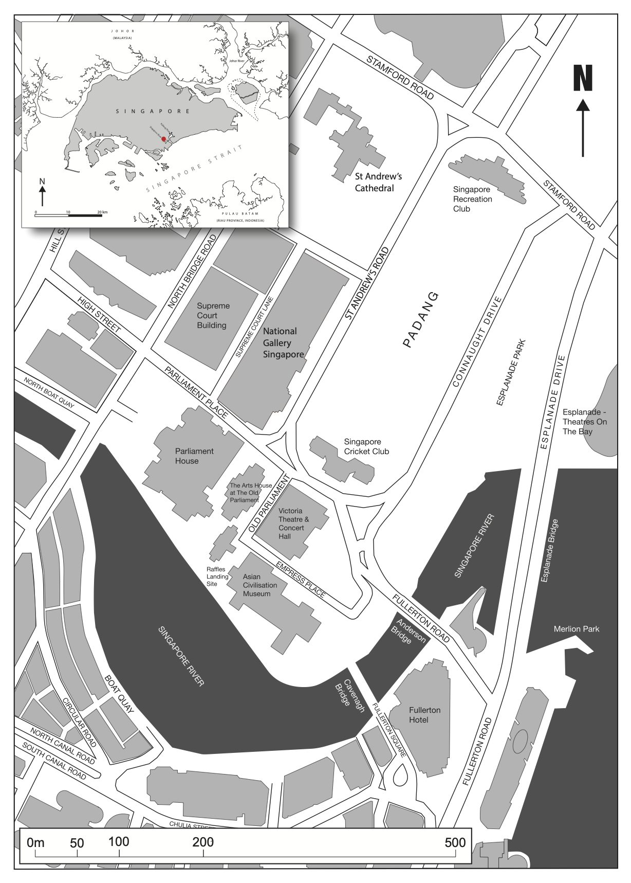
The ISEAS Archaeology Unit (AU) excavated the Empress Place (EMP) site from 2 February 2015 to 12 April 2015. This was conducted during construction works to repurpose the open lawn in front of the Victoria Theatre and Concert Hall into a plaza, to commemorate the 50th anniversary (SG50) of Singapore’s independence. The transplanting of mature rain trees, which required substantial earthworks, posed the main concern for archaeologists who, eight months prior (2014), found 14th-century deposits after excavating two test pits at the site. As in situ preservation was not considered an option by the developers, a large-scale rescue excavation was made possible with funding and support from the National Heritage Board (NHB), the Urban Redevelopment Authority (URA), the Ministry of National Development, as well as private donors. Members of the public and from various institutions such as the Probation Services, the Ministry of Social Services, and the Ministry of Defence also provided fieldwork assistance. With additional funding from the NHB, this post-excavation report aims to provide technical information about the excavation as well as a sample baseline dataset of the finds for further research.
1.1. Summary of the History of the EMP Site

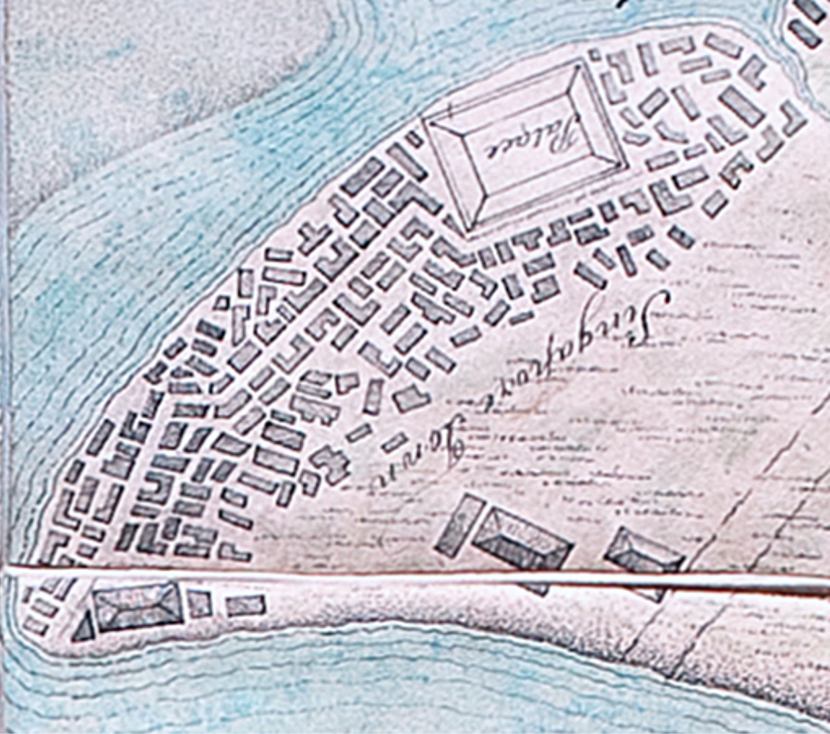
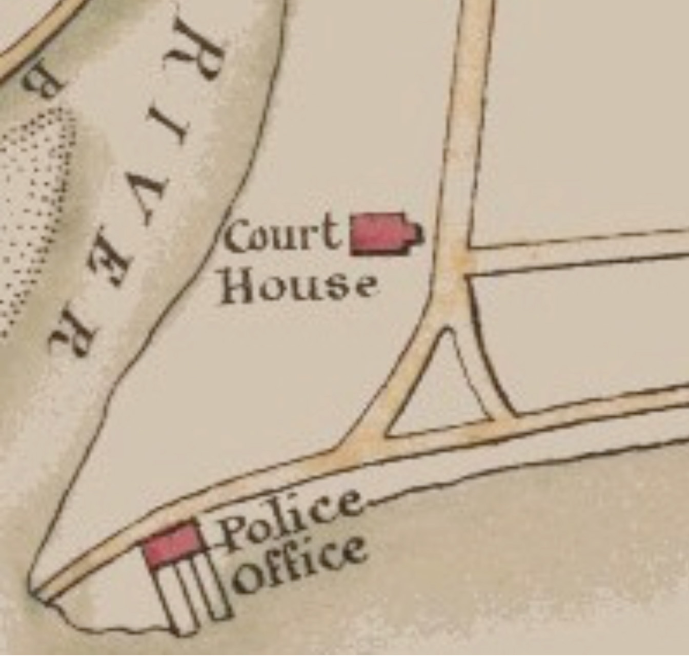
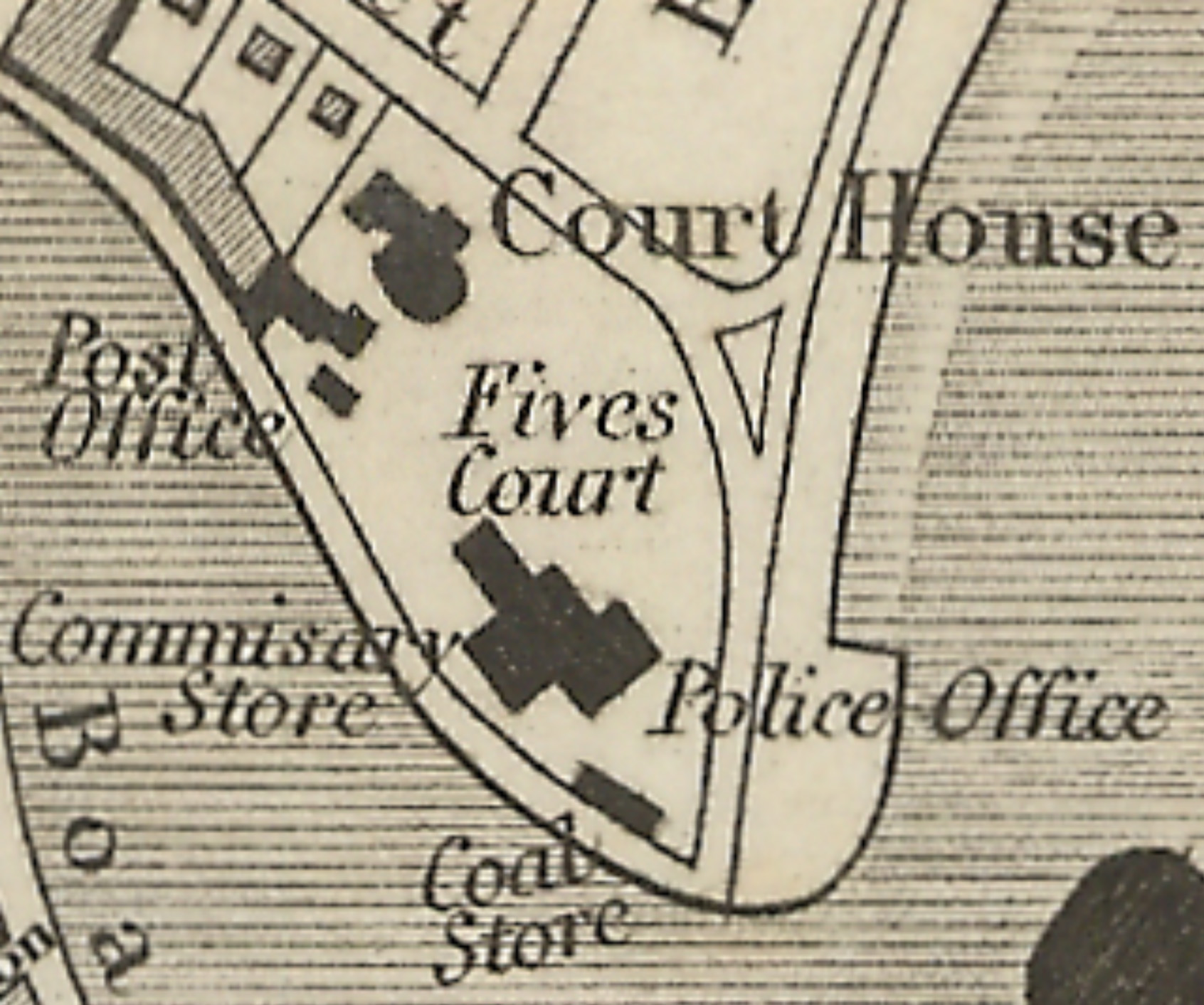
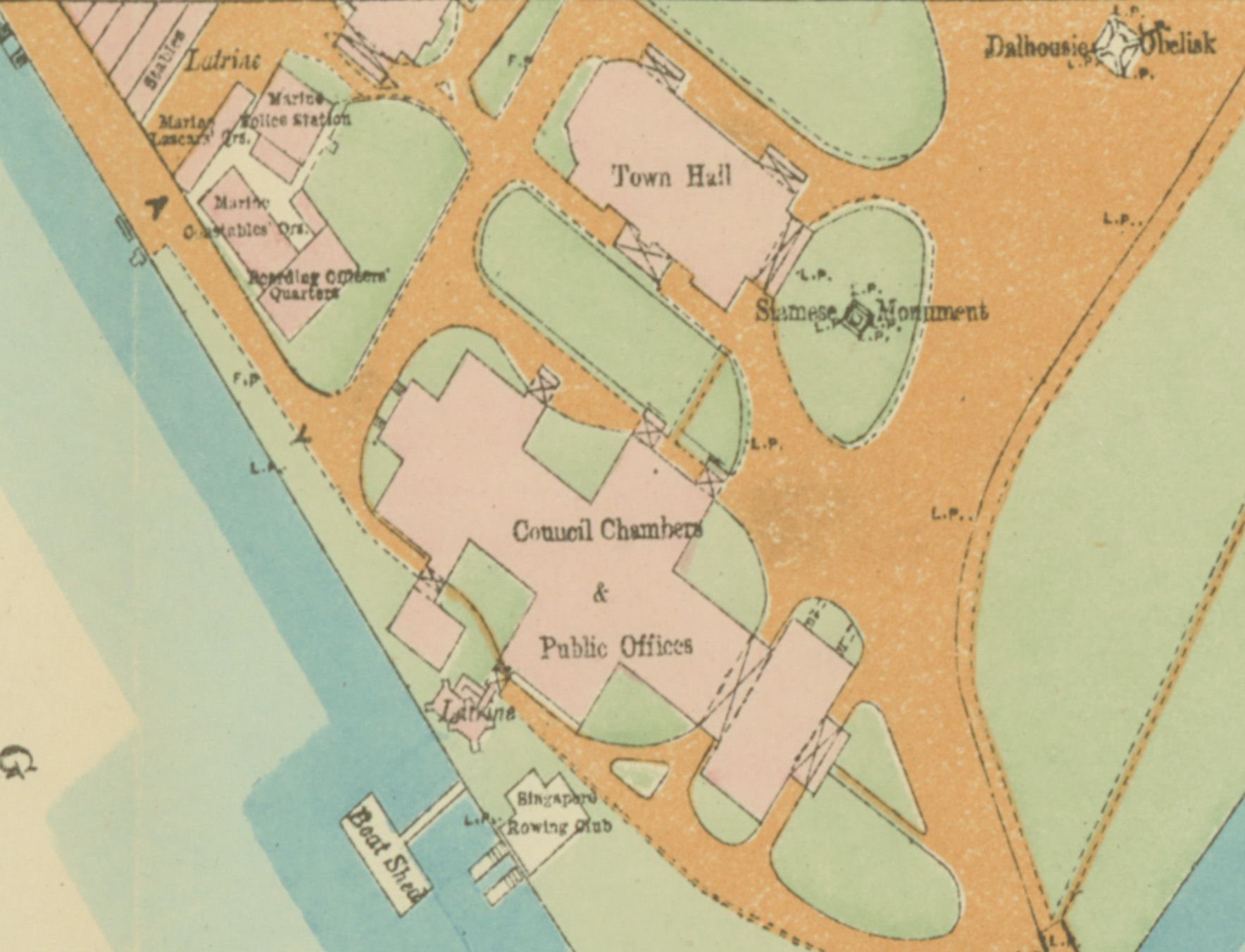
Another decade later saw the construction of the Town Hall establishing the site’s significance as the colonial administrative centre (Figure 6). Between 1864 and 1867, more buildings such as the Government Offices (present ACM building) were added (Figure 7). To cater to growing needs, the building’s capacity was transformed by extensions in 1880, 1908, and 1920. It was also around 1907 that the Government Office and its vicinity was officially known—in tribute to Queen Victoria—as the Empress Place Building and Empress Place respectively. In addition to the Government Secretariat, essential services such as the Public Works Department, Medical Department, and Treasury and Stamp Office could be found here. Its functions changed over time, which included the Printing Office, Post Office, Marine Police, Master Attendant’s Office, the Lower Courts, the Supreme Court, the Council’s Chambers and the General Assembly Hall for the community. It is notable that the Registry of Births and Deaths, the Citizenship Registry, and the Immigration Department of Singapore remained in the Empress Place Building until the 1980s.
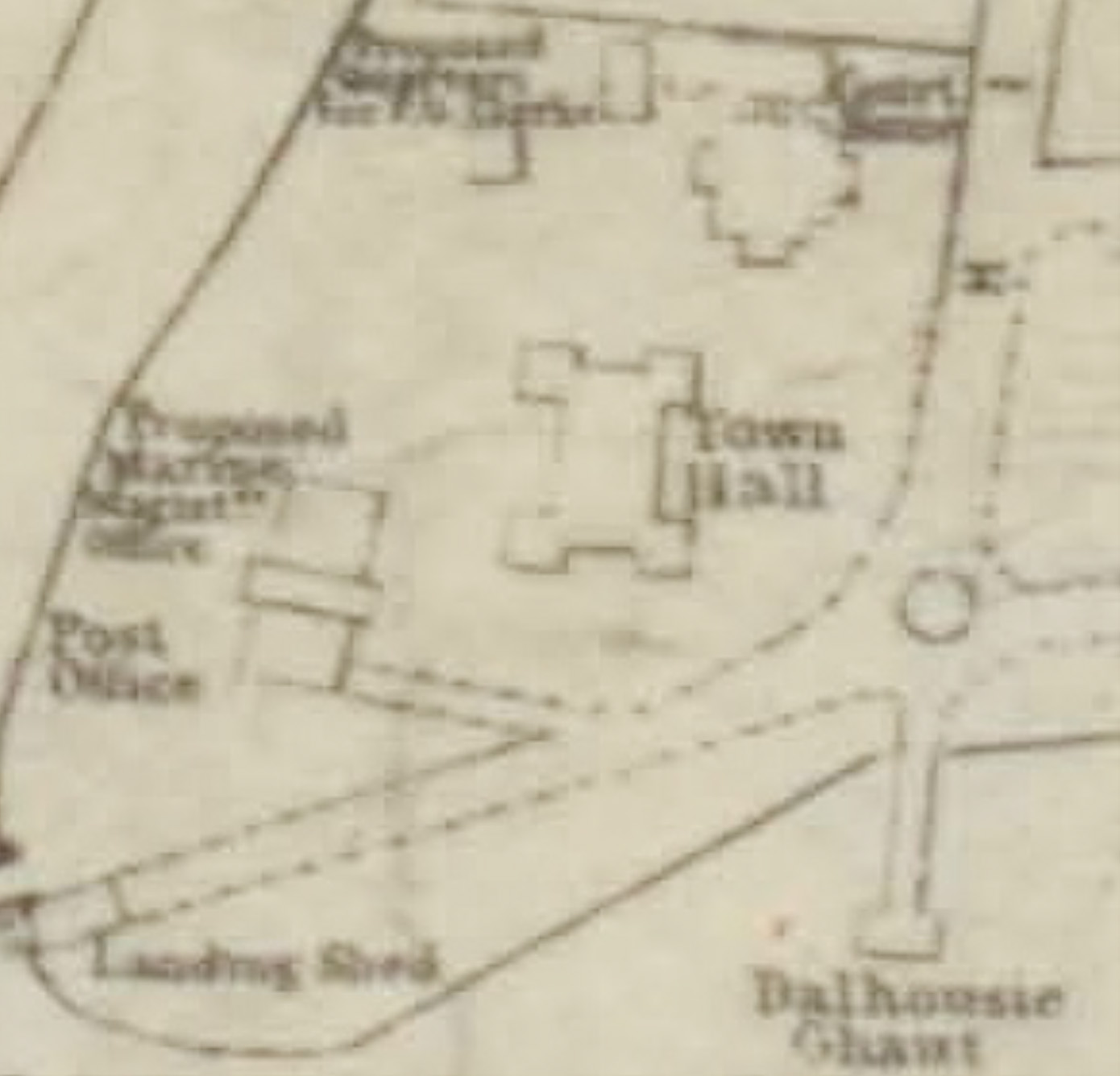

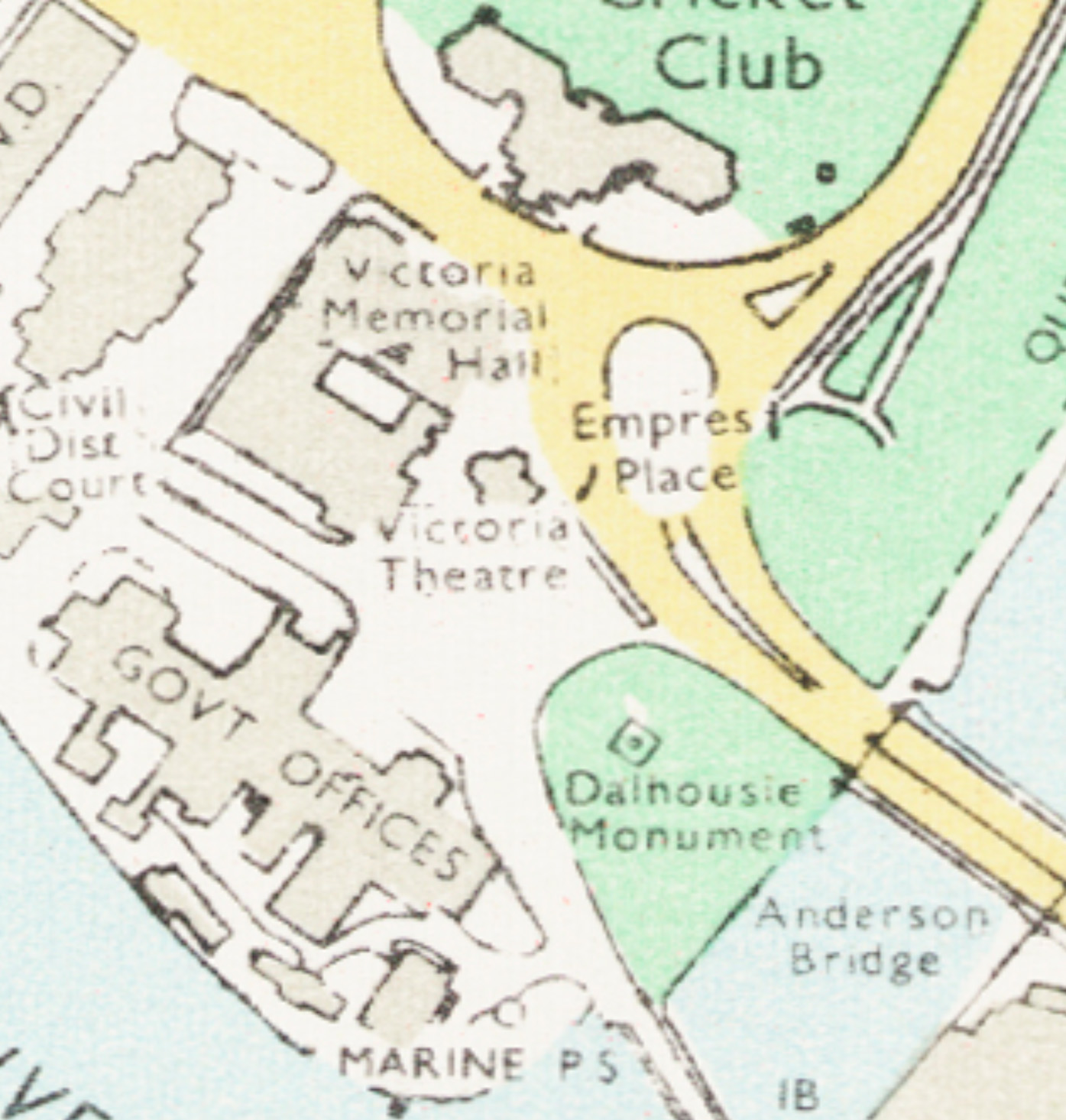
In addition, historical events such as the visits by Lord Dalhousie, Governor-General of India in February 1850 and the Siamese King Chulalongkorn in 1871 are now forever marked by the Dalhousie Obelisk and a bronze elephant statue respectively (for their original location refer to Figure 8). The former, which was erected adjacent to the Dalhousie Pier several hundred yards away, was moved in 1890 to its present location to make way for the construction of Connaught Drive. The bronze elephant statue on the other hand was moved in 1919 from the Town Hall to a location outside the Empress Place Building. The other monument that defined the EMP site is the Victoria Memorial Hall that was built in 1903 and the repurposing of the adjacent Town Hall in 1906 into the Victoria Theatre. Although it has been recorded that developments were done on these buildings for post World War II reconstructions, in 1979, and in 2010, these did not significantly alter their architectural footprints (Figure 9). More important is the preservation of the open space next to these buildings. For a long time, the EMP site was a major traffic intersection (Figure 10) before becoming a car park in the postwar decades. It was later landscaped into a lawn more than 40 years ago. Notwithstanding the introduction of underground services, such relatively undeveloped spaces, like the Padang, are rare in Singapore and can potentially contain archaeological deposits.

1.2. Summary of the archaeology around the EMP site
Since 1984, archaeologists have excavated at least ten major 14th century sites (Lim 2019, 2017, 2015; Miksic 2013) within 84 hectares of the downtown City Hall area. Archaeological deposits in this area are typically found near or within the grounds of national monuments or land that remain relatively underdeveloped compared to their surroundings. Opportunities to conduct slow and detailed research excavations are however rare, as most excavations are rescue (development-led) in nature and are, as a result, limited in time, resources, and accessibility to the sites. Consequently, the scope of rescue projects unavoidably centres on the recovery of the oldest artefacts and less on other important aspects of archaeology. This is regrettable because excavations are irreversible. And because of the differing circumstances that affect the way these sites are excavated and documented, intra-site analysis is not always a straightforward matter.
Despite the challenging situation of Singapore archaeology and the fact that development (since colonial times) has dwindled the extent of archaeological deposits in downtown urban spaces, significant amounts of deposits such as those found at EMP may still be present. Other examples include Fort Canning, the Old Parliament House, the Parliament House Complex, Empress Place (1998), the Colombo Court, the Singapore Cricket Club, the St. Andrews Cathedral, the National Gallery Singapore, and the Victoria Concert Hall. Evidence has shown that these sites are once part of an economically driven Malay kingdom called Temasek or Singapura that was founded in around 1299 (Miksic 2013, 154). According to Miksic (1985), Fort Canning Hill (formerly known as Government Hill and Bukit Larangan), which overlook the entrance of the Singapore River was an elite residence while the other sites located across the sandy coastal plain—separating the hill from the sea—characterise its seafaring community. Like many archaeological sites around the world, the inorganic nature of ceramics mean that this category of artefacts form the bulk of the artefact assemblage that survive. It is apparent from the abundance and the variety of Chinese stoneware and porcelain, in particular, that Temasek was an important and vibrant place. By considering the pattern of similarities and differences between the ceramics found in Singapore and other contemporaneous nearby sites, it appears that Temasek—with its strategic location and natural harbour—served as an entrepôt along the monsoon-driven Maritime Silk Road that has linked merchants and seafaring communities of East Asia and West Asia for more than a millennium (Miksic 2013, 2004, 2000).
Research has also shown that despite Temasek’s decline after a prosperous reign of more than a century, people were still living at the settlement and maintaining their links to Melaka, Johor, Riau and other important places in the Malay Archipelago (Kwa et al. 2018; Borschberg 2010). Unlike the density of 14th century deposits, the archaeological record of the later period(s) is often more subtle and as a result underrepresented in archaeological research. This deficiency also highlights the fact that in order for one to contextualize Singapore in regional history, one must consider the multitude of maritime societies that formed the longue durée of island Southeast Asia (Andaya 2006; Solheim, Bulbeck, and Flavel 2006; Manguin 2001).
An example of this can be found in the historical richness of the Orang Laut who used to thrive in the Singapore and Johor Strait. By tracing their unique way of life, one may argue that perhaps a Maritime Cultural Landscape perspective (Westerdahl 2012; Ford 2011a; Westerdahl 1992)—as opposed to a site-specific perspective—is a more appropriate approach to studying Singapore’s past. At the same time, while the study of long-distance trade remains important, through Chinese ceramics mostly, a fixation on this topic can limit the archaeological narrative. For instance, it is believed that ancient activities in Singapore such as pottery making (Kao 2021), glass recycling (Miksic 2013, 343–348; 1995), and the presence of workshops for gold and other metal products (Zaini 2019; Miksic 2013, 283)—although more subtle in the archaeological record—meant that long-distance trade is surely not all that can be said about ancient Singapore. And based on more recent excavations, site functions such as a market and a residential zone can be distinguished at the Victoria Concert Hall site (Lim 2019) and the National Gallery Singapore Site (Lim 2017) respectively. Clearly, it is the combination of all these inferences which allow researchers to portray a less limited understanding of Temasek.