Only parts of the areas to be affected by landscaping works on the Empress Place site were excavated during the 2015 Empress Place rescue excavation, indicated by the areas in white in Figure 16 above. The dark grey areas in zones 1-9 (as designated by the contractors) were destroyed before the archaeologists could do their work. Just two zones, 5 and 6, yielded nearly 600 kg of artefacts without primary provenience.
The excavation itself was divided into 25 units or squares, mostly within the boundaries of the zones established by the contractors. This page presents detailed drawings of excavation units 001,003, 004, 005, 006 and 007 to give a sharper picture of the process of excavation.
This detail of Figure 16 shows the excavation units within the contractors’ zones 3, 4 and 5.

Unit EMP 001
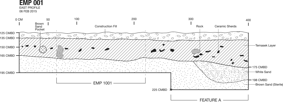
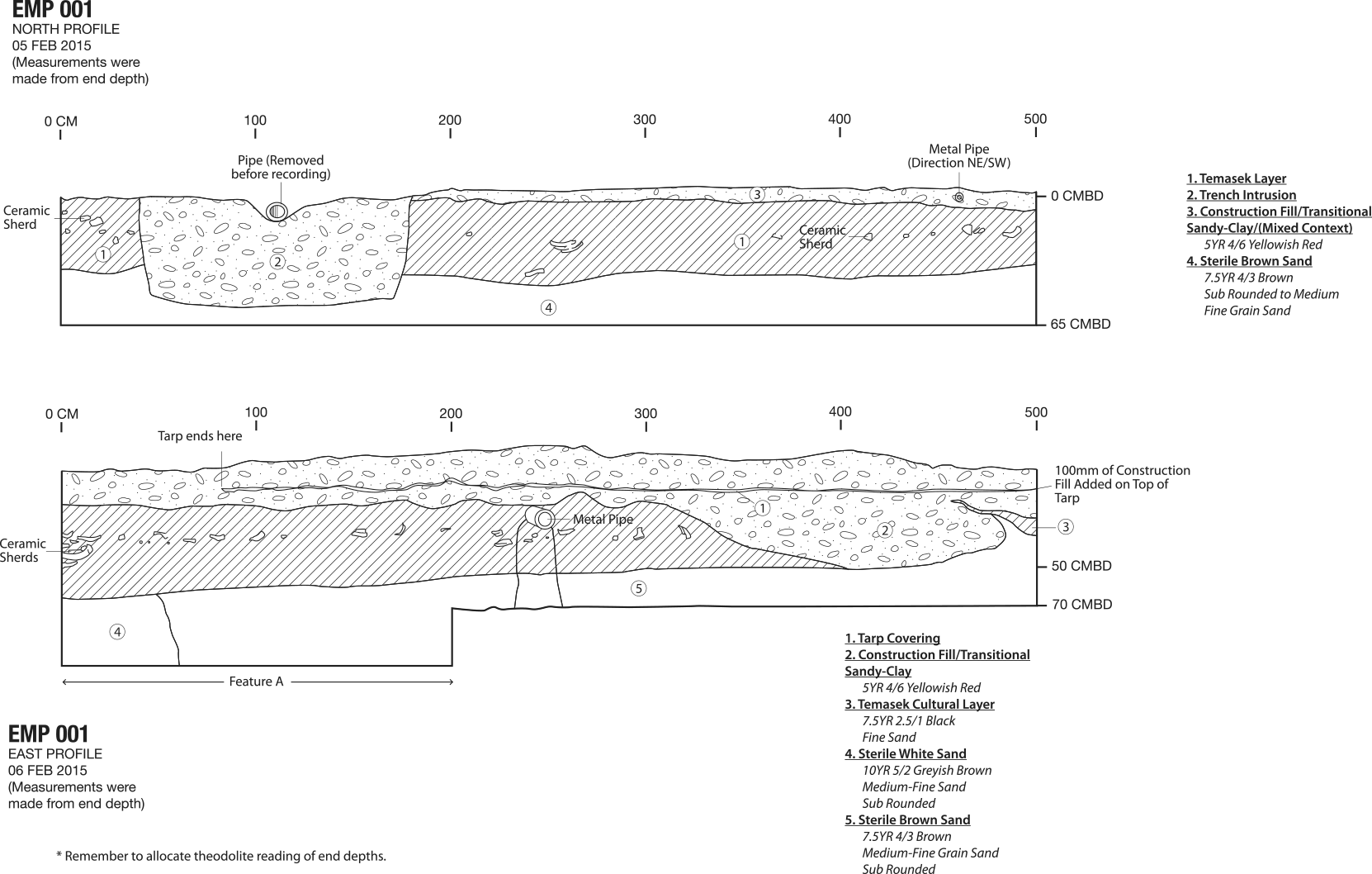
EMP 001 formed a small unit inside Zone 4, interrupted by a sheet pile, as seen in Figure 16a.
Presented below are the four vertical profiles of EMP 001. This unit had distinct concentrations of artefacts. The summary dataset of the artefacts from this unit can be seen here: EMP 001 Dataset


Unit EMP 002
To understand EMP 002’s profiles, see EMP 001's north profile and EMP 007's west profile which mirror EMP 002’s south and east profiles respectively.
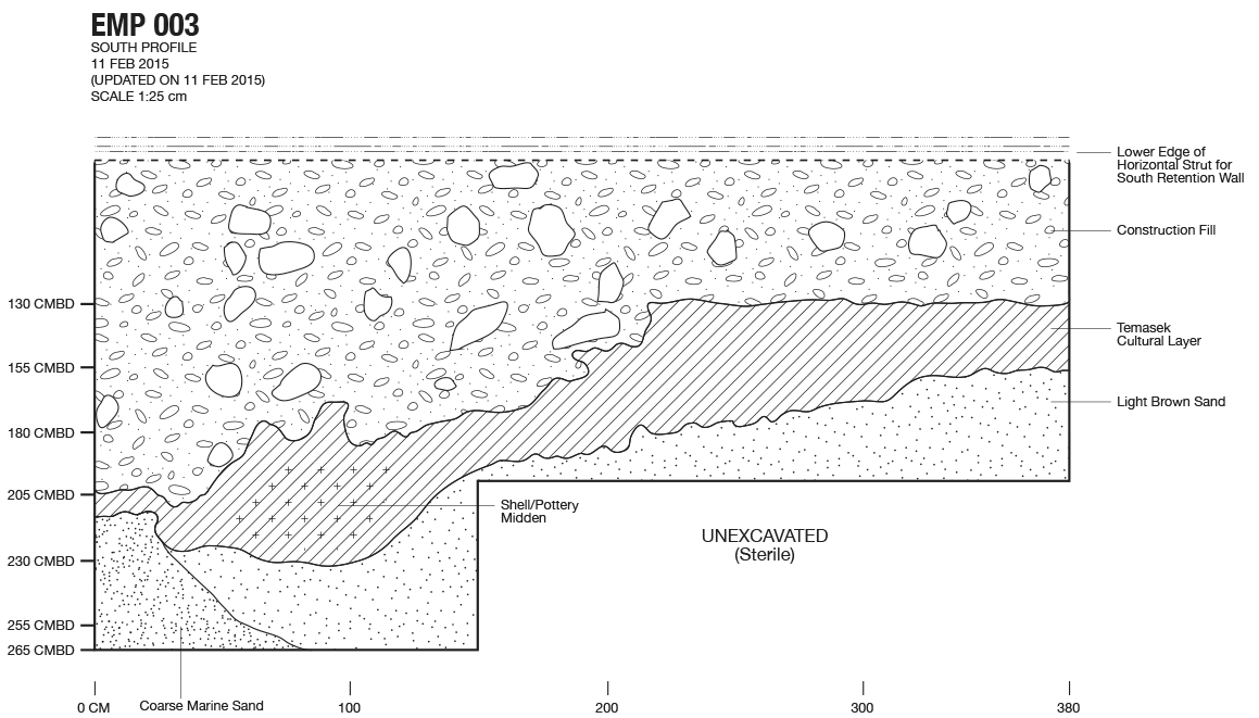
Unit EMP 003
Presented below are the west and south vertical profiles of EMP 003, within the contractor’s Zone 3. The south vertical profile shows a partially disturbed midden containing a significant amount of shell and bone and other inorganic material. The plan view shows the colonial drainpipe feature that extends from EMP 004, also examined in a detailed profile view. This unit is one of the pits that has a concentration of artefacts. The dataset of the artefacts from this unit can be seen here: EMP 003 Dataset


Unit EMP 004
Presented below are the plan view drawing and the north wall vertical profile of EMP 004, adjacent to EMP 003. The north profile of this unit shows the colonial drainpipe feature that extends to EMP 003. This unit is one of the pits that has a concentration of artefacts including a large concentration of 14th century artefacts under the drainpipe feature. The dataset of the artefacts from this unit can be seen here: EMP 004 Dataset


Unit EMP 005
Presented in this section is a drawing of EMP 005’s west vertical profile. There is only one unit drawing as 90% of the pit was destroyed by construction work in Zone 3. The unit however, still yielded ceramics, zoological, and botanical remains as can be seen in this dataset: EMP 005 Dataset

Unit EMP 006
Presented in this section is a vertical profile of EMP 006’s south wall. The south wall shows two features which reach up to EMP 004. This unit also had a concentration of artefacts as can be seen in the dataset: EMP 006 Dataset

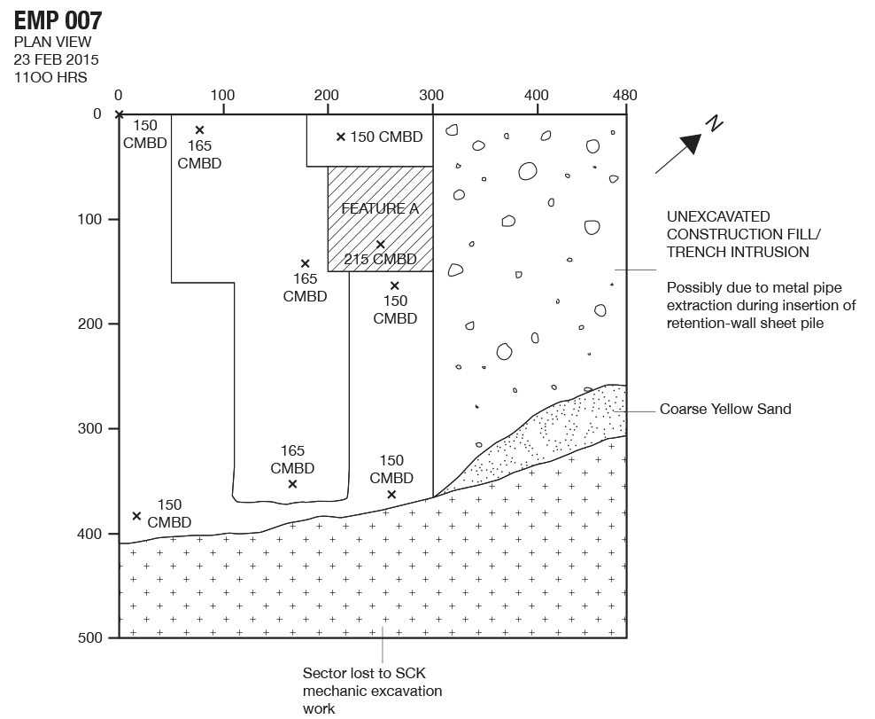
Unit EMP 007
Presented here is a vertical profile of EMP 007’s west wall and a horizontal or plan drawing of the pit. A modern underground pipe bisected this unit, and its removal is the likely cause of a intrusion affecting around 40% of the area of the square. A further 20% of the unit was destroyed by excavator work. Compared to other pits, EMP 007 yielded fewer artefacts, as seen in the dataset provided: EMP 007 Dataset

