
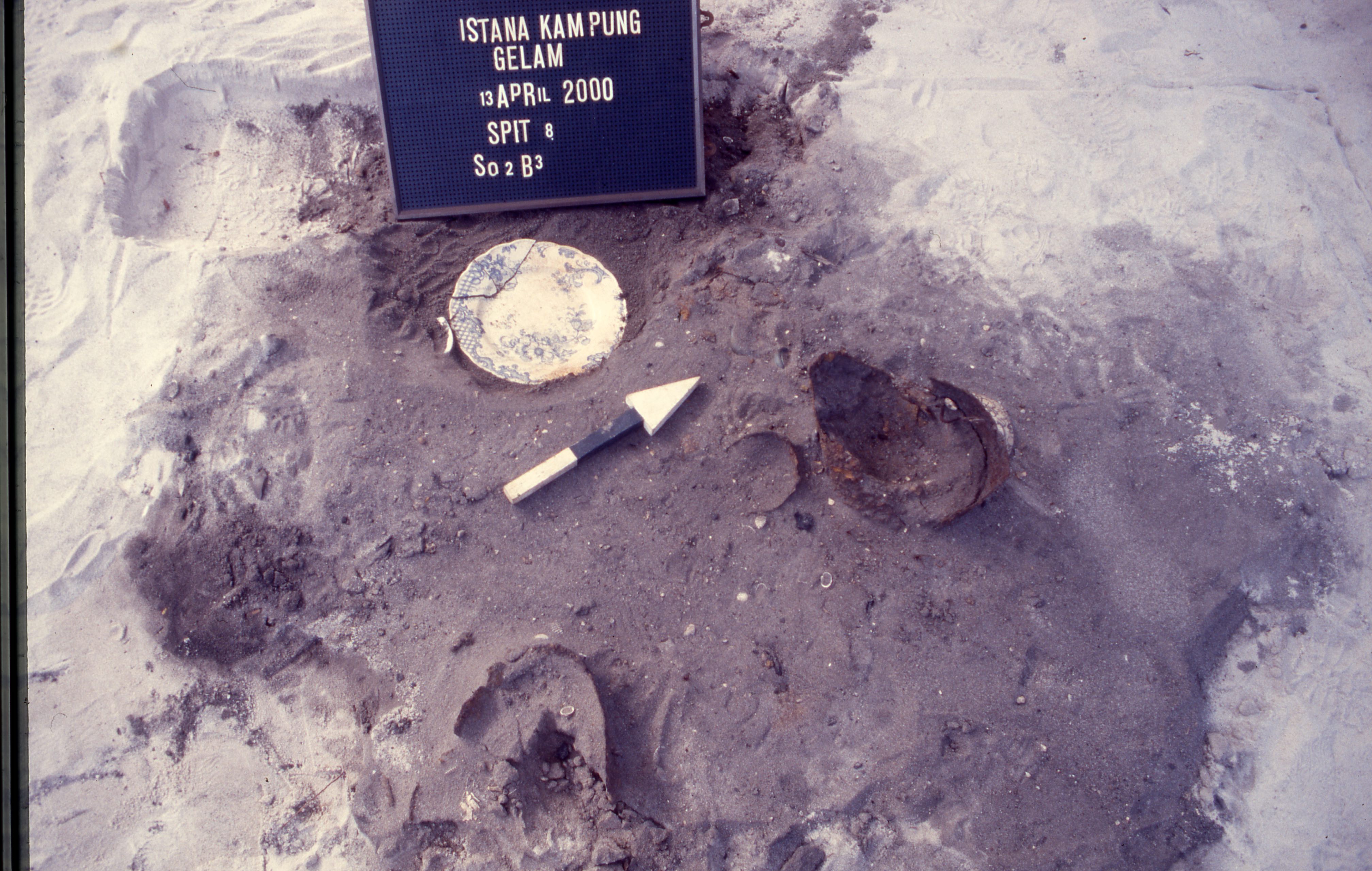
Description of the Excavation Units
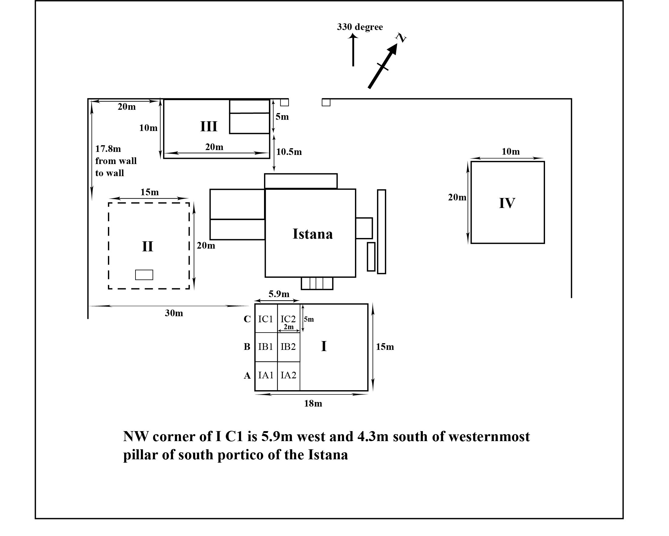
Square I: South of the palace, at the main entrance to the building. Dimensions: 15 x 20 metres, divided into 30 units measuring 5 x 2 metres. At the inception of the dig, grid IB2 was excavated. Historical records show that a fountain once existed at this location. Grid IB3 was subsequently excavated. The weight of artefacts from this unit has not yet been calculated.
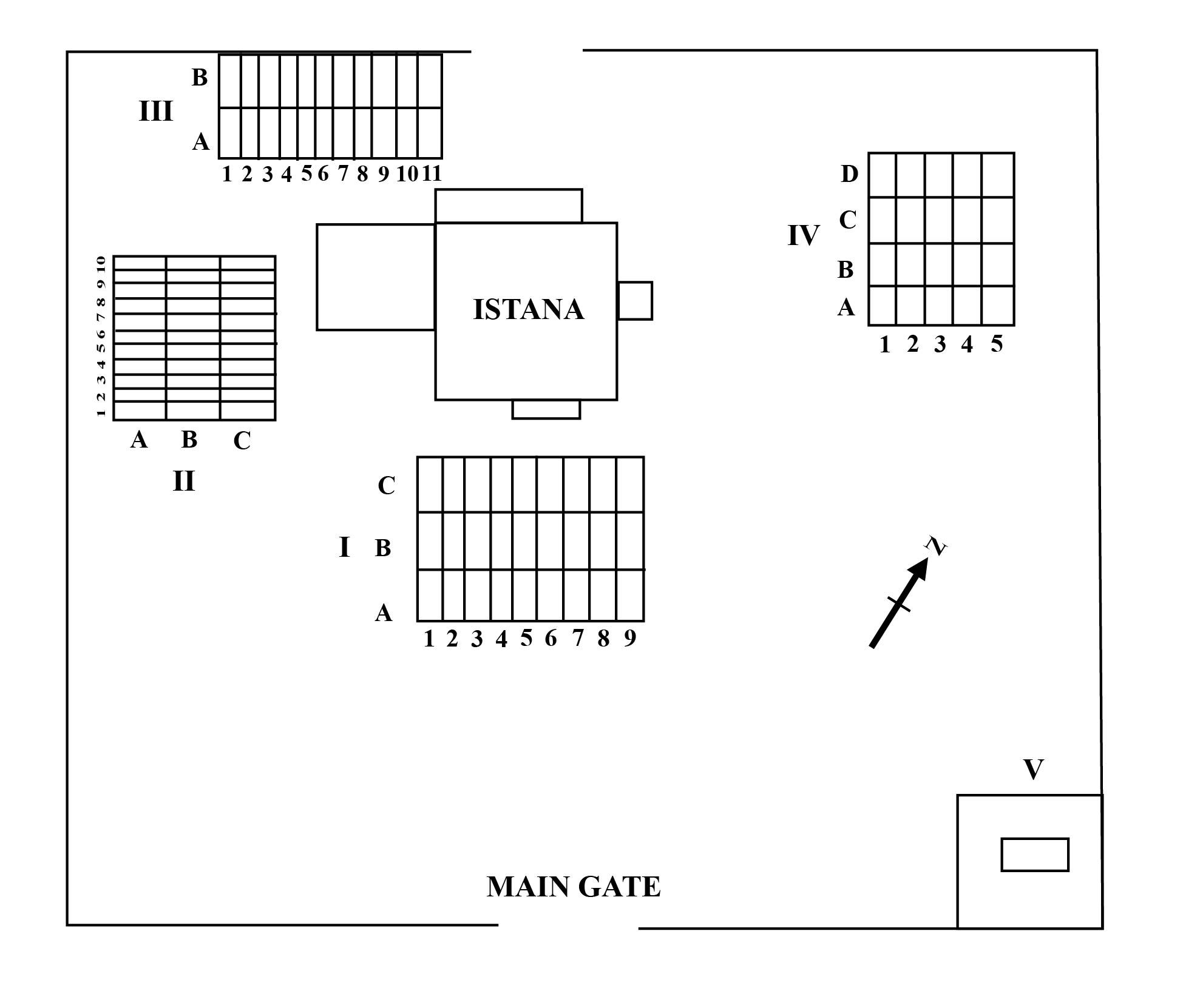
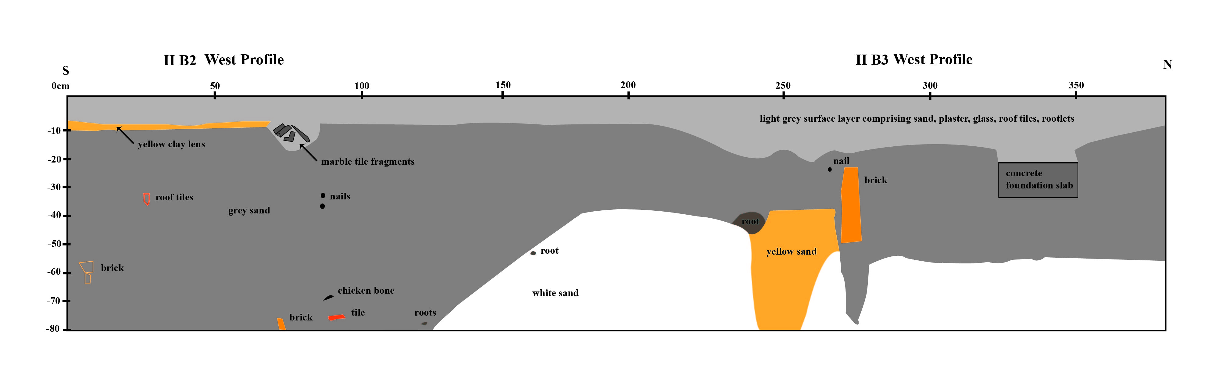
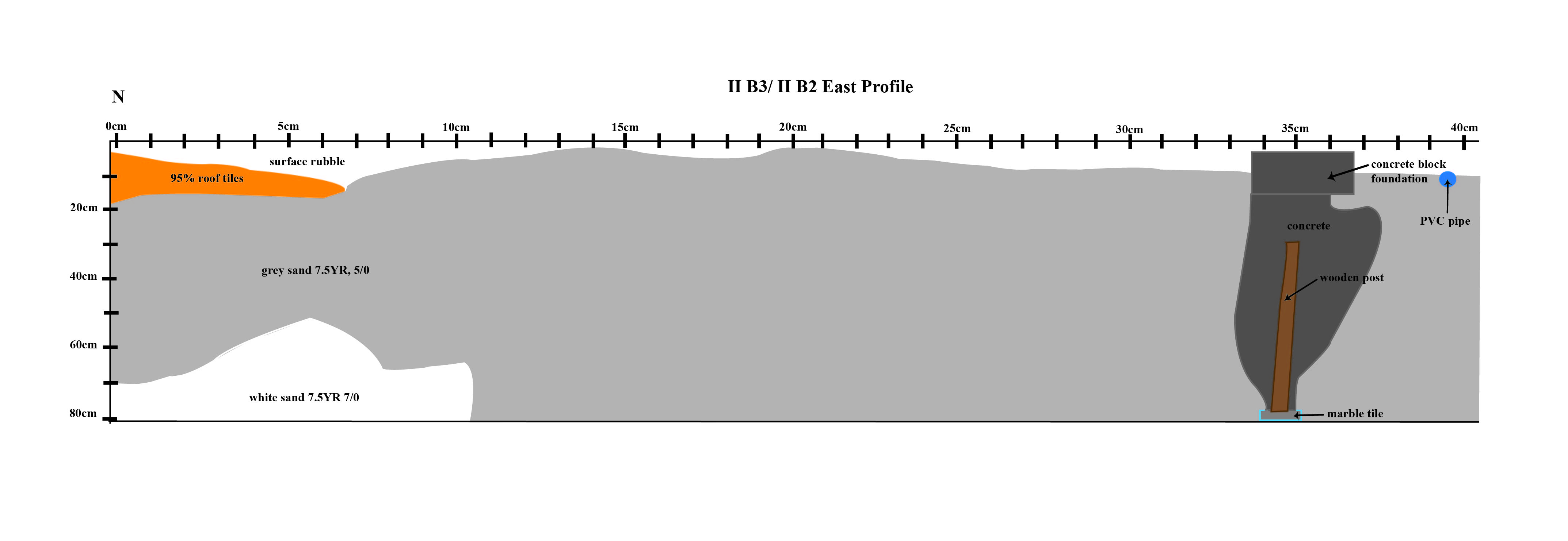
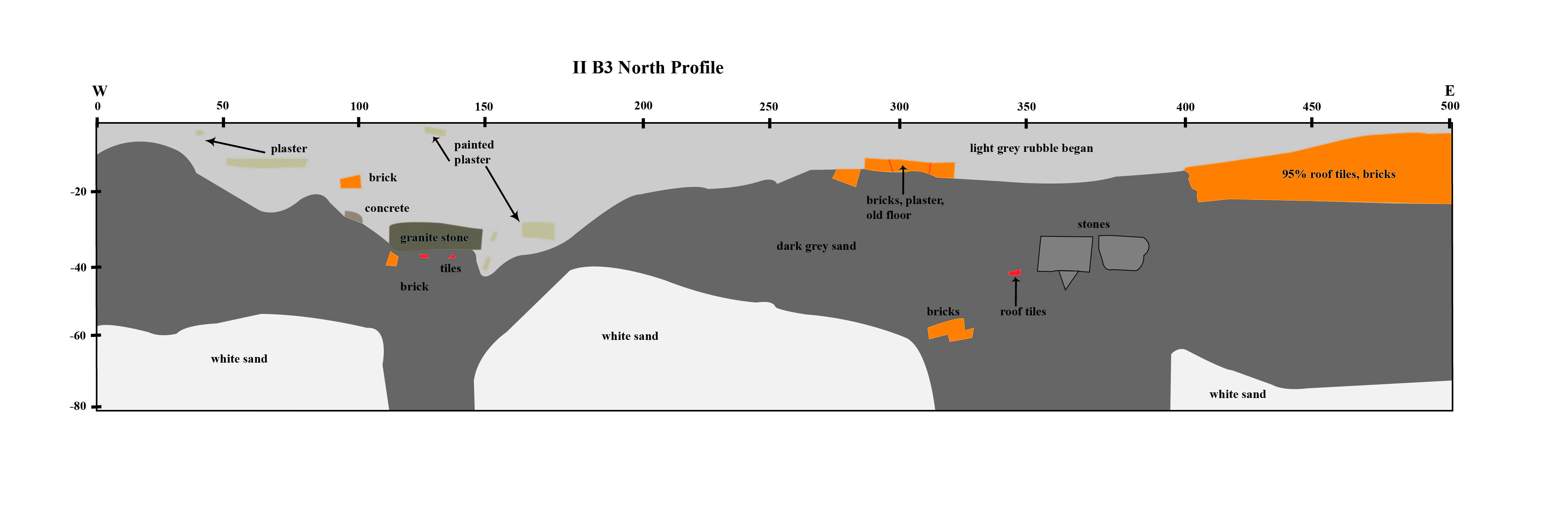
Square II: West side of the palace. Dimensions:15 x 20 metres, divided into thirty 5 x 2 units. Square IIB2 was excavated in the first stage. When more volunteers were available, Square IIB 1 was opened. This area was found to have a deep deposit with a large quantity of artefacts possibly indicating that this area was frequently used to dispose of trash. IIB3 and IIB4 were also excavated later. Statistics for IIB1 are not yet available.
Square III: On the north side of the palace, in the area outside a room suspected to have been the kitchen. Dimensions: 15 x 20 metres, divided into thirty 5 x 2 units. Square IIIB10 was excavated. The central portion contained many bricks and other building materials, so rapid digging with a cangkul was used. Interestingly, coins were also found in this sector. IIIB9 was also excavated. Statistics for this unit have not yet been calculated.
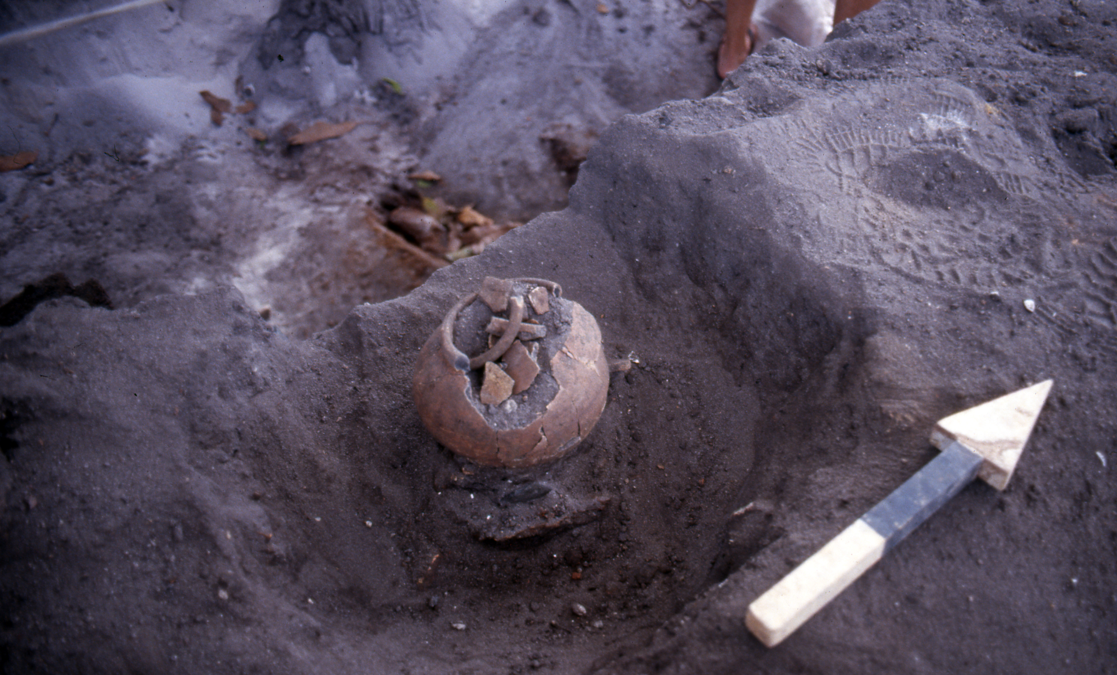
Square IV: East of the palace, and separated from the palace by a line of mango trees that were probably part of an old palace garden, a necessary component of a Malay palace. This sector was 20 metres long (north–south) and 10 metres (east–west). Square IVB2 was excavated first. On 30 March excavation was extended to IVC2 when the previous square reached sterile soil. On 2 April, IVD3 was opened. This part of the site yielded numerous interesting artefacts, including several locally made earthenware pots that had fallen to pieces, but had originally been buried intact. These were probably uri pots, used in Malay custom to bury the placenta after a baby is born. It was common to bury these under or near trees, so the garden was the logical spot to find them. Pupils from Chinese High School contributed labour to the excavation of this sector. IVB3, IVD2 and IVB5 were also excavated. All weights are yet to be calculated.
Square V: Southeast corner of the palace compound. This area was investigated beginning on 25 June 2000. It was located 43.2 metres south of Square IV. It was initially laid out as a 1 x 1 meter square, which was expanded to 5 x 2 metres on 2 July. Numerous artefacts were recovered, in association with a foundation of large rocks irregularly shaped and loosely piled up. A map circa 1840s shows an irregular L-shaped structure at the southeast corner of the compound, where Square V is located (see c. 1875–1879 map, Accession number: SP007233).
The soil of the site was quite easy to excavate as it consisted of loose sand. Already on 22 March, evidence of a white sandy layer similar to that excavated at the Padang was observed in Square IB2. This layer was found to underlie the entire site. Above this layer was a stratum of compact black sand containing many artefacts of the 19th and 20th centuries. It was difficult to maintain the integrity of the excavation walls due to the loose nature of the sandy soil and occasional flow of rainwater into the excavation, but in general it was possible to maintain relatively good control of the stratigraphy of the site.