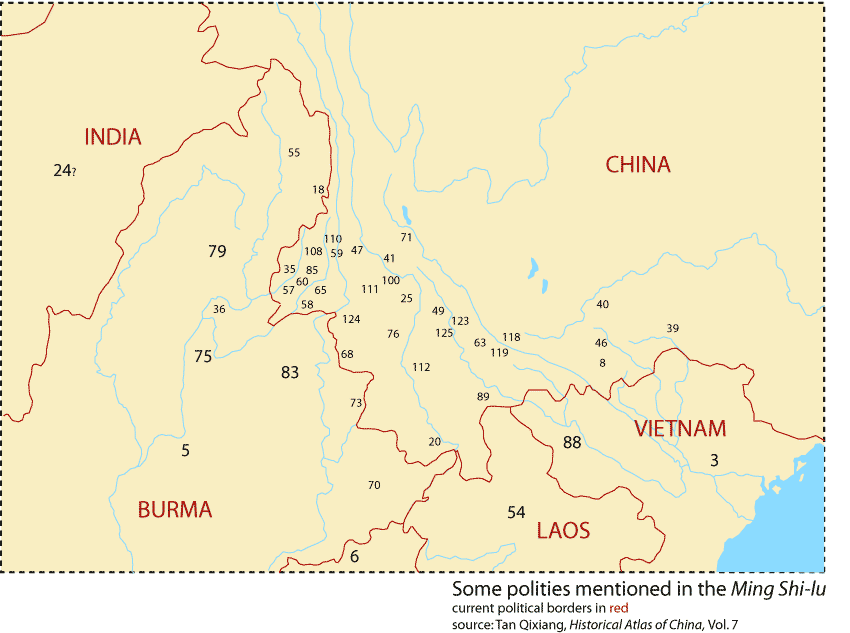
This map has been prepared based on the map of Yun-nan in the Ming dynasty contained in The Historical Atlas of China, V.7, edited by Tan Qi-xiang (Tan Qi-xiang, 譚其驤, «中國歷史地圖集» 第七冊 (元明時期), 1982). It is stated in the Atlas that the map was drawn to reflect the situation in 1582. However, as the basis of compilation of this map, and others in the collection, was the validation of China's current borders, it should be used with some skepticism. This map should be considered simply as a guide to the approximate location of polities, in particular the Tai polities of the upland areas which form the interface between Southeast Asia and China.
Click on a number to be brought to the entry for the corresponding polity.