This was the name of an 8-storey tall building complex which housed commercial enterprises and a post office, and also the road on the southeast side of the block which is now Supreme Court Lane. In the 1970s the major ground-floor tenant was Cortina Department Store. Outside the main entrance facing North Bridge Road was an open courtyard where the Singapore Sweepstakes lucky draws were held (Ministry of Culture Collection, courtesy of National Archives of Singapore, Photo Accession number 5244. https://www.nas.gov.sg/archivesonline/photographs/record-details/67b571d9-cb8a-11e4-859c-0050568939ad accessed 4 October 2020; the building can be seen in the background of https://www.nas.gov.sg/archivesonline/watermark/picas_data/tn_pcd/19980007530-8263-3201-0183/img0102.jpg ). The site is less than 100 metres from the Parliament House Complex site (PHC) which had been excavated from November 1994 to January 1995. PHC had been the first site along the bank of the Singapore River to be studied. It was followed by Empress Place in 1998.
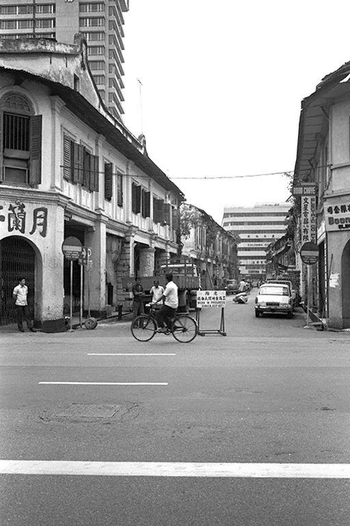
These sites were located on the bank of the Singapore River, though the PHC excavation extended about 100 metres inland. It was highly desirable to look for more sites further from the river for several reasons. First, it was deemed important to evaluate a wider area of the ancient city of Temasek, since the three main sites excavated at that time each displayed unique characteristics. More geographically dispersed samples were needed for comparison to determine the degree of variability and complexity which characterized life in Singapore in the precolonial period. Second, it was necessary to determine whether the city did extend further northeast of the river, or whether life during the fourteenth to sixteenth centuries was focused entirely on its bank.
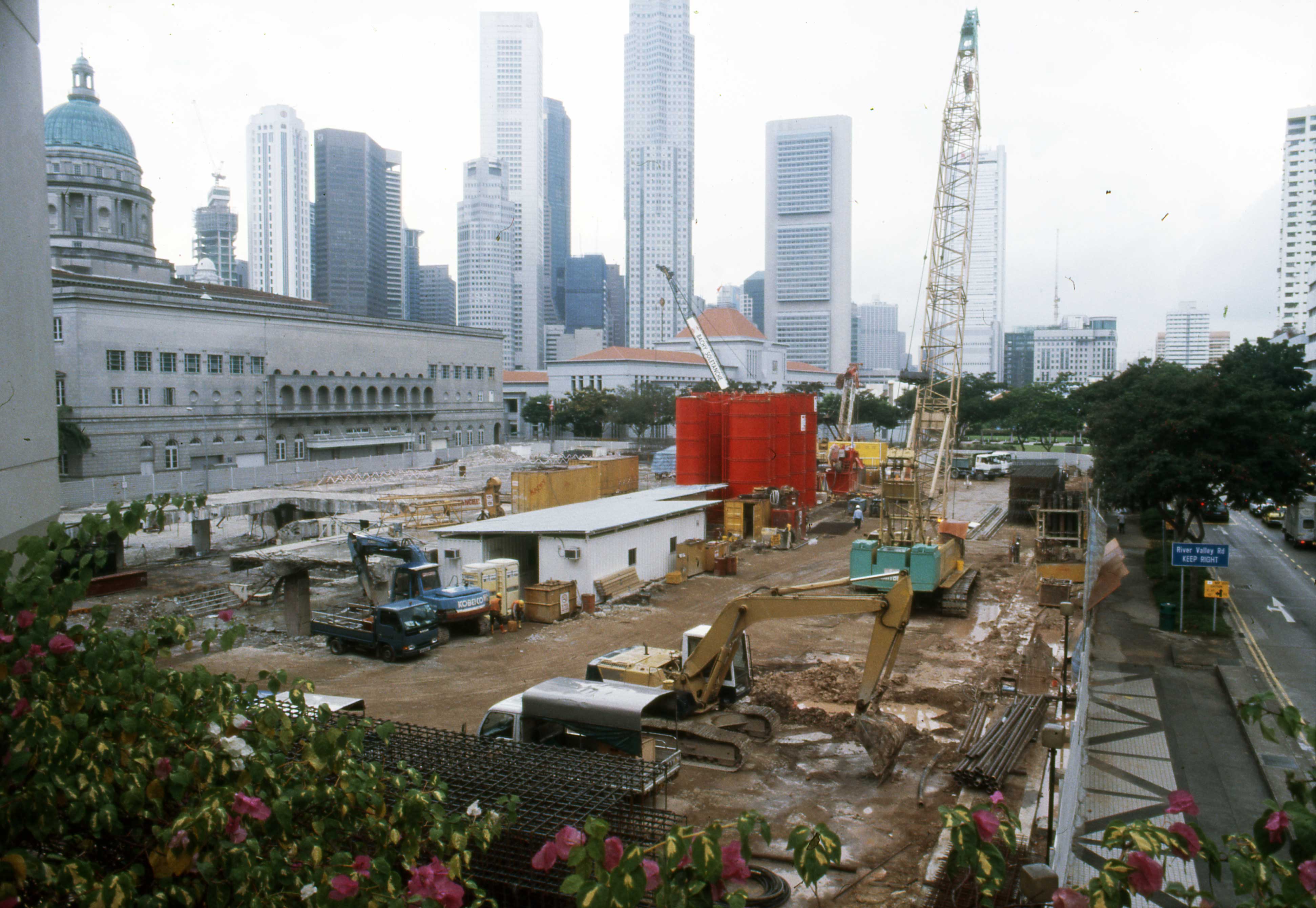
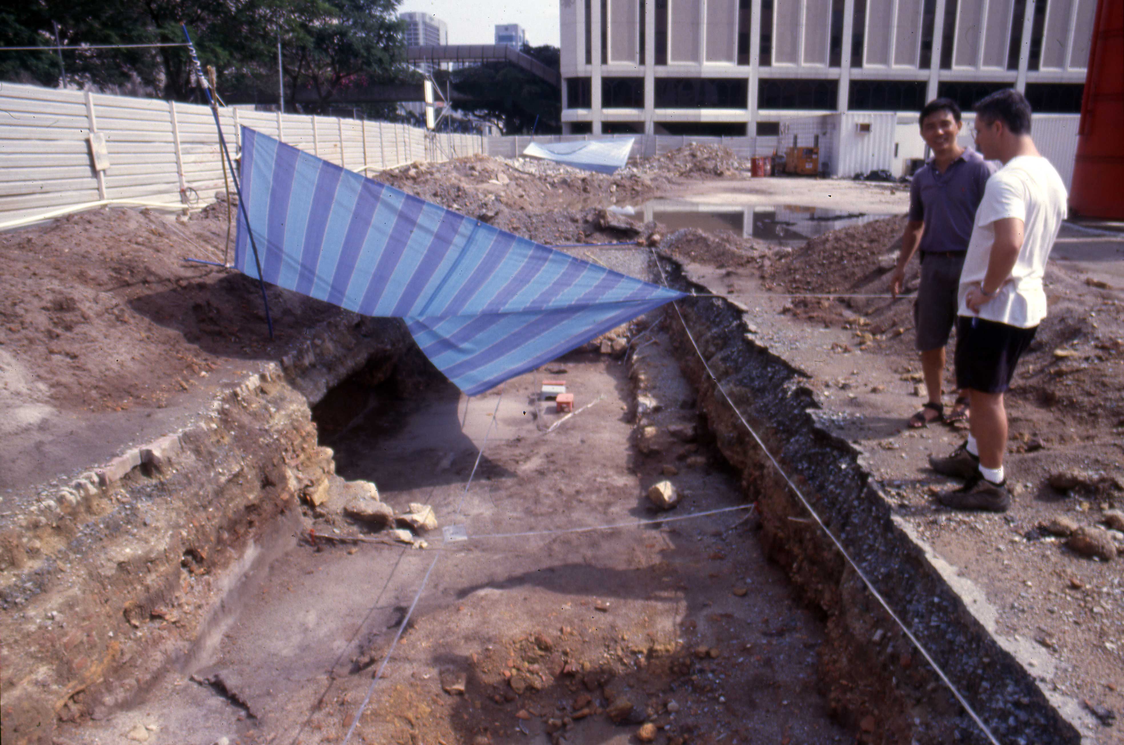
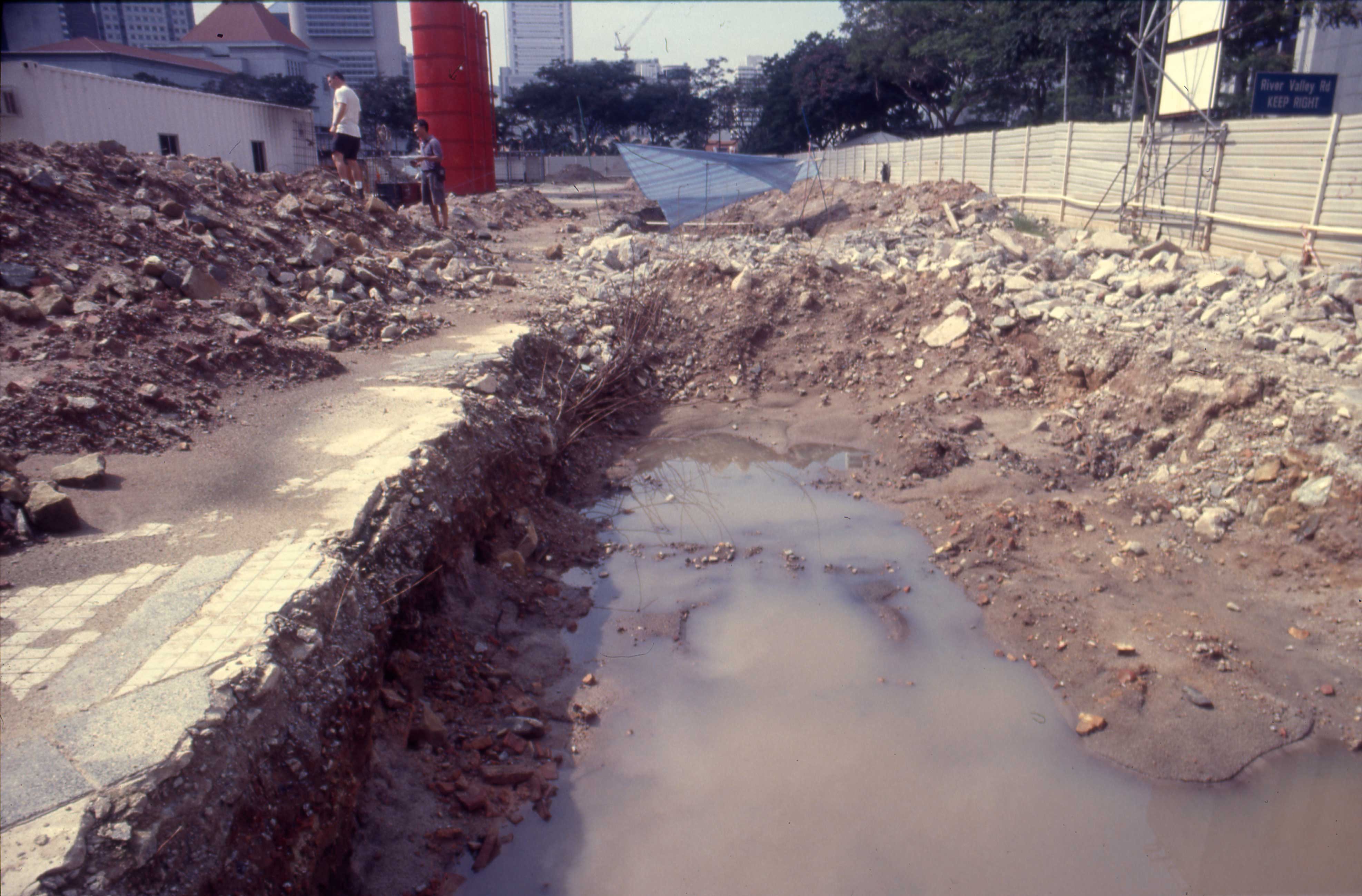
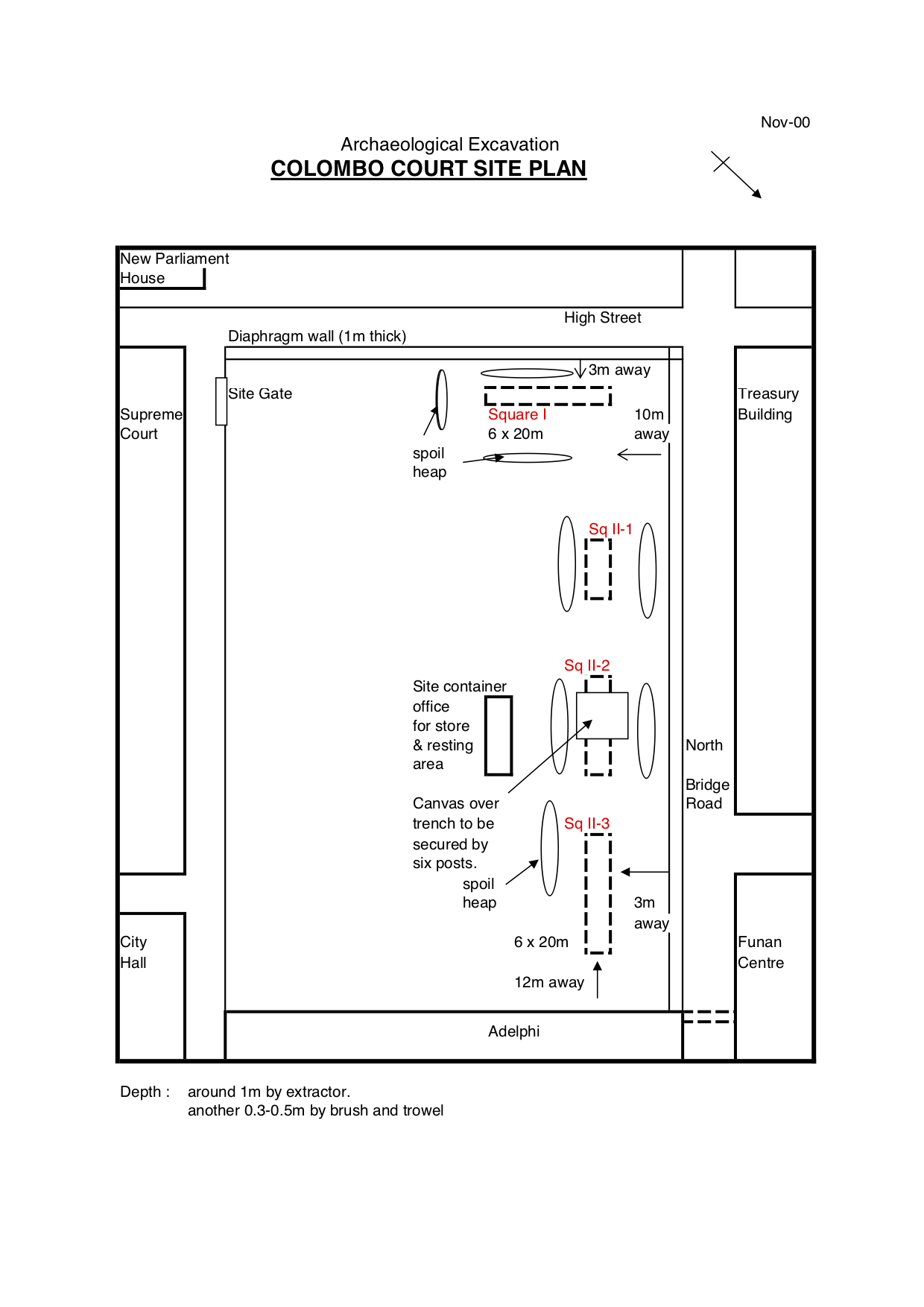
In 2000 the Colombo Court building was demolished preparatory to building the new Supreme Court Building. This created a window of opportunity to conduct an archaeological project which would satisfy these aims. The site was bounded by the Adelphi Building, North Bridge Road, Court Lane, and High Street. The building had a basement, the construction of which eliminated much of the site from consideration, but it was hoped that the areas along the fringes of the block might not have been entirely disturbed.
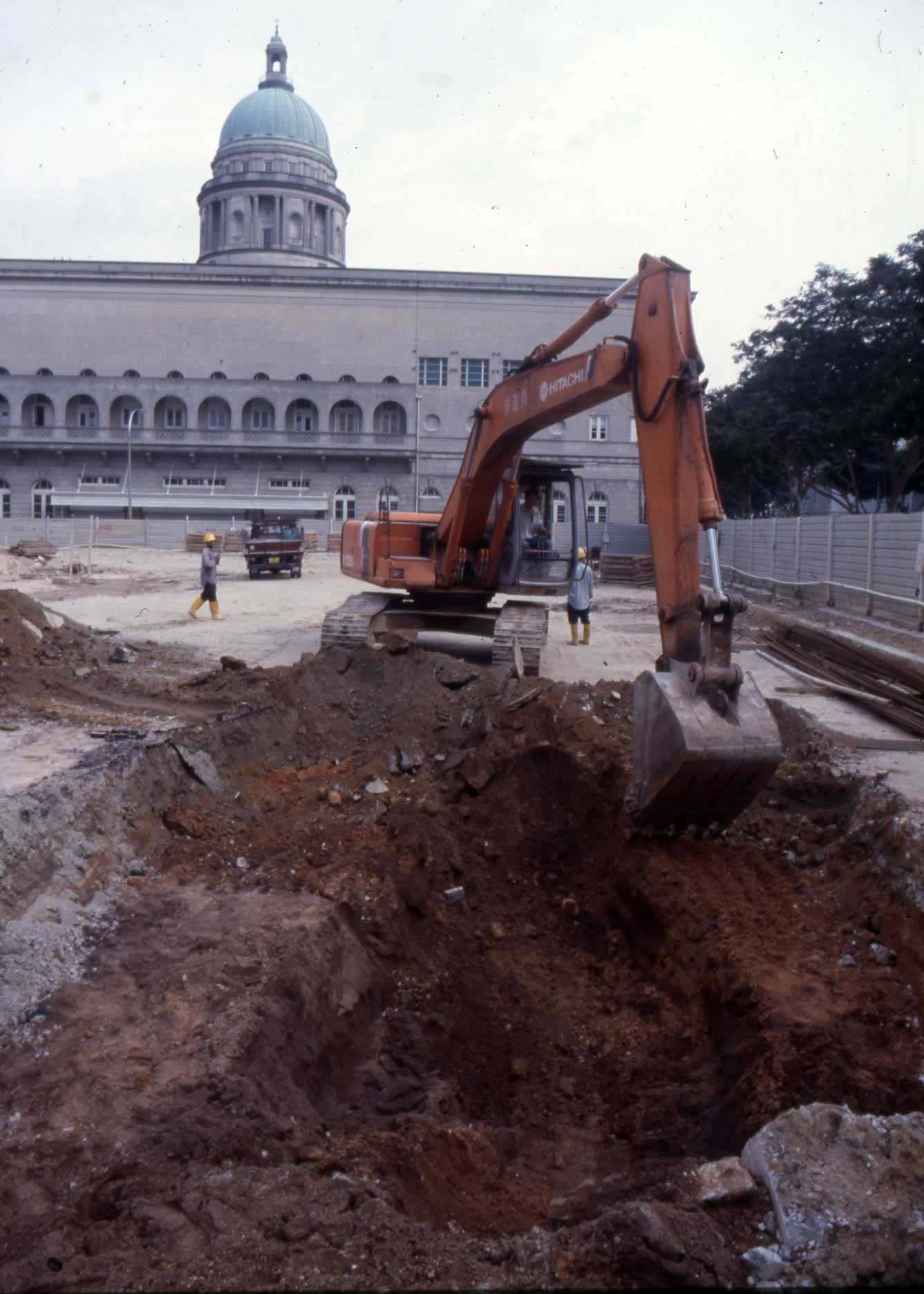
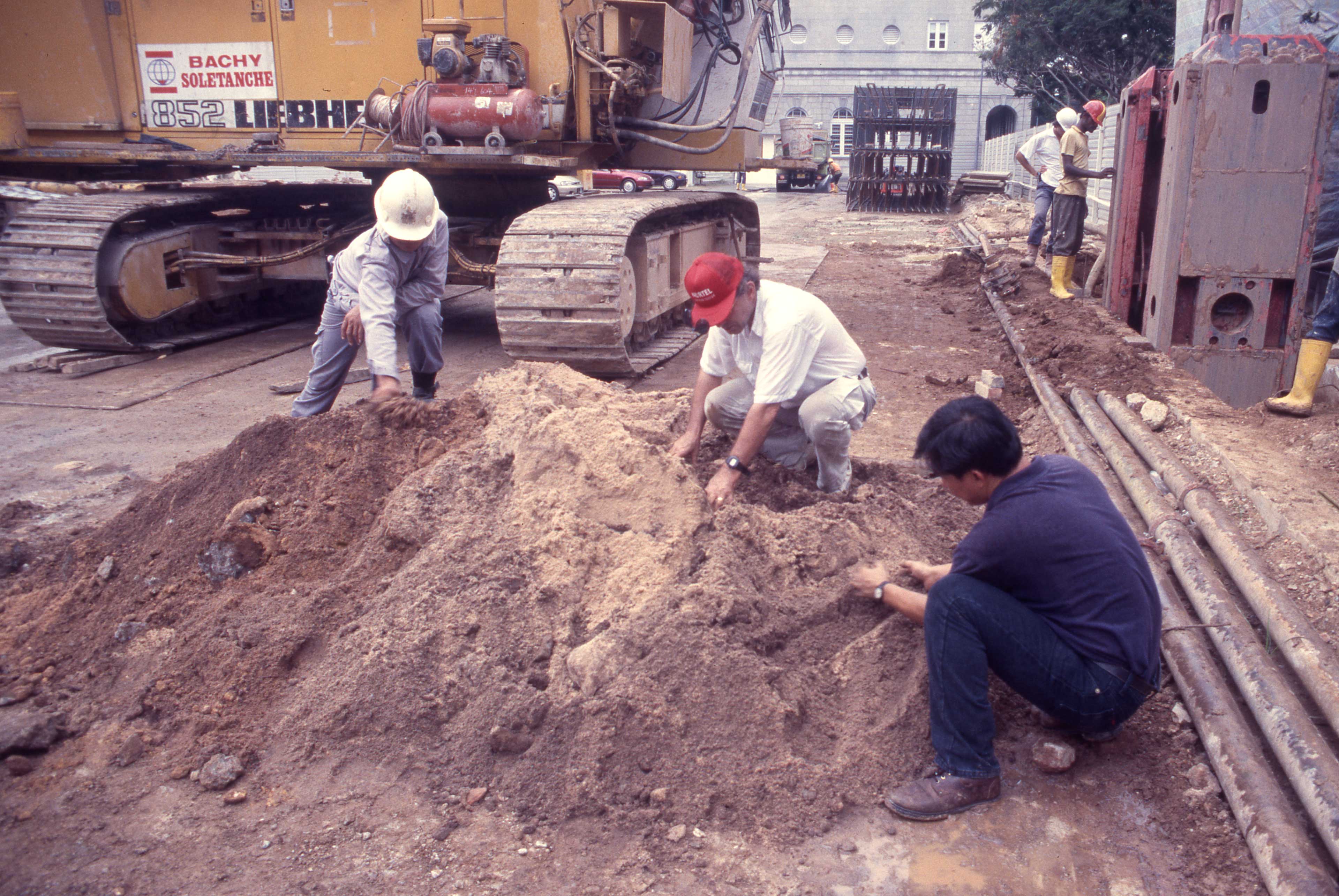
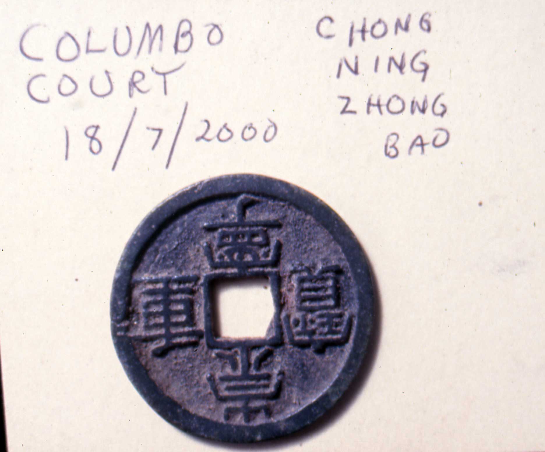
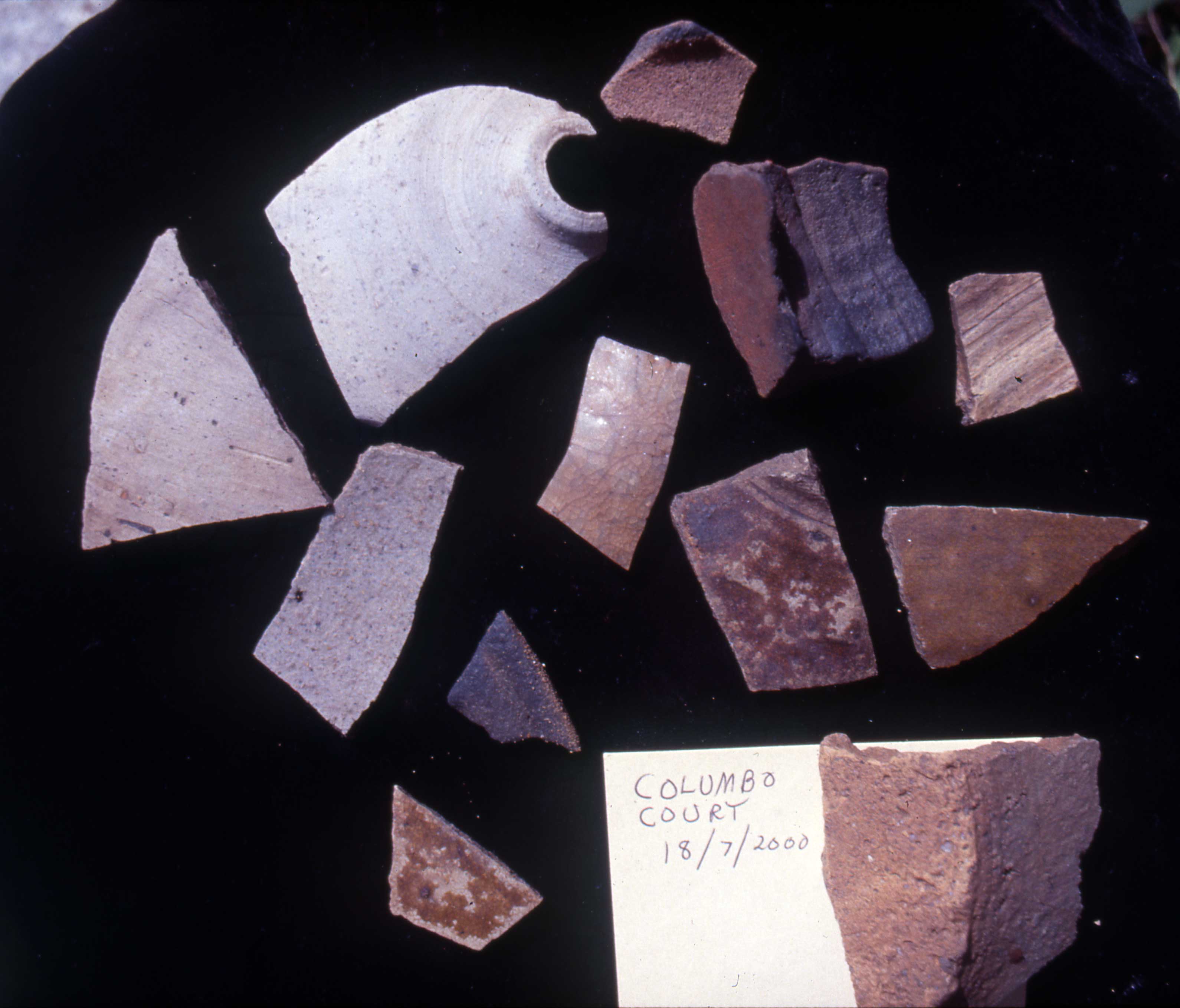
The Supreme Court, the National Heritage Board, and the Singapore History Museum gave permission for an archaeological assessment of the site to be undertaken. On July 18th the contractor involved in preparing the site for new construction and the Public Works Department kindly contributed the services of a large mechanical digger which excavated a test trench parallel to High Street. Results were favourable: beneath a layer with colonial period remains, a stratum of black sand appeared. This was identical to the precolonial layer found at PHC. Artifacts from the Temasek period (1300-1600) were found in that layer, including two Chinese coins and stoneware (see photos), and local earthenware. The coins both dated from the Northern Song; one bore the inscription Hui Zong 北宋徽宗 (1101-1125); the other was inscribed Chong Ning Zhong Bao 崇宁重宝 (r1102-1106; diameter 33cm).
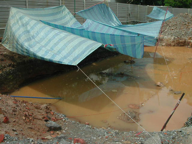
A trench 20x3 metres was laid out parallel to High Street, 3 metres from it, and designated Square I. It was divided into a grid with 12 units measuring 5x1 metres (60 square metres). Further investigation indicated that another narrow area along North Bridge Road on the northwest side of the site also preserved a black sand layer. Another site designated Square II was investigated here. Three areas were excavated here: II-1 (five units measuring 5x2 metres, or 50 square metres) 5 metres from North Bridge Road; Square II-2 (four units 5x2, or 40 square metres), and Square II-3 (one unit, 5x2 metres).
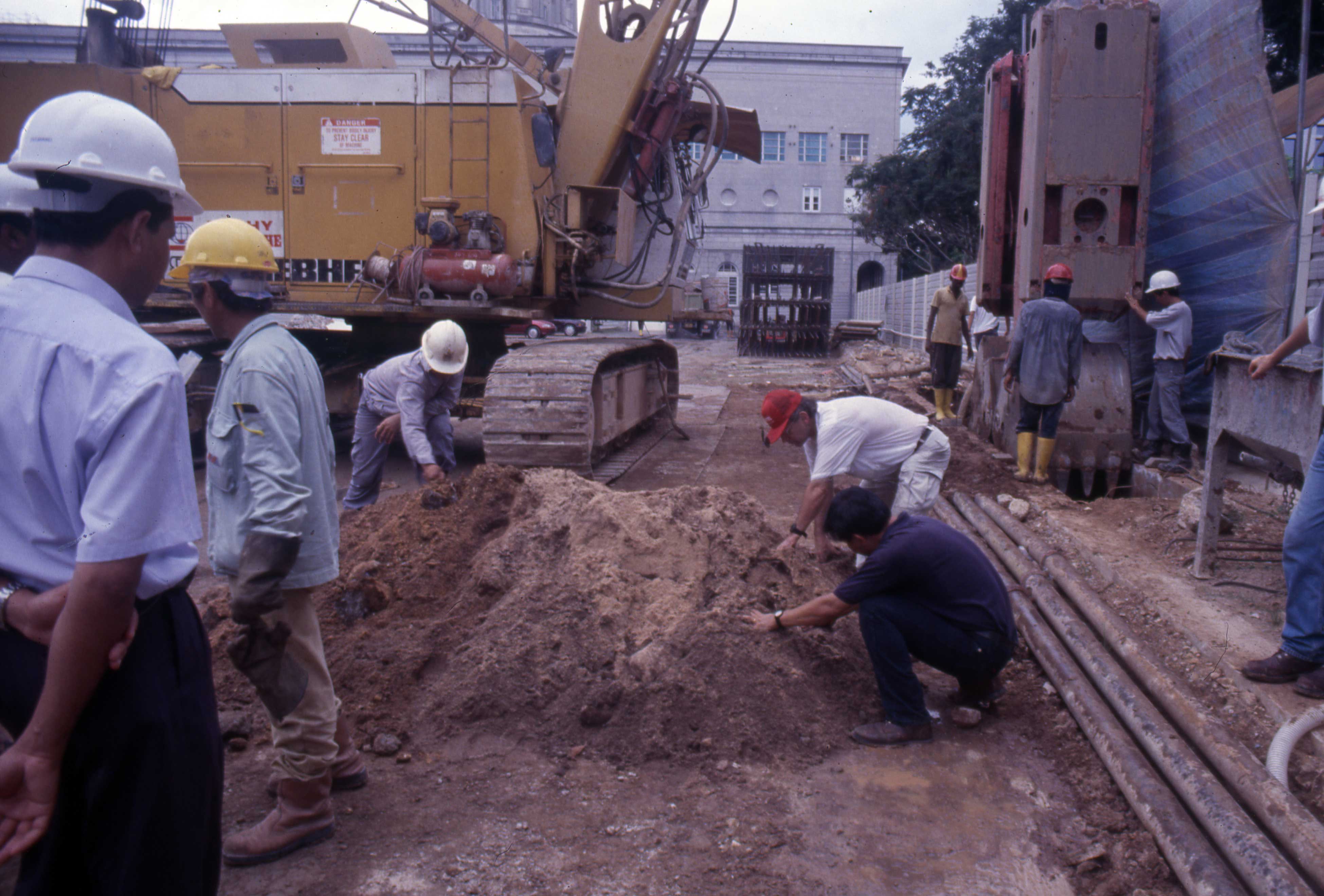
Dr. John Miksic was appointed Excavation Director; Mr. Ng Ching Huei acted as Site Supervisor. He also undertook much correspondence with the official bodies whose permission was required. Dr. Kyle Latinis, then a postgraduate student at the National University of Singapore, provided important expertise in recording stratigraphy and supervising untrained participants in the excavation. As is customary in Singapore, volunteers from the general public formed the main excavation team.
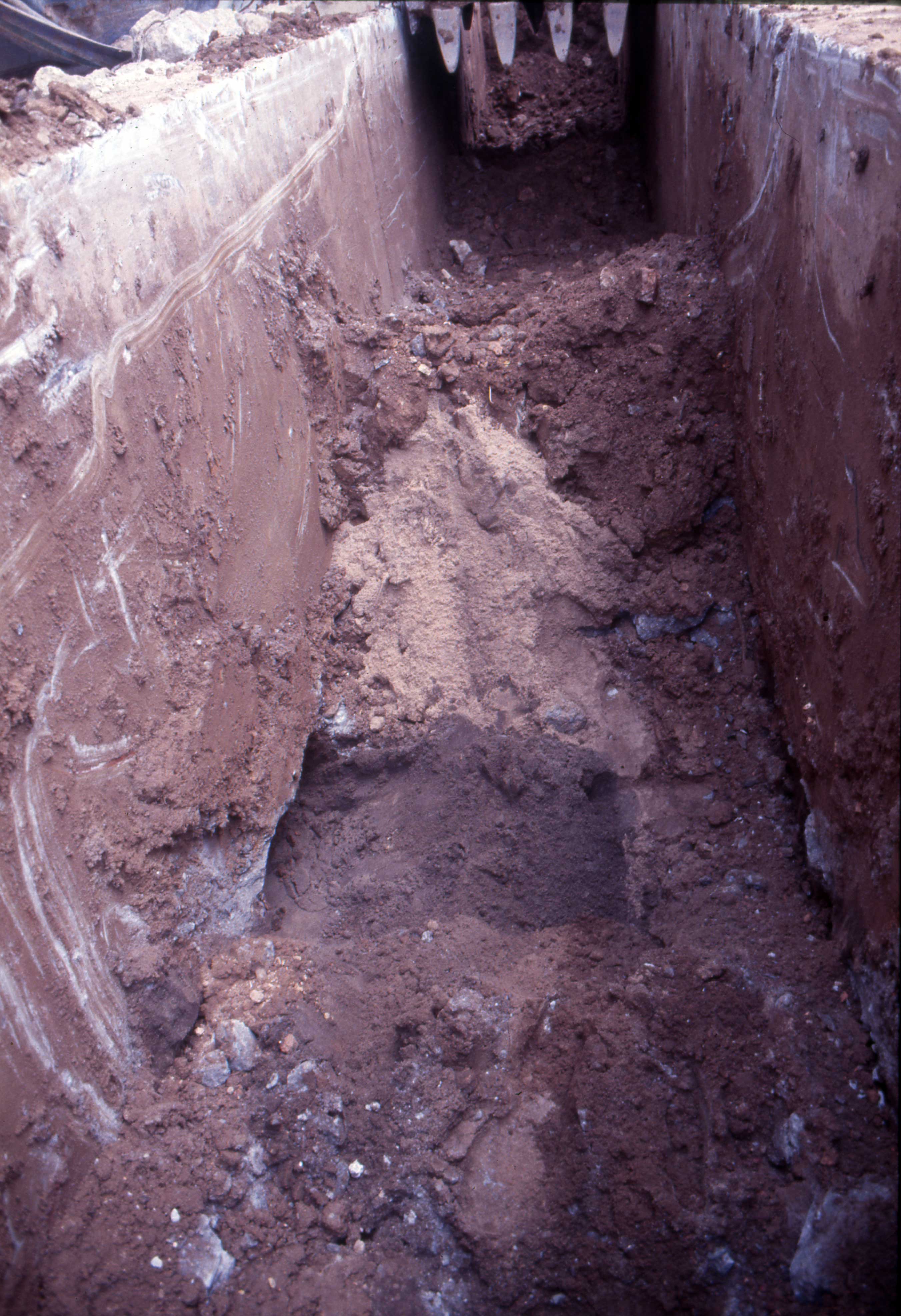
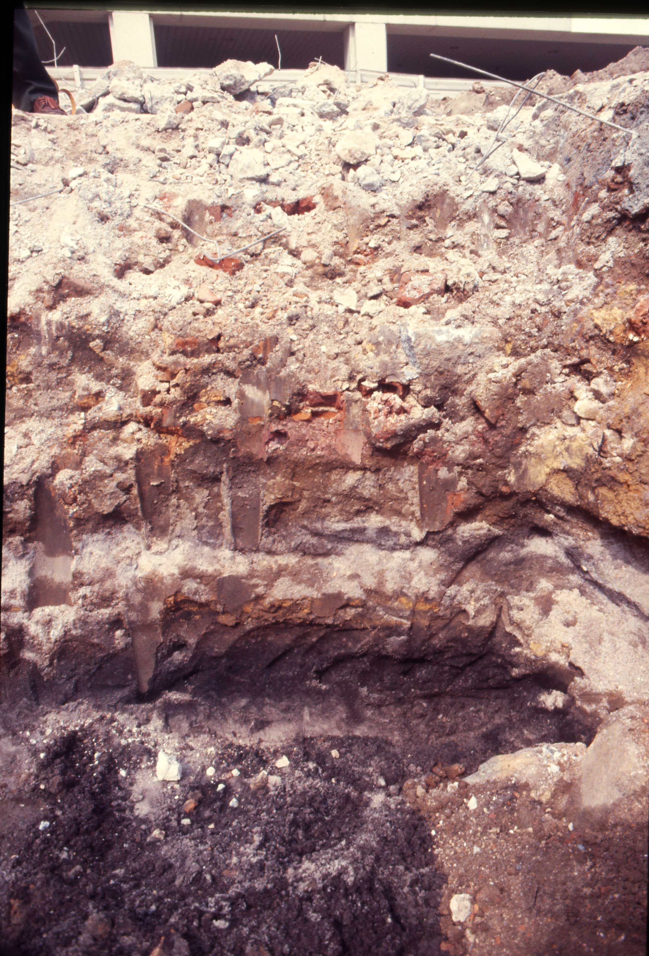
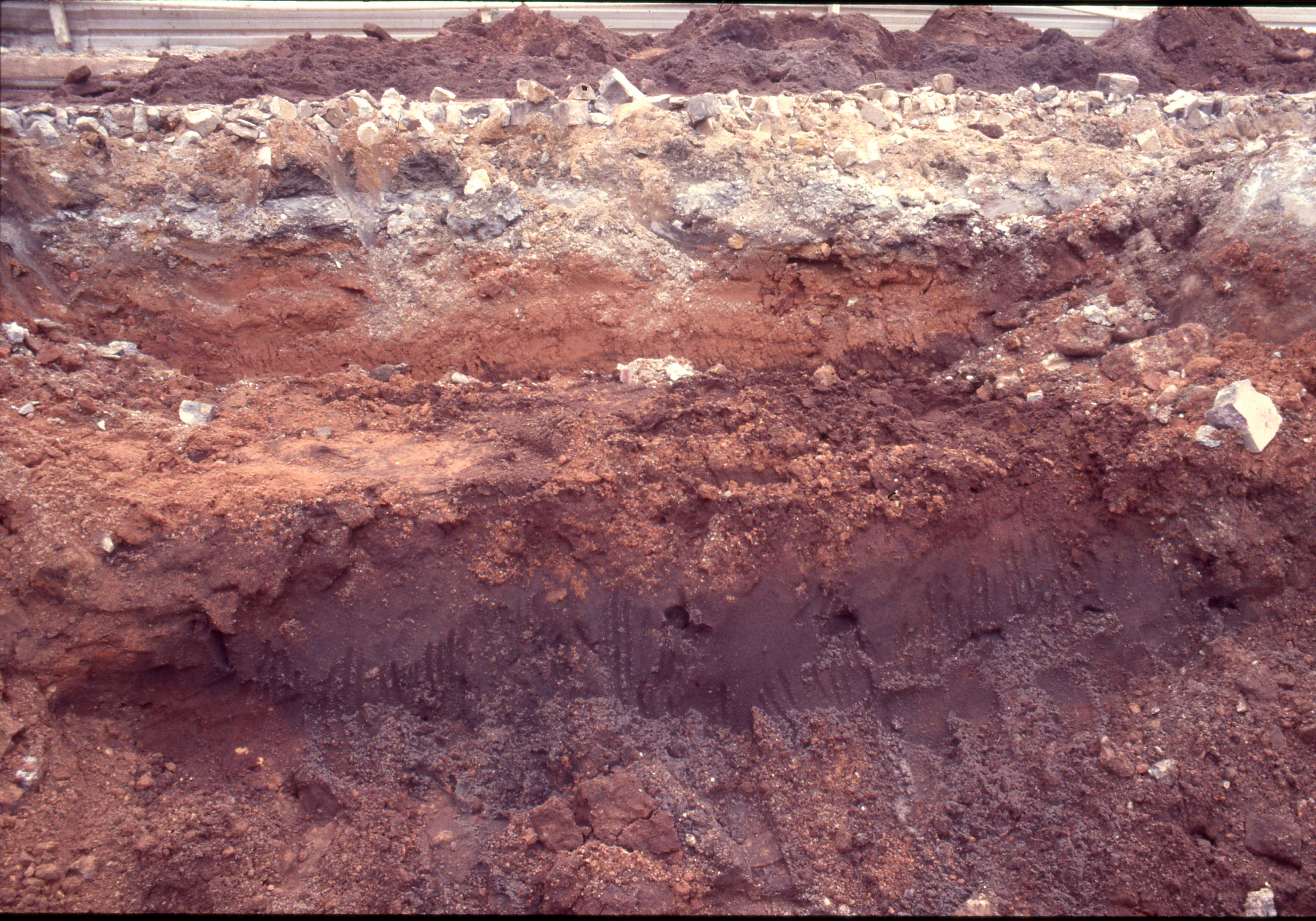
Excavation in Square 1 was conducted in 10-cm artificial layers. The upper layer containing construction fill was removed by mechanical digger to a depth of approximately 70-100 cm. In some units, it was possible to discern natural layers (lots) within the excavation, but on the whole no clear transition could be observed between the colonial and precolonial strata. The average thickness of the entire artifact-bearing layer containing both 14th-16th and 19th-20th-century remains was 20-30 cm. Due to the thinness of the layer and the nature of the sandy soil, much mixing of colonial and precolonial artifacts was observed. Nine sections of the grid (ID1-3, IE1-3, and IF1-3) were excavated. At the lower boundary of the black sand stratum was a layer of white sand, representing the period before human occupation of this area of Singapore which took place around 1300. The layer was found at SCC, St. Andrew’s Cathedral, and at Istana Kampung Gelam. Some post molds were discerned in this layer, indicating the presence of some type of wooden structures, perhaps Malay-style houses on stilts.
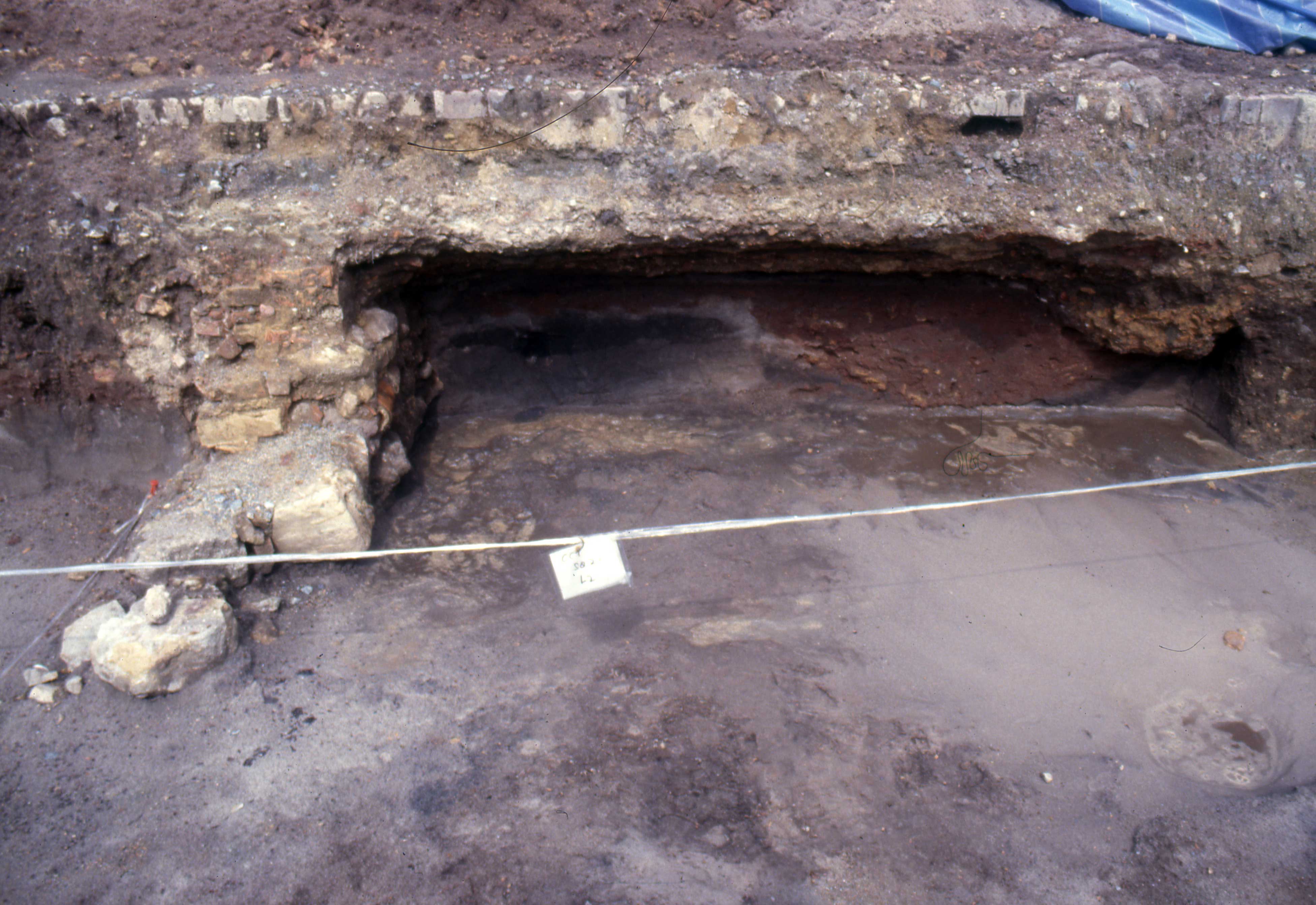
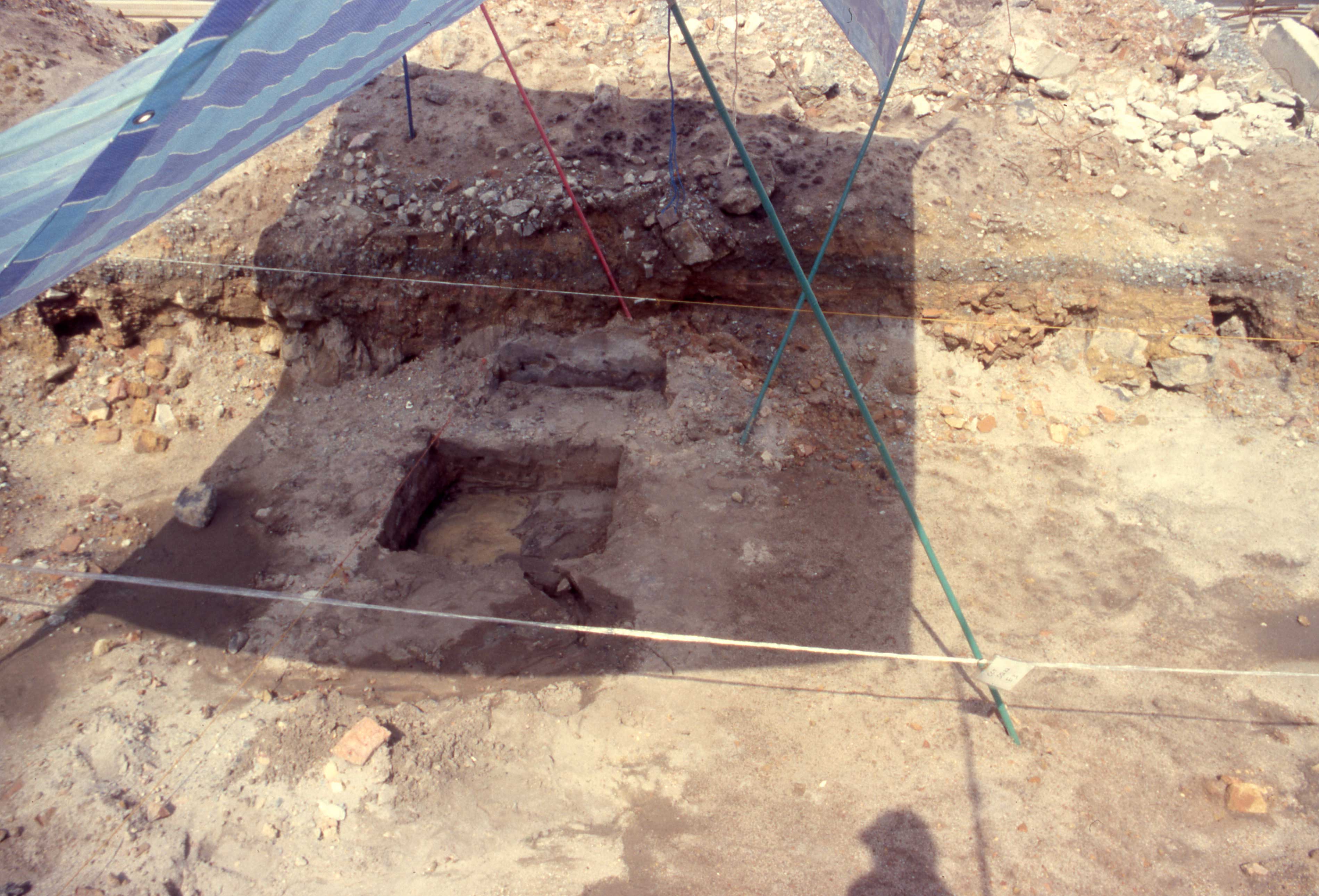
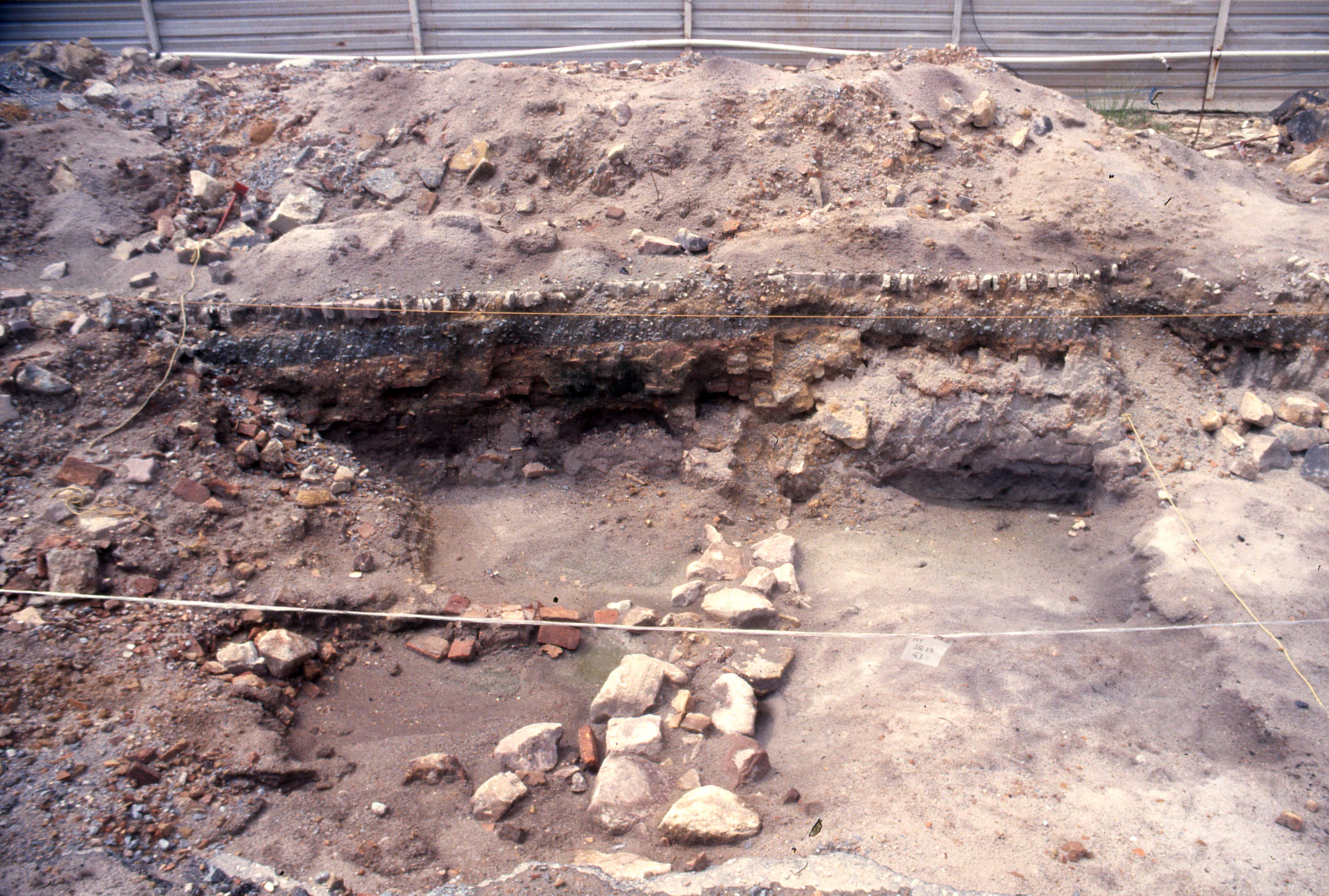
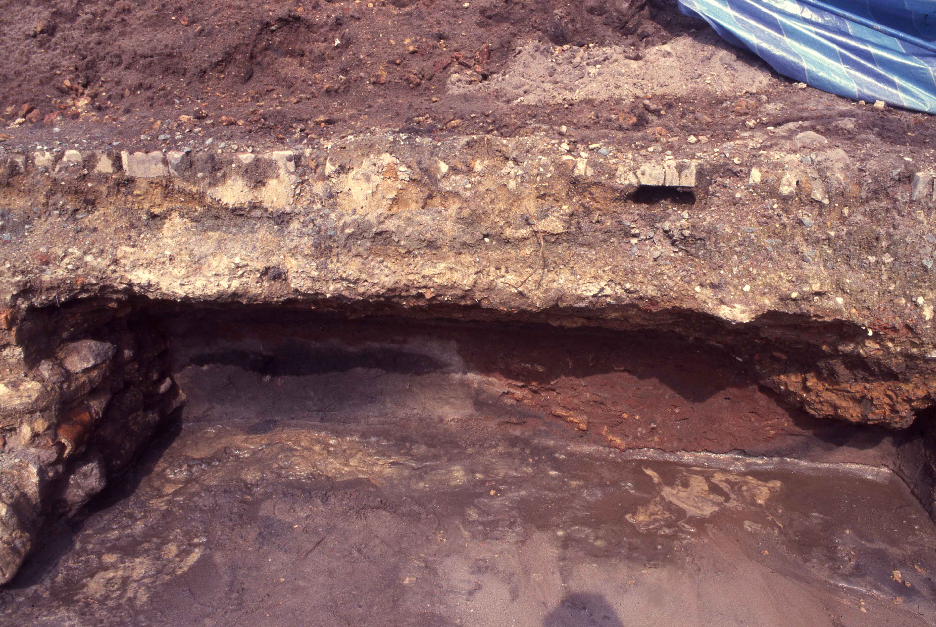
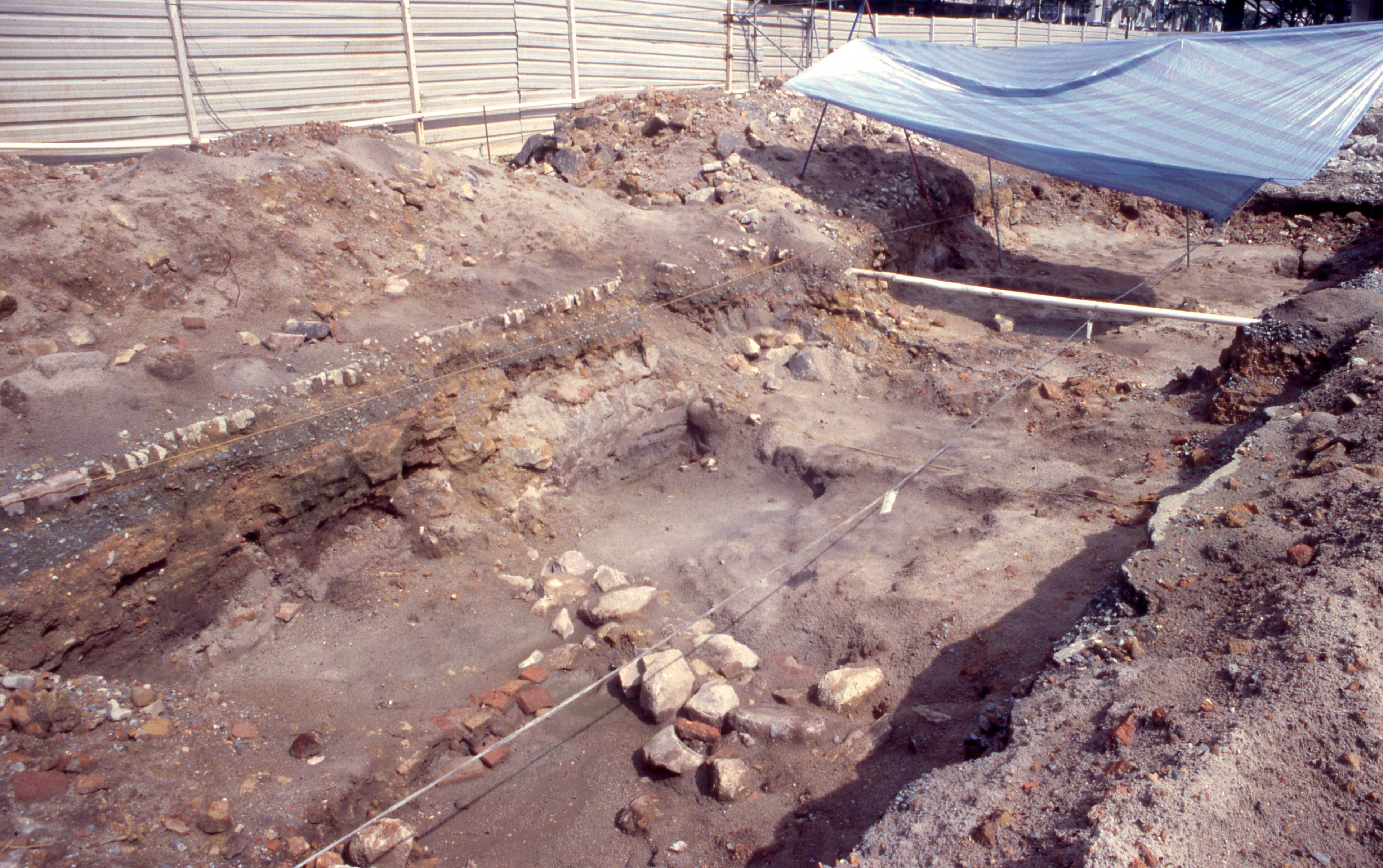
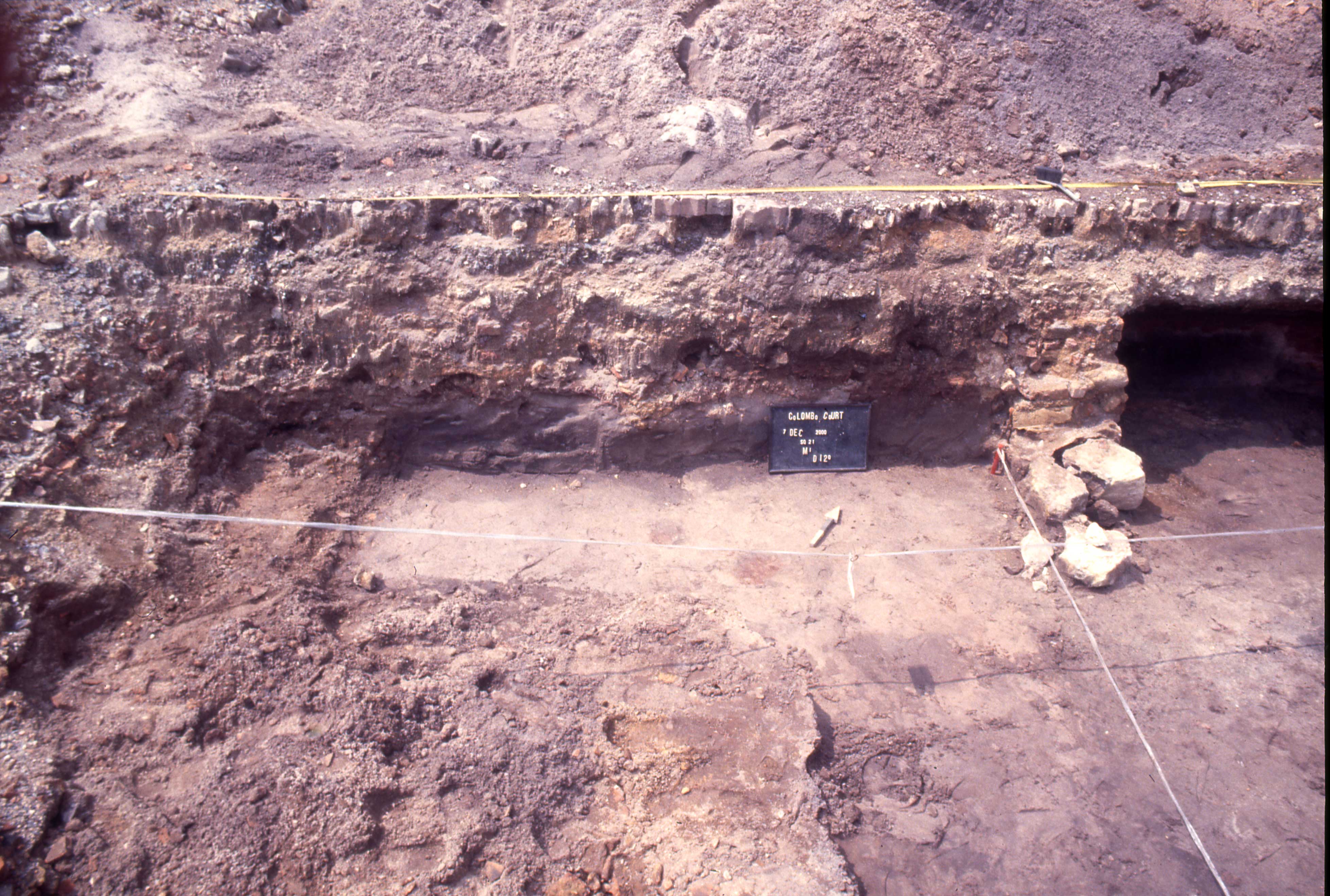
The northwestern profile of Square II-1 (M1) displayed the most coherent stratigraphy. Beneath a brick wall or foundation it was possible to trace the foundations of an earlier structure made of round stones, possibly dating from the early to mid-19th century. This probable foundation had been made by digging into the precolonial layer. Two other probable 19th-century intrusions were also noted at other locations. (See also John Miksic, Singapore and the Silk Road of the Sea, Singapore: NUS Press, 2013, figures 5.46 and 5.47, p. 253 for photographs of Square I and Square II.2 during the excavation).
Excavation in Square II, 30 metres northeast of Square I, was conducted by rapid digging due to time constraints and a desire to prioritize artifact recovery. No stratigraphic data for the artifacts were recorded. This is unfortunate, because Square II turned out to yield the densest concentration of artifacts. Square II-1 consisted of five 5x2-metre units, for a total of 50 square metres. Square II-2, 15 metres northeast of Square II-1, consisted of four 5x2 units (20 m²). Square II-3, 10 metres further northwest, was a single unit, measuring 5x2 metres (10 m²).
It is not yet possible to compare quantities of artifacts from CCT with other sites northeast of the Singapore River such as Parliament House Complex (PHC), Empress Place (EMP), Old Parliament House (OPH), or the Singapore Cricket Club (SCC), since the complete data for those sites have not yet been compiled. It is however notable that PHC and SCC both yielded much evidence of specialized metalworking, whereas CCT does not exhibit such remains. While it is probably safe to conclude that CCT was not a specialized metalworking site, it is impossible to discern what activities actually took place on the site. Two postmolds found in Square II indicate that some kind of building on wooden piles once stood here, but we do not know what that building was meant for.
No stone beads comparable to those found at SCC were found at CCT. A few 15th-century Chinese and Vietnamese ceramics were found at CCT, indicating that this area like PHC and EMP was not abandoned when the Malay political centre moved to Melaka in 1400. Fort Canning Hill was deserted after that date, but the Portuguese recorded that a harbourmaster representing the kingdom of Johor was stationed at the mouth of the Singapore River around 1600, together with Chinese ceramics of the late Ming found along the Singapore River at PHC and EMP, show that an international port was still functioning at that date. The discovery of the Vietnamese cup and a few Ming sherds at CCT show that the settlement was not restricted to the riverbank; it also extended into the centre of the area between the river and the Old Malay Wall, now Stamford Road, which formed the northeast boundary of ancient Temasek.
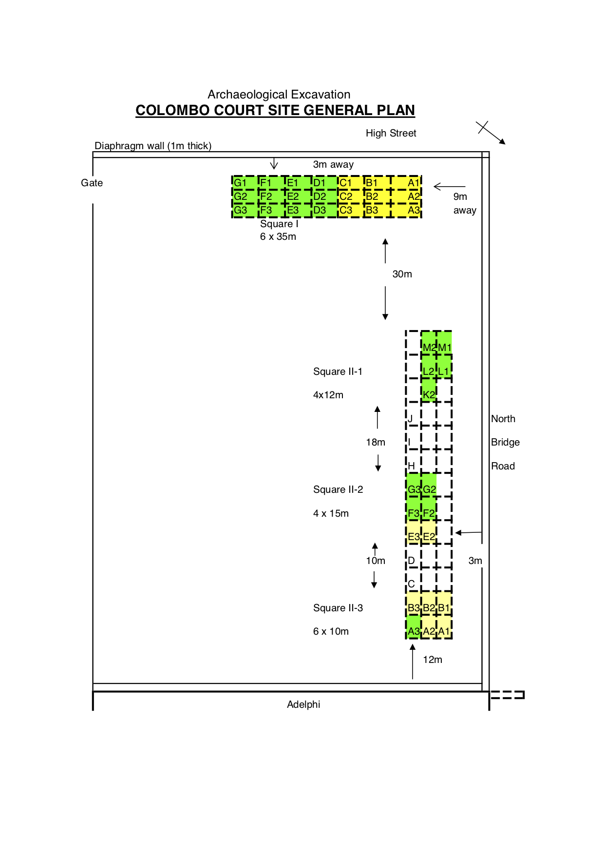
The units highlighted in green are fully excavated and the ones in yellow were not completed.
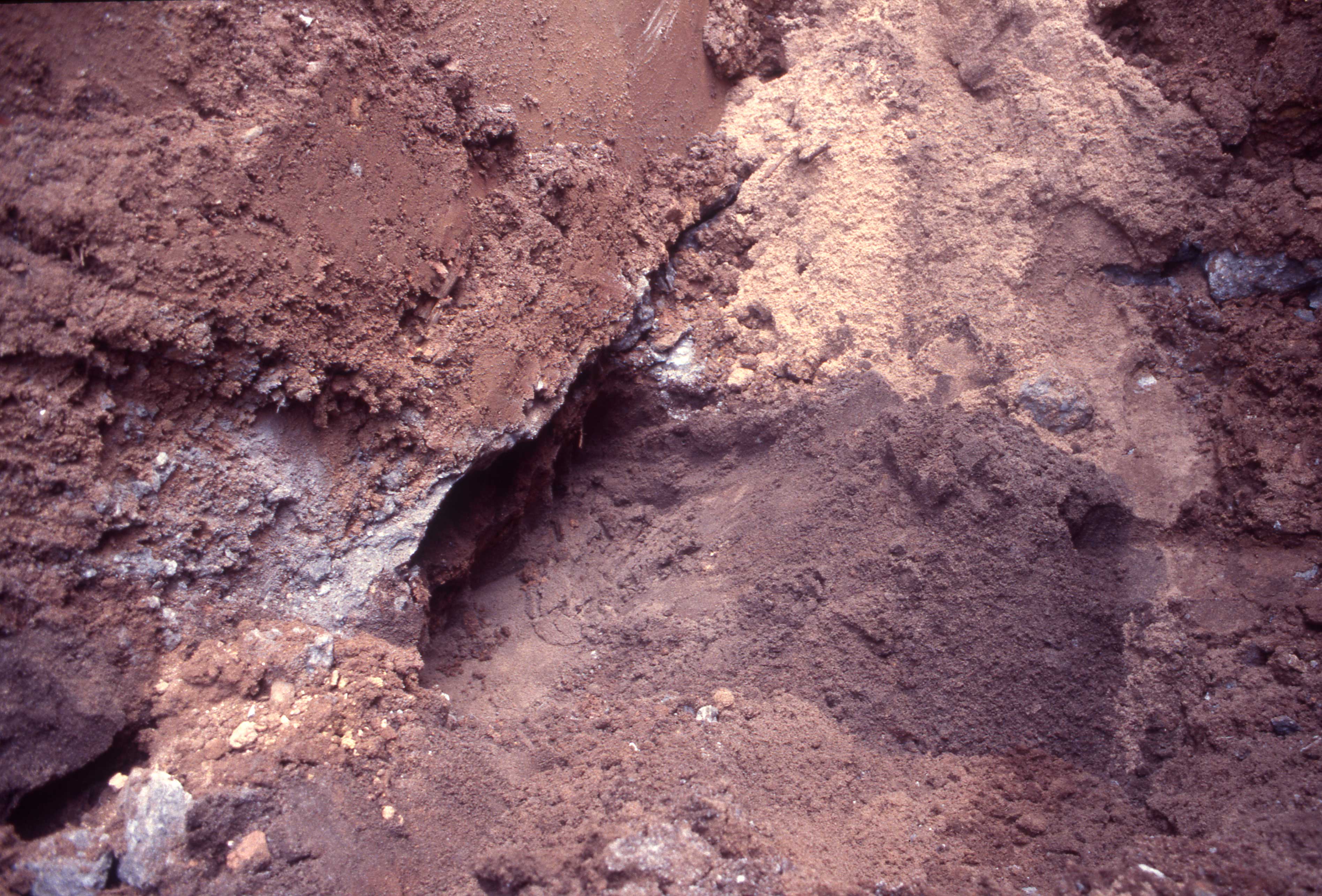
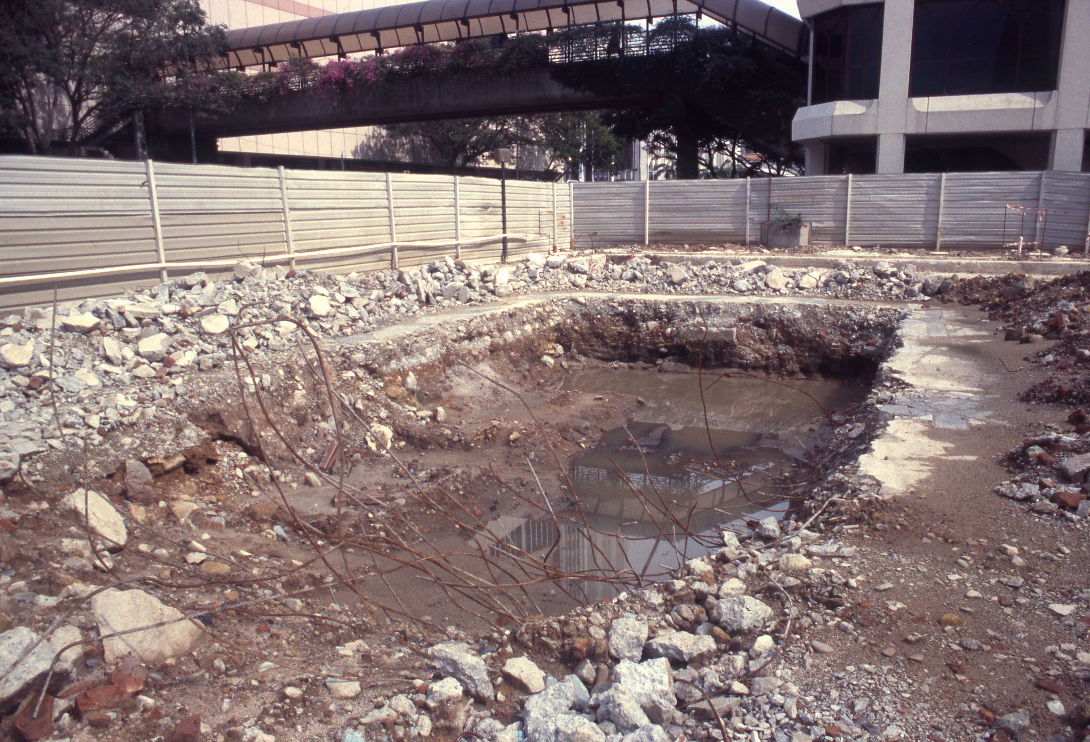
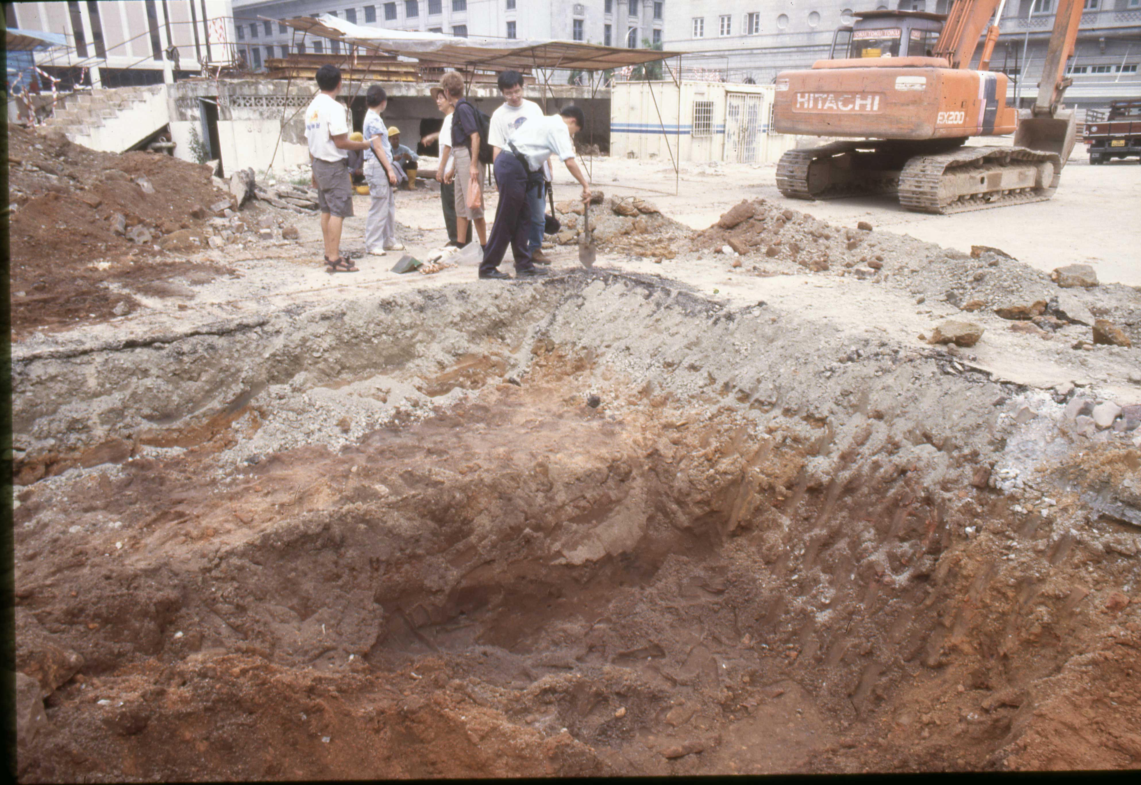
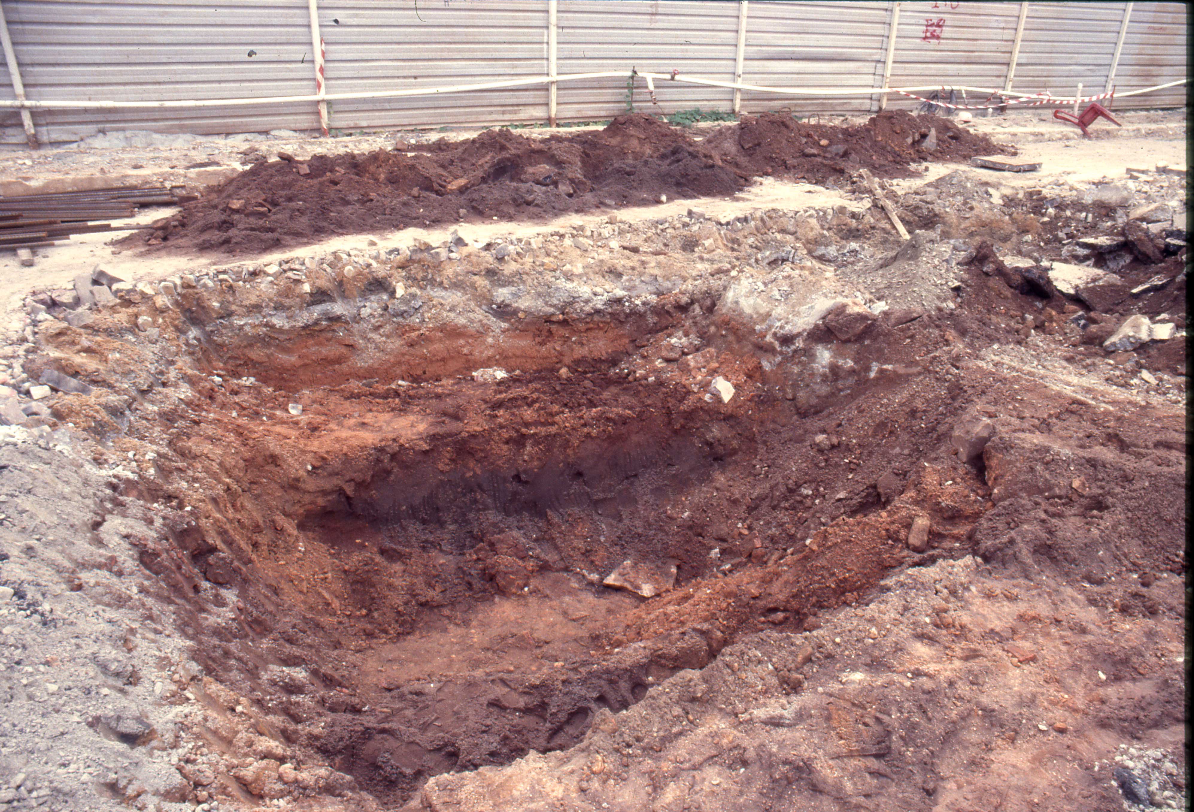
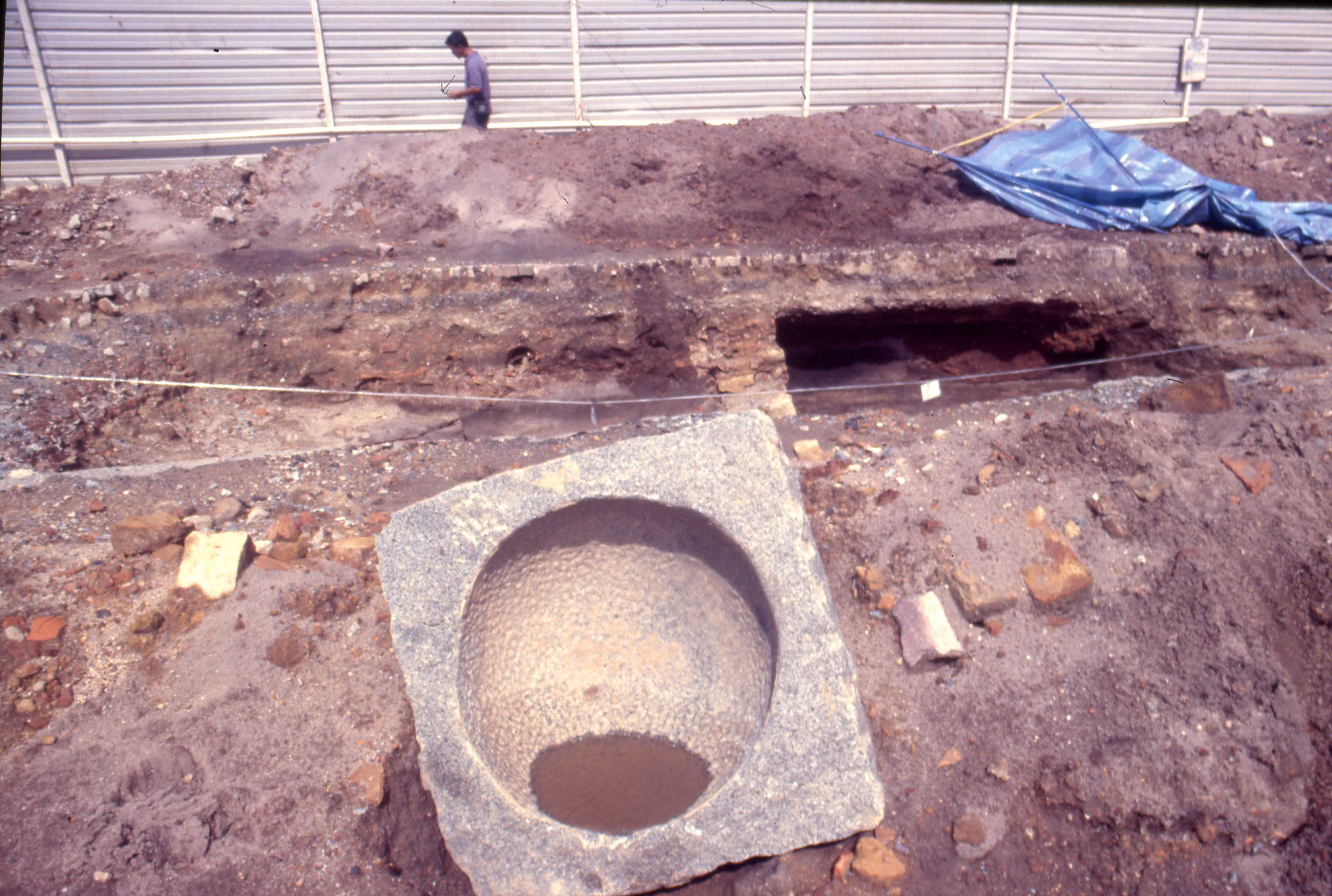
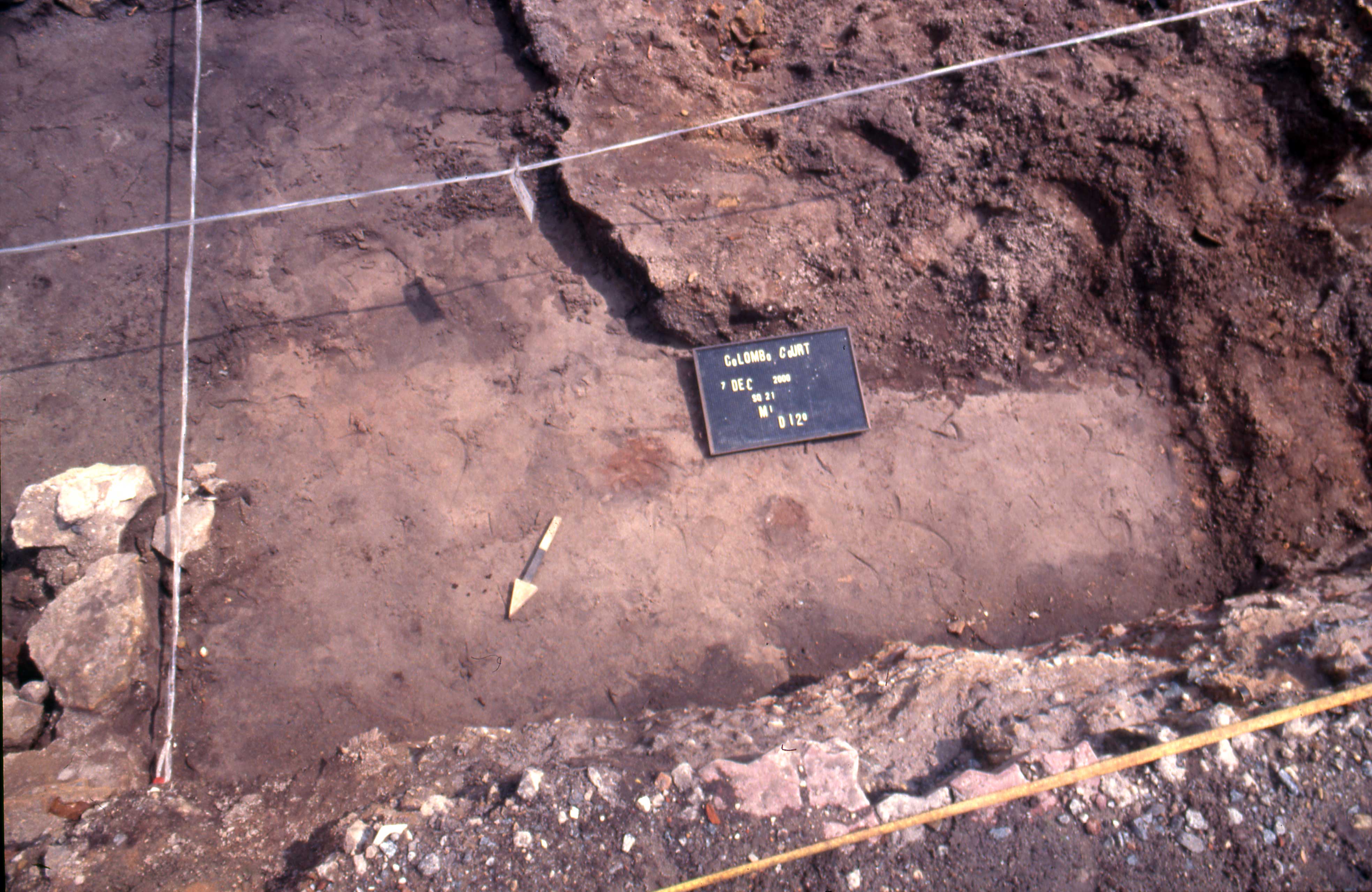
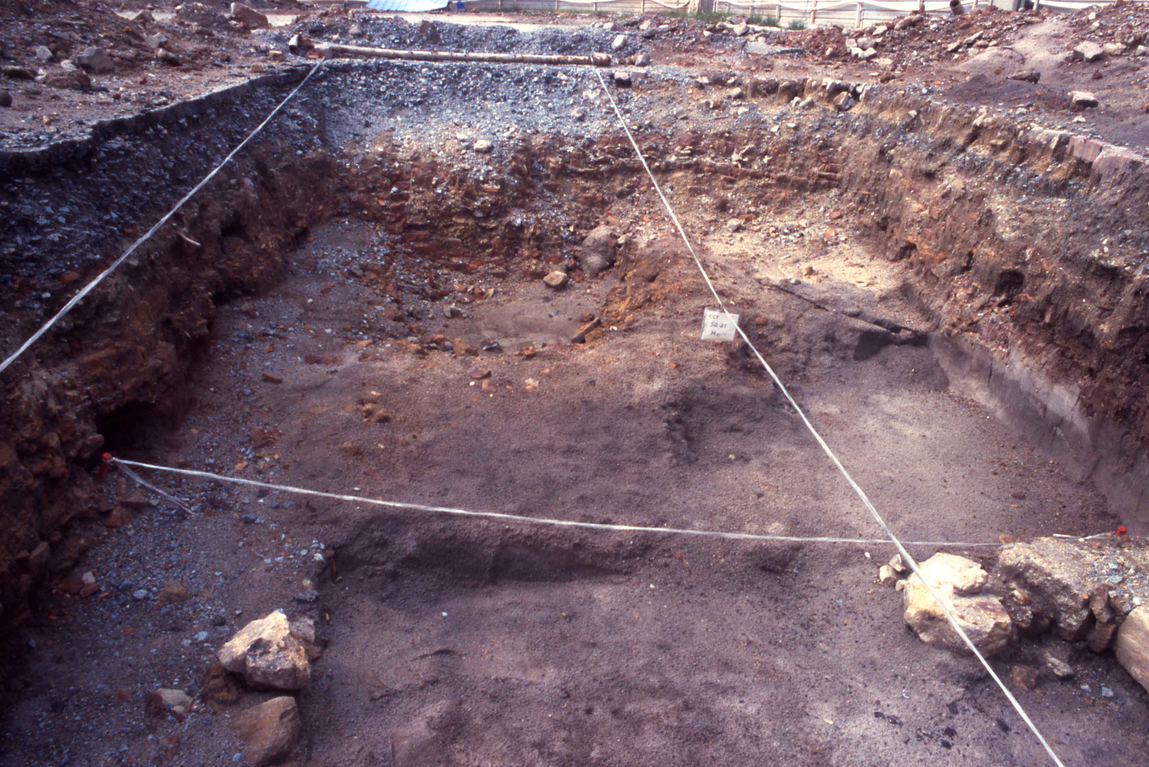
Photographs of Excavation: