Several sites have been excavated specifically in order to recover information about life in Singapore during the colonial era (1819–1962). These include Duxton Hill, Istana Kampong Gelam, and Bras Basah Park (Miksic 2013: 420–31). Another site, Pulau Saigon, was not excavated, but artifacts were systematically collected there in the late 1980s. This site was an island in the river. Shaped like a triangle covering about 8,500 square meters (Low 1996: 20; The Singapore and Straits Directory, 1904: 52), the island practically ceased to exist when an underground tunnel was constructed as part of the Central Expressway in the late 1980s. An eight-lane expressway and two tunnels now occupy the space where the island formerly existed. As a result, there is no possibility that any further archeological investigation can be conducted at this site. None were conducted previously either. The names “Pulo Saigon Road” and “Pulau Saigon Footbridge” were printed in the Singapore Street Directory of 1988 (Map 19) but had been expunged by the time the 1991 edition was published (Low 1996: 5), signifying the end of any geographical feature which could be called Pulau Saigon.
A public-spirited Singaporean, Koh Lian What, began gathering artifacts from construction projects on the island in the late 1980s (Koh 1989), and contacted John Miksic, an archeologist at the National University of Singapore. Miksic worked with volunteers to recover as many of the archeological remains from the island as was possible during the early phase of the expressway construction by surface collection (Miksic 2013: 420–1). These remains were later examined by Jennifer Barry, who analyzed and classified many of the main types (Barry 2000). Cheryl-Ann Low Mei Gek investigated the archival sources concerning the island and compiled the results in her honors thesis (Low 1996). The authors of this report have made extensive use of the works of Koh, Barry, and Low.
The place name “Kampong Saigon” first appeared on maps in 1878 and 1881 (Low 1996: 6; Barry 2000: 8). These and later maps and oral history indicate that Kampong Saigon included not only the island, but the land on the opposite bank of the Singapore River where River Valley Road now runs. For example, on a map from 1923, an area on the north side of the river opposite Pulau Saigon is also labeled Kampong Saigon (Low 1996: 28b). The appearance of the name corresponds to a period when urban development was proceeding up the Singapore River and had just reached this deep into the hinterland. “Kampong” is a Malay word which in an urban context suggests the existence of a cluster of settlements possessing a particular character which identifies it and distinguishes it from other such clusters. Kampong can be named after ethnic groups, occupations, plants, unusual geographical features, or social strata, among various possibilities.
The origin of this name is unknown. One author (Raja-Singam 1939: 131) claimed that Vietnamese products were stored on the island in the “early days”, but he gives no source to substantiate this claim; it may have been his own inference. Singapore’s second Resident, John Crawfurd (1828: 510) was aware that Saigon was a major port, but he said nothing to indicate that commerce with Saigon was important for Singapore.
A local newspaper, The Singapore Chronicle (March 25, 1830) reported that ships from Cochin China (southern Vietnam, including Saigon) anchored in the Singapore harbor, but were probably too big to go up the Singapore River. There is no indication that trade with Saigon or Saigon merchants were important to Singapore’s economy until the 1860s (Low 1996: 8). According to Low (1996: Appendix A), trade between Singapore and Cochin China suddenly increased from $1.2 million in 1857–58 to $3.2 million in 1869. This was mainly due to rice purchased by Singaporean merchants (Wong 1960: 24). Much of this rice was not meant for Singapore; it was re-exported (Wong 1960: 157). It seems unlikely that an appreciable community of Saigon merchants was living in Singapore at this time.
According to another hypothesis, “Saigon” was a corruption of “sago” (Low 1996: 11–2). Sago was an important source of dietary starch in Southeast Asia in ancient times. Sago palms are listed among the plants grown in the royal garden of Srivijaya in 7th-century Sumatra (Coedès and Damais 1992: 50). In the 14th century, when a fleet from Thailand attacked Singapore, the invaders ate sago rather than rice (Rockhill 1915: 100). Pulau Saigon was once known for its sago mills (Berry 1982: 91). A week after Sir Stamford Raffles landed in Singapore in 1819, a cargo of sago arrived, relieving the shortage of food available in the small settlement. By 1827, Singapore surpassed Malacca as a sago milling center (The Singapore Chronicle March 15, 1827; Low 1996: 11). Most of the sago mills were located along the “creeks and canals of the Singapore River” (Logan 1849: 307) which would have included Pulau Saigon. This was a convenient environment for unloading the bulky raw material and loading the finished flour. A supply of water was another necessary ingredient in the processing of sago for food.
Coleman’s Map of the Town and Environs of Singapore (ca. 1836), shows the island, still nameless, surrounded by mangrove swamp. By 1878, the area known as Kampong Malacca appeared on the right bank of the Singapore River opposite Pulau Saigon, a further indication that development was expanding upstream, leading to the naming of places (Low 1996: 17).
The first description of Pulau Saigon appears in a government publication, Report on the Straits Settlements Blue Book (1880: 563), and it is not complimentary. According to the publication, Pulau Saigon was “covered with huts upon piles occupied by some of the worst characters in Singapore” (Low 1996: 13). In 1881 there were still no buildings or roads on the island worthy of being depicted on a map. In 1888 the character of the island was profoundly altered (Low 1996: 15–7). All existing structures (which were probably flimsy buildings of wood and thatch) were removed. A concrete wall was built around the island, and the level of the island’s surface was raised by about a meter using mud dredged from the river and refuse collected from the town. Communication between the island and the mainland was facilitated by the construction of a quay for loading and unloading boats, and two bridges linking the island to the north and south sides of the river. A dirt road called Pulo Saigon Road was built across the island (Low 1996; CO 273/152: Correspondence from Cecil Smith to Lord Rutherford May 19, 1888; Straits Settlements Annual Report (SSAR) 1888, 233; SSAR 1889, p. 169; Administrative Report of the Singapore Municipality (ARSM) 1890, 1896).
The marginal position of Pulau Saigon in 1889 is evident from the use to which the newly reclaimed island was put: an abattoir for cattle and pigs covering about two-thirds of the island. This abattoir existed for 40 years before it was moved to a more remote location (Low 1996: 18). Hokkien and Cantonese names for the island, “Thai-tu-long khau” and “Thong-chu fong” respectively, meaning “place where pigs are slaughtered”, date from this period (Firmstone 1905: 120–1; Tan et al 1906: 204). Four incinerators for trash, two of brick, two of clay, were also constructed on Pulau Saigon at this time (Low 1996: 19). However, it seems that the smoke from the burning trash spread far enough to annoy nearby residents, so they were removed a year later (Low 1996: 19; ARSM1889: 9).
Storehouses were apparently built on the remaining land on the island between 1895 and 1905, used to store various commodities such as timber and Malacca tiles (Low 1996: 22; various building plans). In 1907 an extension of the railroad which linked Singapore to the Malay Peninsula was built across Pulau Saigon’s eastern side (Low 1996: 23). Sidings, a goods station, and railway godowns were built, but no facilities were provided for passengers (Low 1996: 24). Pulau Saigon was very close to Singapore’s main passenger station which stood just across the Singapore River, approximately where the Fort Canning MRT station now exists.
In 1930 the government abattoirs were converted into warehouses for commodities such as rice (Low 1996: 28–30). According to oral history accounts, pythons were raised there to keep the rat population in check (Low 1996: 32). Another account of Pulau Saigon in the 1950s mentions that businesses such as a private abattoir still operated there, along with an ice factory and a bumboat repair workshop, most of which were not officially registered (Low 1996: 31). A map of Pulau Saigon in the 1930s shows an “abbatoir” [sic] on the island’s northwest corner, and a Public Works Department store east of it (Low 1996: 42a) The latter structure was still there in 1954 (Low 1996: 42b, “Map of Singapore City”).
In the 1960s most structures on the island were still attap sheds in which charcoal, gutta-percha, and rice were stored. Few people actually lived on the island; those who did worked in the warehouses. There were coffee and provision shops but no wet markets (Low 1996: 33–4). Oral sources indicate that opium was smuggled onto the island and consumed there (Low 1996: 35–6; Koh Lian What 1989: 57). Among the artifacts Koh discovered were five opium cups with a thin brown glaze, which came in two sizes: a smaller type, 2.5 centimeters high with a base diameter of 1.9 centimeters; and a larger type, 3.2 centimeters high with a base diameter of 2.3 centimeters. “Former opium addicts, who are more than 60 years old, say that they have not seen these cups being used during their time, but believe that these were opium measuring cups used at the dens. Such identification could date the cups to about a hundred years ago” (Koh 1989: 68; Fig. 37, p. 69). A total of 14 similar artifacts were found during an archeological excavation in the alley behind a house on Duxton Hill (Miksic 1989: 39–40; Miksic 2013: 424–5, Figs. 12.22–23). This secluded area would have been a good place to consume opium without fear of detection. One of the artifacts recovered during a surface collection in 1989 was part of an opium pipe (Miksic 2013: 411, Fig. 12.19).
By the 1980s most of the godowns still standing on Pulau Saigon had been abandoned, some of which were perhaps a century old (Koh 1989: 57), but at least five were still active until 1990 (Low 1996: 40). Other old warehouses were still standing on what had been the west coast of Pulau Saigon at Alkaff Quay and Earle Quay.
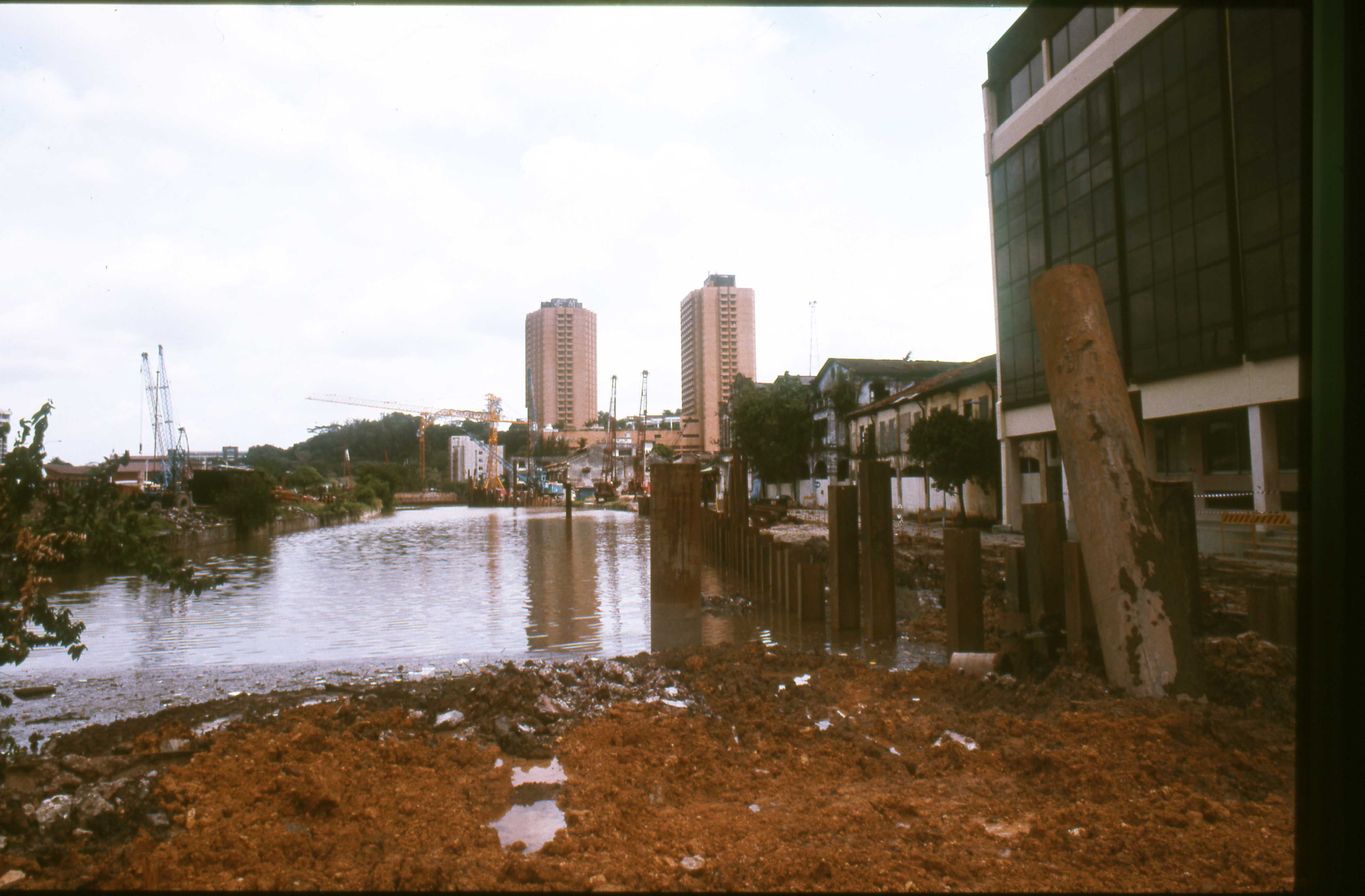
The first stage of reclamation work on the west side of Pulau Saigon began in 1972. The arm of the river which separated the island from the western mainland near Alkaff Quay and Earle Quay had been filled in by that time, so Pulau Saigon was technically no longer an island. The east side of the island was still bounded by an arm of the Singapore River, which separated it from Magazine Road (see Barry 2000: photograph, pg. 10, courtesy of Koh Lian What).
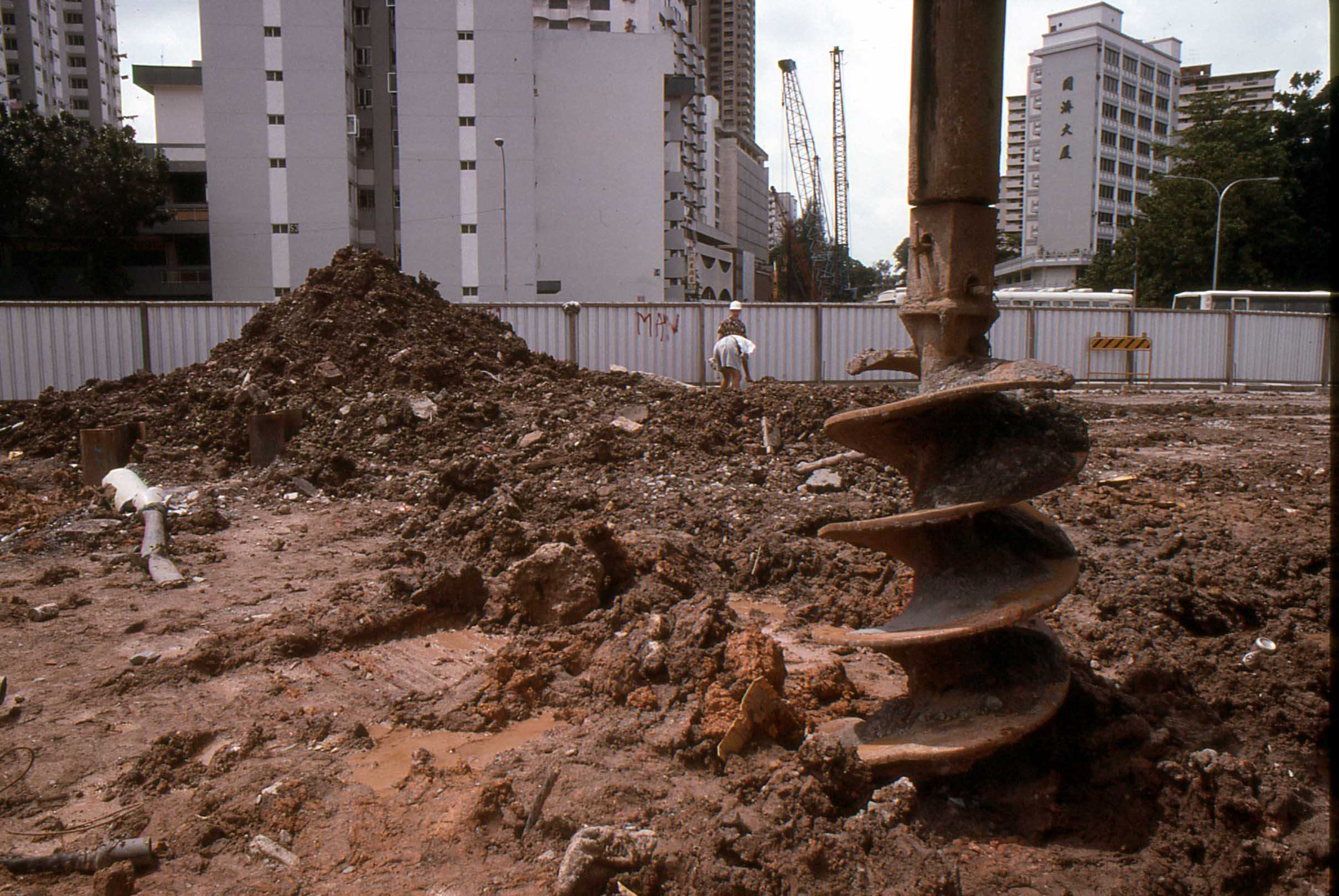
Koh began collecting artifacts at the site in 1986 when Telecoms and the Public Utilities Board undertook construction involving the excavation of trenches. When major excavation work for the Central Expressway began in 1988, Tan Gek Choo and his family, who had established Chuan Bee Petrol Station at the south end of the island around 1950, were living in a red zinc bungalow behind it (Low 1996: 33). They called Koh’s attention to the artifacts exposed by this project (Barry 2000: 14). Koh had read about Miksic’s excavation at Fort Canning and contacted him. Miksic assembled a small team of volunteers to assist in surface collecting, which took place during the rainy season from November 1988 to March 1989 when construction work was at a low level due to the weather and the holidays which took place during this period (Miksic 2013: 420–1, Figs. 12.17–20).
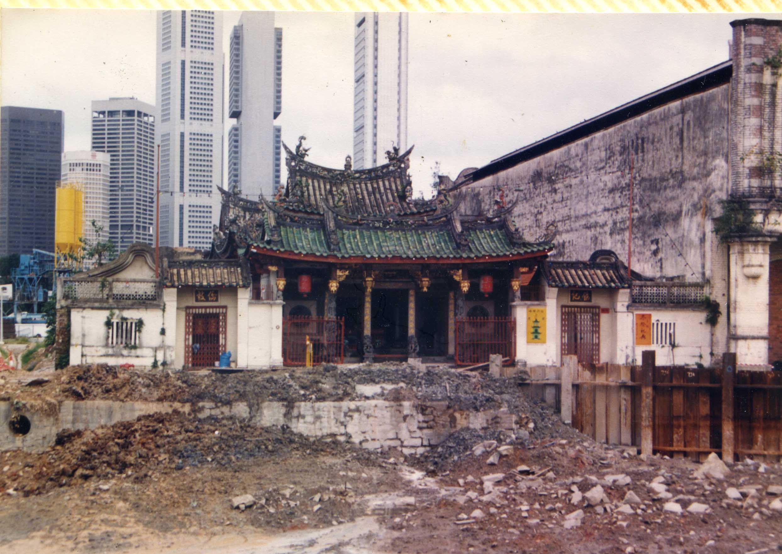
Photographs of Pulau Saigon in Koh’s 1989 report include three black and white photographs of the construction project. One shows the view of the Tan Clan Ancestral Temple (Tan Si Chong Su Temple) on Magazine Road east of the island, which was originally located on the bank of the arm of the river that ran along the southwest side of the island. The temple is still there, but now faces a street which was built over the old riverbed. Barry’s 2000 book includes six color photographs of the island taken by Koh in 1989 (Barry 2000: 9–10) and a photograph of Kampong Saigon taken in 1932 from Fort Canning Hill (Barry 2000: 12).