
A. Background of this research project
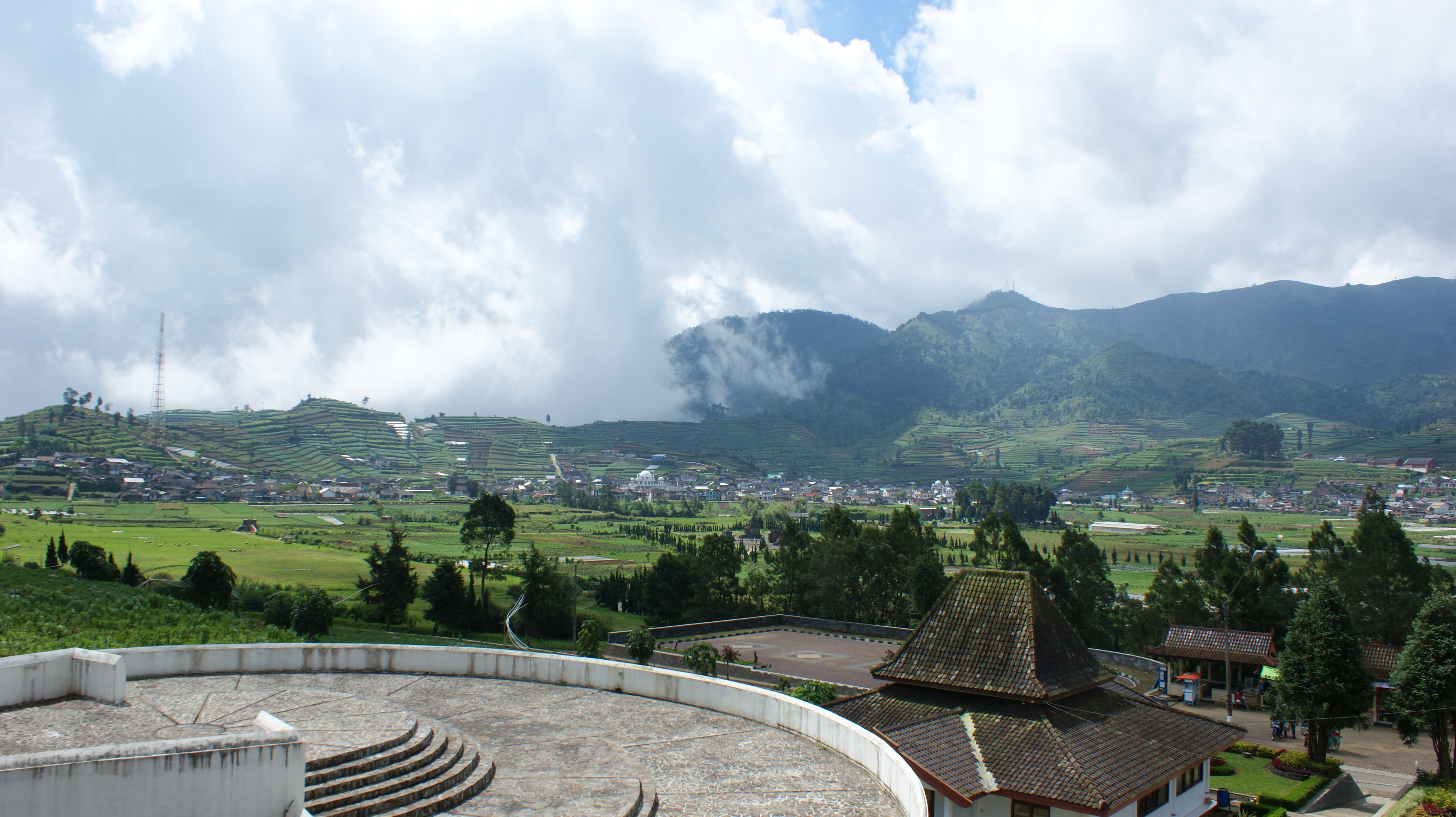
The Dieng Plateau lies at an approximate elevation of 2000 meters above sea level. At night temperatures can fall to the freezing point. The plateau is 1,800 meters long from north to south, and 800 meters wide at its widest point. It forms an oblong bowl, probably formed by a volcanic crater. The valley is surrounded by a number of peaks including Perahu and Panggongan. A small river, the Kali Tulis, flowed into the remains of the lake in the centre of the crater, Bale Kambang, until the end of the 20th century. Now the river and lake have practically vanished due to water diversions by farmers, who have become prosperous by supplying temperate crops such as onions and carrots to consumers in the lowlands. Another lake, Telaga Warna, exists in the southeastern part of the crater, but it too is rapidly disappearing.
The Dieng plateau in ancient times was known as Dihyang, a derived from Old Malay, in which language it means “ancestors”. The plateau was probably viewed in prehistoric times as a propitious place where humans could commune with the spirits of the deceased in order to obtain their protection. The numerous volcanic phenomena found on the plateau no doubt aided considerably in the attachment of this belief to this specific area.
The Chinese may have heard about Dieng as early as the 9th century. According to the New History of the Tang Dynasty, the king of Java made an annual pilgrimage to a high place known as Lang-pi-ya from whence he could view the sea (van Orsoy de Flines 1941-47; Groeneveldt 1960: 14) . A Javanese inscription of 919 CE mentioned that Dieng was one of Java’s sacred mountains (Lulius van Goor 1922: 220.
Research on the temple complex of Dieng has largely focused on built structures and inscriptions, mainly to ascertain the construction period of the candi (temples) in the complex. Although some portable artifacts such as bronzes, earthenware, and ceramics have been recorded, these finds have not been the focus of research in the past. The artifacts most analysed are statues which have been used to study the styles of carving applied in the Dieng temple complex. The research project reported here endeavoured to recover earthenware, foreign ceramics and other possible finds in order to illustrate characteristics of trade contacts which linked Java to the outside world during the early Classic Period.
B. Previous research at the Dieng Temple Complex
The Dieng temple complex has been a focus for research since the 19th century. Most research has centred on the stone temples or candi and other structures in the area, as well as the translation and interpretation of inscriptions (Subroto 1984). Palaeographic study of the inscriptions indicates that the Dieng temple complex was built between 731 Śaka (809 CE) and 1132 Śaka (1210 CE) (Krom 1923, 1: 187, 198, cited in Subroto 1984: 4). An inscription in Brahmi script dated 731 Śaka (equivalent to 809 CE) was found behind Candi Arjuna, and the same date was found on a gold fragment found in one of the pits in the central portion of a candi in Dieng. A total of 13 inscriptions with “ancient kawi letters” have been found so far in the area surrounding the Dieng temples (Subroto 1984: 36). One date of Śaka 1132 (1210 CE) in another inscription in Kawi script on the peninsula between Telaga Warna and Telaga Pengilon, written in black paint, indicates this part of the site was visited (perhaps only briefly) almost 500 years after the temples were built. N.J. Krom believed that the plateau might have been reoccupied briefly in the 13th century, after a long period of abandonment (Krom 1923: 175). Another expert more recently inferred from the 1210 inscription that Dieng was in use for 500 years (Chihara 1996: 107). No archaeological remains from the intervening 500-year period have been discovered, so Chihara’s theory seems improbable. It does seem however that the plateau’s significance had not been entirely forgotten.
An inscription found on the Dieng Plateau written in Old Malay language in the eighth century provides a detailed list of items donated to Śiva, probably to a specific temple or group of priests. It includes 20 servants, 10 buffaloes, 2 wash-basins, 10 items of copper, 2 tahil (approximately 1 ounce or 28 grams) of gold, a suit of male clothing, 8 banners, an ivory comb, a mirror, 2 candles, 2 spoons , 4 jars, 2 stones, a kettle, and other items the meanings of which are no longer understood (Griffiths 2018: 276-278; De Casparis 1956: 207-11, Damais 1968: 439).
An undated inscription written in red paint in Brahmi script and found on the surface of a rock wall on the peninsula which divides Telaga Warna from Telaga Pengilon in the southeast corner of the plateau and written with a red-coloured substance, suggests that candi construction began during the 8th century. Experts in palaeography draw this conclusion from its style, which is similar to inscriptions using similar script such as the Sojomerta inscription from the Pekalongan area (7th century), the Tukmas inscription found in the Magelang area (6th century), and the Canggal inscription from Sleman (732 CE). Based on the dates of the various inscriptions found and the styles of the temple buildings, statuary, and decorations, Jacques Dumarçay concluded that the Dieng shrines were built in two phases. One phase lasted from the end of the 7th century to around 730, when Arjuna, Semar, Srikandi, and Gatotkaca were built. The second phase began in 730 and lasted until 780, when Puntadewa, Sembadra, and Bima were constructed. Although no new temples were founded after 780, modifications were made to some of these buildings from time to time over a long period. For instance Candi Gatotkaca was significantly altered in the mid-ninth century when its base was expanded to enable a second temple to be built next to it (Dumarçay 1986: 9-14).
The first inventory of the monuments here was made by Cornelis, who was sent here by Sir Thomas Stamford Raffles after Cornelis had completed the first survey of Borobudur. Cornelis found the plateau heavily overgrown by jungle, and was not able to inspect the entire site. A British officer, Captain Baker, followed his footsteps the following year. The plateau was uninhabited at the time. Later visitors through the first half of the 19th century continued to add to the number of buildings found on the plateau. In 1836 a visitor estimated that there were 400 ruins on the plateau (van Goor 1922: 23).The photographer van Kinsbergen transported his cumbersome equipment to the plateau in 1865, and in order to facilitate his work, he caused a channel to be dug which drained a lake which covered part of the valley floor. The Department of Public Works continued to excavate monuments until 1878, when the care of the site was delegated to a man who managed the local rest house for government officials, or pasanggrahan. Thereafter the valley became flooded again, and the local population took advantage of official neglect to begin quarrying the ruins for their own purposes. This activity was still going on when the Archaeological Commission of the Netherlands Indies was established in 1900.
The head of the Commission, J.L.A. Brandes, studied one of the ruins, Candi Bima. The first official restorer of Borobudur, Th. Van Erp, compiled a brief archaeological report on Dieng in 1909. From 1911 to 1916 Dieng was officially investigated under the supervision of the official Leydie Melville. By 1919 Dieng was included in a guidebook meant for the general public, which was translated into English in 1922 (Lulius van Goor 1922).
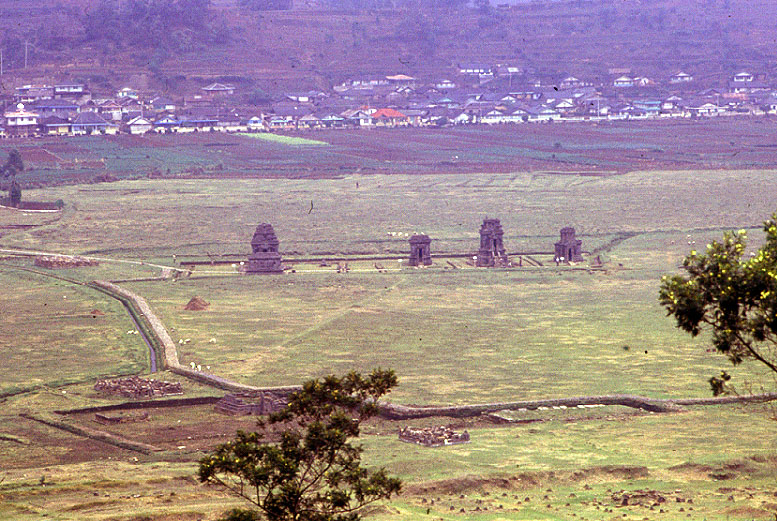
The largest group of surviving structures lies just north of the former Bale Kambang near the center of the plateau: the Arjuna Group. This group consists of temples named Arjuna, Srikandi, Puntadewa, and Sembadra, built in a line from north to south, with another structure, Semar, forming an auxiliary building in front of Arjuna. Further north on the slope of Mt Perahu is Candi Dwarawati. On the west side of the valley is Gatotkaca; at the southern end is Candi Bima. These are all that remained of the hundreds of ancient structures which once stood in the valley. In 2010 another ancient temple, Candi Sencaki or Setyaki, north of the Arjuna group, was rebuilt. These names all are derived from the Mahabharata. There is no evidence that the names are ancient, but they were already in use when Cornelis visited Dieng.
In addition to the stone temples, an ancient drainage system now called Aswatama stretches from the Arjuna group northwest toward the lowest point on the hills which rim the valley. On the east side of the valley is a stone wall (now called Candi Kelir) with a staircase; this was probably built as the facing for a platform built on the sloping rim of the crater. On top of the wall there is a broad flat area which provides a beautiful view over the valley floor. Ruins of structures were found here in the nineteenth century, but they have since disappeared.
In the 19th century, Candi Sencaki or Setyaki in the northwest sector of the plateau was still in “relatively good condition” according to Brumund (quoted in Krom 1923: 176). This temple had been reduced to a pile of rubble, but restorers succeeded in reconstruction much of it around the time of the excavations discussed in this report. In the 19th century there were also foundations of at least three other structures in the vicinity. They were named Onto Reco, Sombo, and Bagong. Next to Gatotkaca was Ngakulo-Sadewo. Four more ruined temples collectively called Candi Magersari once stood near Candi Kelir, on the eastern rim of the plateau. On flat ground at the top of the wall five small structures once stood in a row: Candi Dwarawati (two ruins), Abiyasa, Pandu, and the Guardroom. Further north, above the former pasanggrahan or rest house, were six temples, according to the explorer Franz Junghuhn, in two parallel rows (Krom 1923: 187). Possibly one of the temples then known as Dwarawati is the one of that name which still stands. Near it once stood another named Candi Parikesit, which van Kinsbergen photographed when it was still standing, and three others.
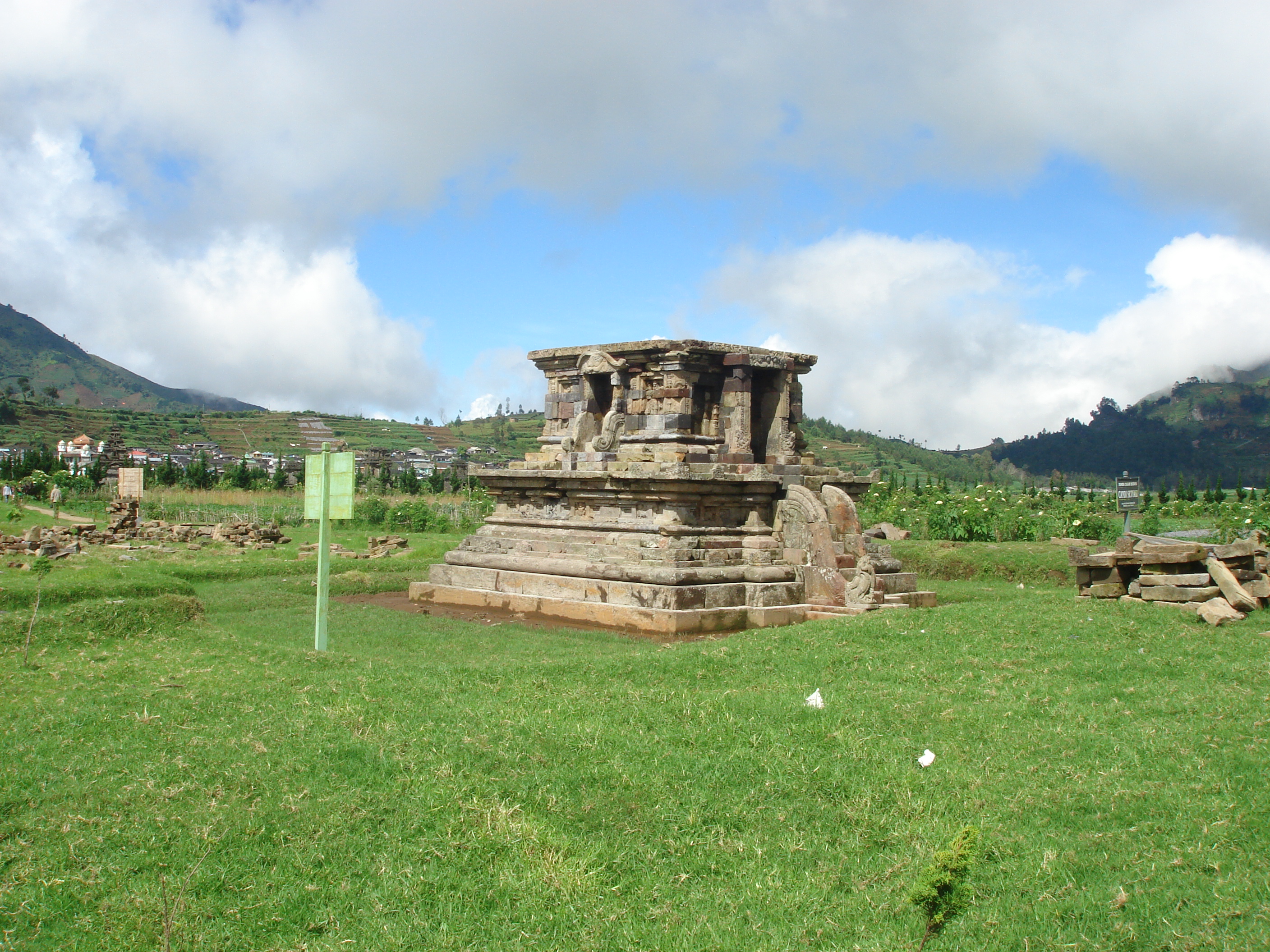
About 250 m west of Candi Arjuna was a foundation which had no local name and was therefore termed Candi A, which had a type of profile more commonly associated with 9th-century central Javanese masonry, and which Krom therefore concluded was evidence that the Dieng temples were ancestral to later Javanese architecture (Krom 1923: 200). The cubical temple body of the temple was adorned with reliefs of deities associated with Śiva, including his son Kartikeya on a peacock. This is now termed Candi Setyaki.
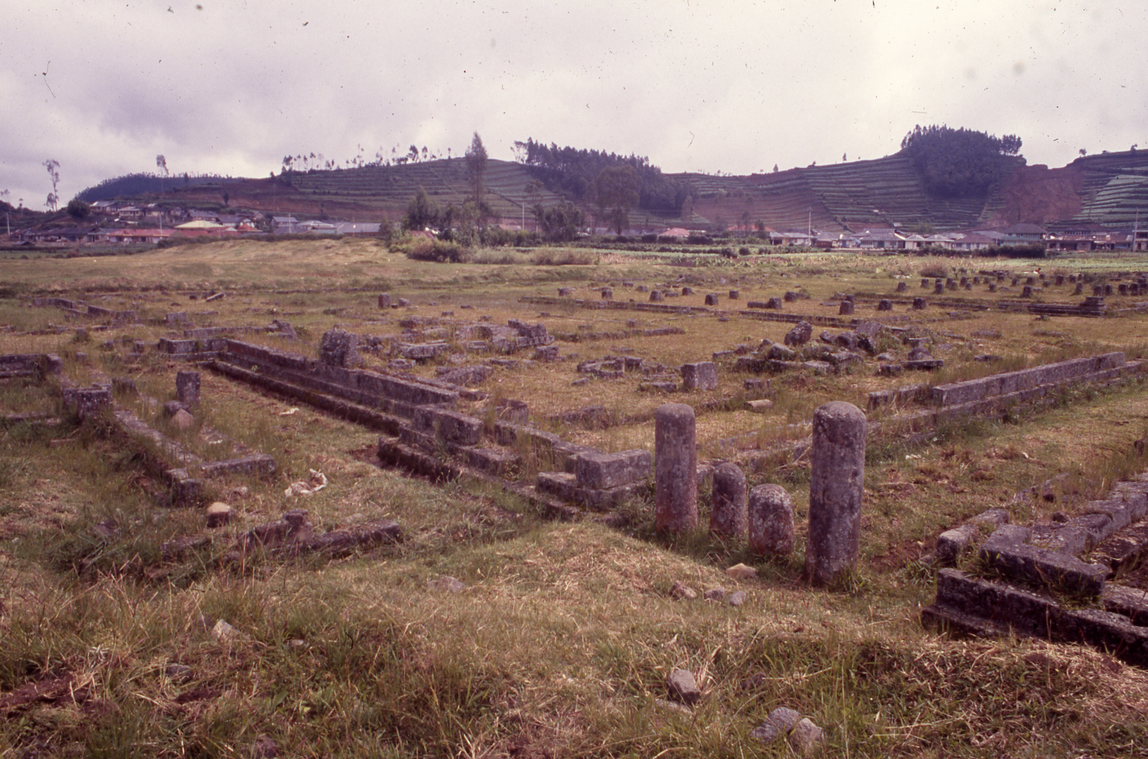
The area northwest of the Arjuna group near Candi Setyaki appears to have been crowded with many wooden buildings, of which extensive stone foundations still remain. They seem to have been open-sided pavilions or pendopo, to judge from the low stone walls forming bases for raised platforms, staircases which provided access to the platforms, and stone bases probably built to support wooden pillars for the roofs. Cornelis mentions two long rows of small structures, 208 in one row, 105 in the other, partly submerged in the lake which then covered the valley floor. Krom (1923: 199-200) mentioned an excavation in his time which revealed the foundation of a structure more than 90m long and 60 m wide, divided into two rows of small rooms, with subsidiary structures. He likened the complex to a cloister with numerous cells, or a hospice.
The summits of nearby mountains also bore sanctuaries; on Mt. Panggongan, many squared stones and two inscriptions were found, and on Mt. Perahu, two ruined structures and a gold plate with incised Nandi and footprints carved in stone (perhaps associated with Viṣṇu) were discovered (Krom 1923: 201).
The plateau was linked to the lowlands by two staircases carved into the bedrock of the mountains. They were flanked by a balustrade about 30 cm high on each side. They were discovered and recorded between 1860 and 1870 (van Goor 1922: 22). From the north the road ascended from Bawang in Pekalongan via Deles and Segemplong to the plateau via Mt. Kendang. From the south the road began at Mt. Tawang 9 km south of Wonosobo, through Wonosobo, Mungang and Kalibeber to Kalilawang, from whence it ascended a steep slope to Ngadiluwih, where it branched into two paths; one on the right ran over Sitrus and entered the valley at Telaga Warna, whereas the other detoured via Lobang. The Lobang-Dieng portion has not yet been traced; this spur may have terminated at Lobang.
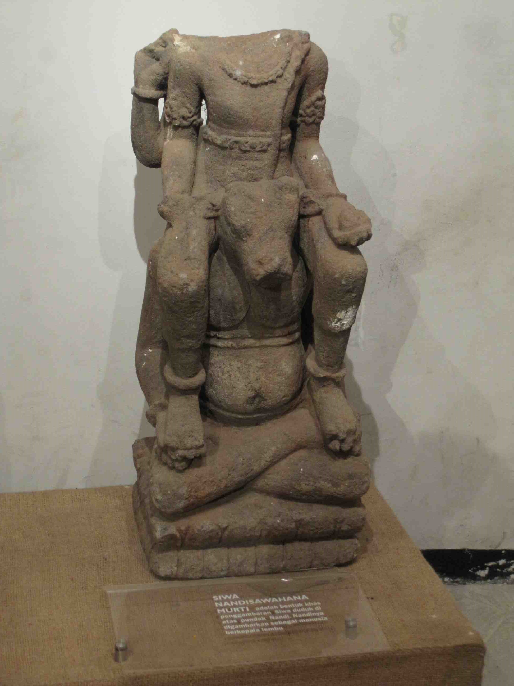
Statuary found at Dieng is entirely derived from the Hindu pantheon. It includes Śiva, Parvati, Durga, Ganesha, Brahma, and Viṣṇu, as well as bearded ascetics. Its depictions are idiosyncratic in ways indicative of an early phase of development which deviate significantly from Indian statuary. For example, deities such as Nandi are depicted as a human with a cow’s head. There is however evidence that Candi Bima was altered at some point, perhaps in the early 9th century, when an octagonal base was added and doorways were completely changed, perhaps to accommodate Buddhist iconography (Dumarçay 2003: 35). Excavations at the site of Selomerto, about 40 km south of Dieng, have revealed the foundations of a very large Buddhist sanctuary of the 9th century (Djoko Dwiyanto 1984).
Aside from inscriptions which are useful for determining the chronology of the buildings in the Dieng temple complex, several earlier research studies found non-structural remains such as a round footed pot discovered above a foundation behind Candi Puntadewa. Other finds are a bronze kettledrum, bronze bowl, and gold fragment. The bronze kettledrum was found in the vicinity of Candi Puntadewa. The bronze bowl and gold fragment were found inside Candi Dwarawati (Subroto 1984:38).
Other finds from previous excavations are statues which formed parts of temples. Many of these statues are now stored in the Dieng site museum. Among the above-mentioned finds were a variety of kala heads: a type without a lower jaw; a lion-like face without lower jaw; and a group of kala with lion face and with lower jaw (Subroto 1984: 58). Images of Śiva Mahaguru, “the great teacher”, are common in the Dieng region (Lopez 2003).
The chronology of the Dieng temple complex was still a major issue for researchers in the 1980s. Data used to support their interpretations mainly consists of inscriptions, buildings, and statuary. Ceramic finds at Dieng temple complex have never been a focus of attention as supporting evidence for researchers in their interpretation of the chronology of the Dieng temple complex.
In 1979 Candi Gatotkaca was restored by the Indonesian government. In 1983 an excavation was carried out near Candi Gatotkaca by participants in an ASEAN workshop (Adi Haji Taha, Fernandez, Shiranan, and Otti Mundardjito 1983). The excavation focused on the chronology of the monument. While the report of the workshop advocated that more attention be paid to Chinese ceramics as a means of dating their construction, no ceramics were mentioned as having been found in the excavation.
In the late 1990s and early 2000s, when the concept of Cultural Resource Management was becoming increasingly recognized in Indonesia, the temple complex was studied in conjunction with plans for regional development. In 2007, several test pits were dug in the Candi Dieng complex in connection with the government’s intention to develop Dieng as a tourist destination. Plans were made to construct physical facilities to facilitate the preservation of the Dieng temple complex. Locations of surveys and test pits were as follows:
- The area between Candi Gatotkaca and Balekambang from 29 October-2 November 2007 (50m from Balekambang and 48m below Candi Gatotkaca; unpublished report of BP3 Jateng 2003: 3). The survey yielded several candi stones, as did three test pits each of which measured 2x2m. No ceramic sherds were found in test pits 1, 3, or 4. The only exception was the two ceramic sherds in test pit 2 (Lambang Babar Purnomo 2007: 6-10).
- Near Balekambang from 3-7 November 2007. Three test pit units were dug. No candi stones or ceramic sherds were found in the three units.
- The empty zone area B (Arjuna and Gatotkaca group) near which a footpath was built to connect Candi Arjuna complex, Bale Kambang, Candi Gatotkaca, and the Museum Complex. Three units were dug: b’87, b’97, and b’107. In these three units, candi stones were found, but not in the context of any structure, and no ceramics were reported (Lambang Babar Purnomo 2007: 5-6).
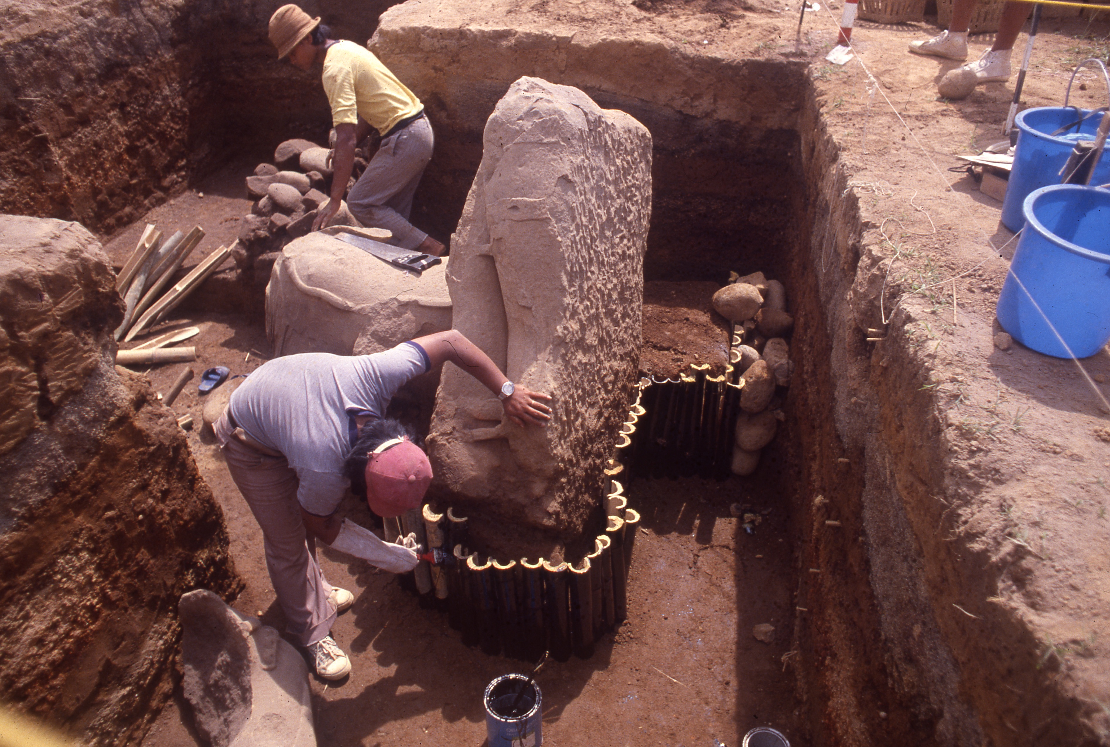
The Archaeology Department, Faculty of Social Sciences, UGM, Southeast Asian Studies Programme, NUS, and the School of Humanities and Social Sciences, NTU, carried out collaborative research in the Dieng complex from June 1-12, 2010. The reasons for the decision to undertake this project are as follows.
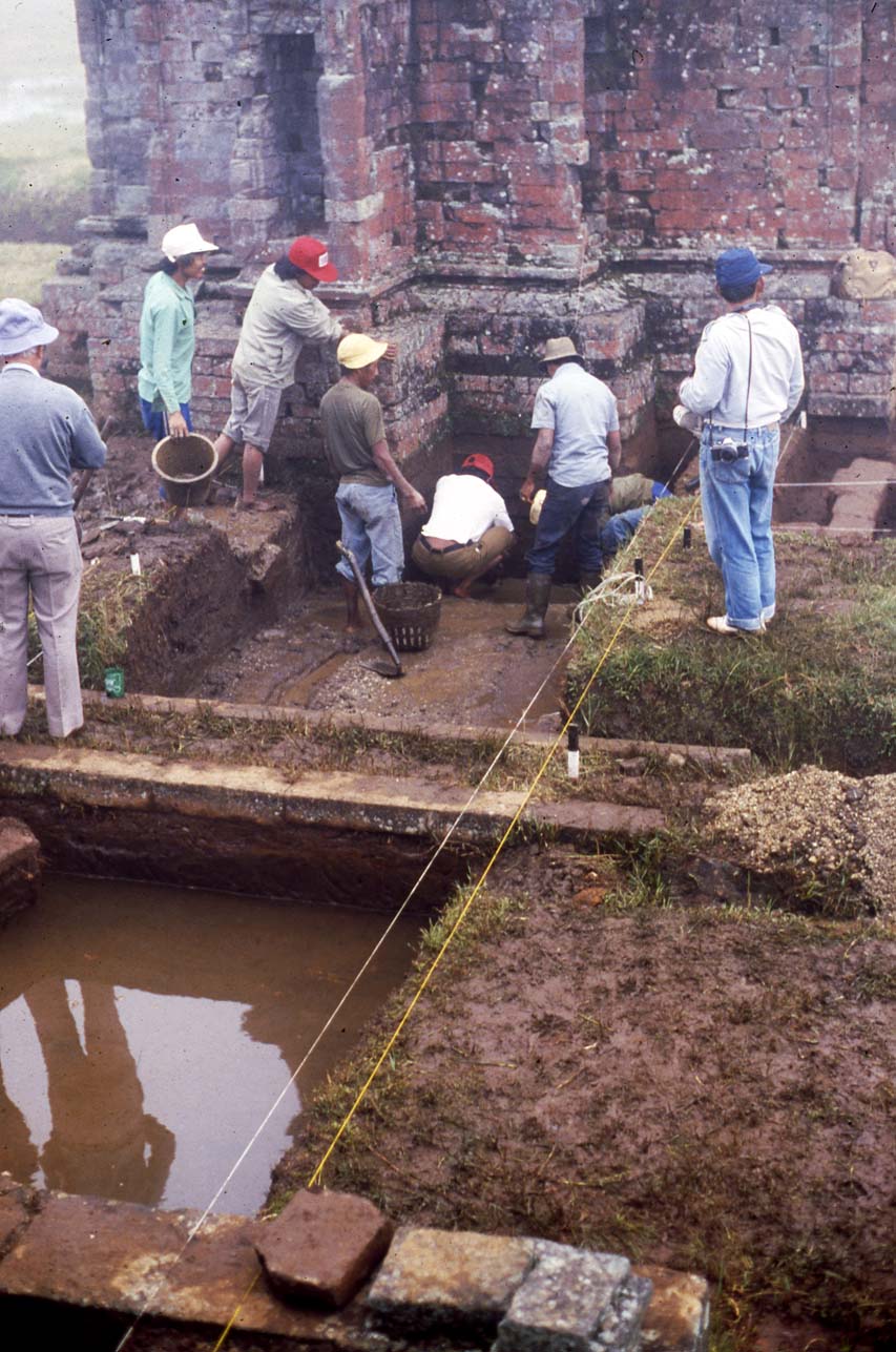
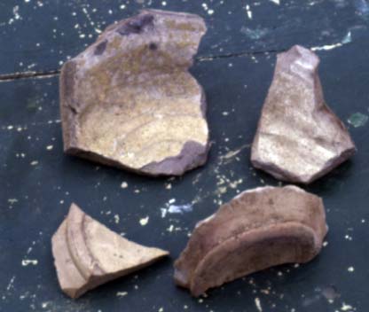
During the construction of a raised walkway across a swampy area (probably a former lake) to enable tourists to walk from the Arjuna group of temples to the site museum in 1982, earth was excavated from the slope of the hill between the Arjuna and Gatotkaca temples to serve as fill. The excavated earth proved to contain sherds of pottery, both Javanese and Chinese, of the Tang Dynasty (principally of the 9th century). Survey of the area around the Arjuna group at that time revealed fragments of Changsha ware, a Chinese glazed pottery type made for export in the 9th century; the same type has been discovered on the Belitung shipwreck off southeast Sumatra, around the Buddhist temple of Sojiwan and on the Ratu Boko plateau near Yogyakarta, and along sites in the north-central coastal area of Java (van Orsoy de Flines 1941-47)
The profiles of the pit from which the soil for the causeway had been excavated displayed a clearly-defined layer of habitation remains, in the form of a dark soil stratum containing much charcoal and sherds of pottery, including Tang glazed ware and unglazed local earthenware. Sherds recovered were given to the local archaeological office.
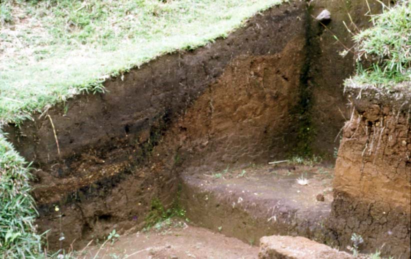
A reconnaissance of the site in July 2009 indicated that the area where the profile of the pit was exposed in 1982 was still undisturbed. Vegetation had grown back over the area, and the vertical face had partially collapsed and eroded, but otherwise the soil in the vicinity seemed to have been preserved intact.
A team led by archaeologists from the Central Java Office for the Preservation of Antiquities and the Department of Archaeology, Universitas Gajah Mada, proposed to conduct a systematic test excavation of this site. The objectives of the excavation were:
- to confirm the existence of a layer of 9th-century deposition at this location;
- to attempt to establish its approximate extent;
- to recover a sample of artifacts with which to reconstruct the nature of activity at this location;
- to test the hypothesis that this site represents the remains of a monastery or other religious dwelling;
- to compile a report on the finds and their significance.
The test excavation was to begin by locating and clearing the profile first revealed in 1982. This profile could then be expanded by excavating 2x2 meter squares on the west and south faces. Assuming that the 9th-century layer continued in both directions, other squares of the same dimensions would be laid out 5 meters south and 5 meters west of the first two squares. If these are sterile, then the intervening area would be investigated further to recover more artifacts, the extent of the additional excavations to be determined by the availability of time and funds.
One hypothesis which the research project wanted to test was that early Chinese ceramics had reached the Dieng complex, especially during the Tang dynasty. Chinese ceramics from the 8th-9th century including Dusun jars and Changsha kendis have been found at Candi Plaosan and Prambanan, but these were never the focus of research, and so their significance has not been explored. If the variety and total quantity of foreign ceramics from the above-mentioned period were numerous, this would strengthen the evidence that by this period, Java had become an important destination for Chinese products.
The Belitung/Batu Hitam Shipwreck
This research objective was stimulated in part by the discovery of a ninth-century shipwreck off Belitung, Indonesia, in 1999, and the subsequent assumption that the ship was destined for Oman or another port in the Persian Gulf, despite its location far from the normal shipping route from China to the Indian Ocean. By the ninth century, if not earlier, foreign ships had begun to sail within Southeast Asian waters. A shipwreck site discovered in the Gelasa Strait between Bangka and Belitung Island, Indonesia, in 1998, contained a rich cargo of Chinese products from the early ninth century. The ship, sometimes called the Batu Hitam, probably sank between 830 and 840 (Wilson and Flecker 2010). Coins on the ship date from the period between 758-845 CE. Carbon dates range from 680-890 CE. The most likely date for ship’s demise is around 835 CE.
The ship’s precise origin cannot be determined, but details of its construction suggest that it was built in the Persian Gulf (Flecker 2000). Besides a large quantity of Chinese ceramics, the ship carried precious metals, including gold artifacts of imperial quality, as well as silver ingots. It is logical to conclude that the ship had called at a port or ports in China or Southeast Asia where a large quantity of high-value Chinese goods was loaded on board. The Southeast Asian artifacts aboard the ship indicate that its crew may have included Southeast Asians; no items which might have belonged to a crewman from the Indian Ocean were found on the wreck (Wilson and Flecker 2010: 40). Southeast Asian items include a gold coin of the piloncito type, a stone mortar and pestle, a flat grinding stone, and a pair of scales for weighing small items. The ship seems to have been old; it had been refitted, with new lashings and wadding between its planks made from material found in the Singapore area: Melaleuca (paperbark). The twine for the lashings holding the planks together may be Hibiscus tiliaceus, one of the most common plants used by Malays and Indonesians for making twine (Flecker 2008). Chinese ships going to Ta-shih (Arab lands) in the twelfth century often repaired their ships in Palembang (Wolters 1983: 55); these materials would certainly have been available there.
Many sherds of Chinese and Arabic pottery and glass from the ninth century have been discovered at sites on both sides of the isthmian region of the Malay Peninsula, such as Takuapa and Laem Pho, and at Barus, northwest Sumatra. These archaeological sites as well as historical data prove that the Isthmus of Kra was a common meeting point for ships from China and the Persian Gulf. It is possible that the Batu Hitam ship had been to China, but it could also have picked up the cargo at an intermediate port on the east side of the isthmus, in the area of Patani or Chaiya for example.
Where was the ship bound? One theory is that it was returning to the western Indian Ocean, possibly to Oman (Guy 2001-2002: 25). The shipwreck’s location however shows that it was not going through the Straits of Melaka, which would have been the normal route to the Indian Ocean from the South China Sea. If the ship were heading for the Indian Ocean, she would have had to enter it via the Sunda Strait between Sumatra and Java. There is “no reliable evidence that the Sunda Straits were ever used in early times” (Wolters 1967: 267 note 4); this route is dangerous because it involves sailing up the west coast of Sumatra, exposing ships to violent storms coming from the Indian Ocean and numerous reefs, rocks, and shoals, with few harbours, whereas the north end of the Straits of Melaka was well-known to Indian Ocean sailors.
The location where the Batu Hitam sank is located on a very popular sailing route from the South China Sea to Java. The evidence seems to point clearly to the conclusion that the cargo of the Batu Hitam comprised Chinese imperial gifts sent in response to a Javanese diplomatic mission. The quality of the artifacts in the site is unprecedented for any previous site of this period, on land or under the sea. This was the period of the great Javanese kingdom of Mataram which constructed such major monuments as Borobudur. Javanese society was at the peak of its ancient glory when the ship sank.
The assumption that the Batu Hitam was on the way to Oman when it became lost and sank, coincidentally on the route to Java, is based on the idea that the Chinese were much more anxious to impress the Arabs than the Javanese. It is sometimes asserted that a particular painted pattern on the interiors of some of the Chinese bowls on the Batu Hitam is meant to represent the word Allah, in order to cater to a Muslim market. A Chinese scholar however notes that this “pseudo-calligraphy” is actually a Chinese design meant to represent mountains and clouds (Liu 2010: 153).
Foreign merchants, including many Arabs and Persians, were massacred at Guangzhou in the early ninth century, when the Tang dynasty was in decline. As a result, Muslims from Siraf and Oman “continually sailed to Kalah and Zabag [Sumatra/Java]” (Sastri 1949: 71, quoting al- Mas’udi in a source dated 943 CE). It is therefore improbable that the Belitung dhow went to China. The cargo may well have been picked up at an intermediate point in the Malay Peninsula. A country named Shepo first appeared in Chinese records of the fifth century. The Chinese used this transcription to record diplomatic missions from Java. Foreign merchants, including many Arabs and Persians, were massacred at Guangzhou in the early ninth century, when the Tang dynasty was in decline. As a result, Muslims from Siraf and Oman “continually sailed to Kalah [the Isthmus of Kra region] and Zabag [Sumatra/Java]” (Sastri 1949: 71, quoting al- Mas’udi in a source dated 943 CE).
A country named Shepo appeared in Chinese records of the fifth century. The Chinese used this transcription for diplomatic missions from Java. Shepo sent 6 embassies to Chang ’an between 813 and 839 (Louis 2010). The frequency of missions indicates that the two kingdoms had close diplomatic ties. The Chinese would have reciprocated the gifts of the Javanese envoys with their own products. This is precisely the period during which Arabs and Persians would have steered clear of China. They would instead have met in the region of the Isthmus of Kra, Sumatra, or Java. According to one scholar, “The overwhelming predominance on the wreck of Changsha ware in relation to other wares is certainly not reflected in finds from Near Eastern sites and may suggest that part of this cargo was meant to be off-loaded somewhere on the way (Krahl 2010: 187).
The excavation on the Dieng plateau had the potential to dispel the misconception that the Belitung cargo could not have been intended for Java. The discovery of Chinese sherds from the Tang period of the same types as were found on the Belitung cargo would demonstrate that such ceramics were in fact exported to Java, and that Java was therefore in a perfect position to receive a highly valuable cargo as a sign of the respect with which Java was viewed in China in the early ninth century.