
Description of the Site and Excavation Procedure
This excavation was conducted at the Fort Canning Spice Garden, an area set aside by the Fort Canning Park administration for displays of plants related to the location of Singapore’s first botanic garden in the 1820s. This garden was intended as an experimental plot devoted to plants such as clove and nutmeg. It was located near the first cemetery established in Singapore. After the construction of Fort Canning in 1858, it fell within the jurisdiction of the British military. No major buildings appear to have been built there during the colonial period.
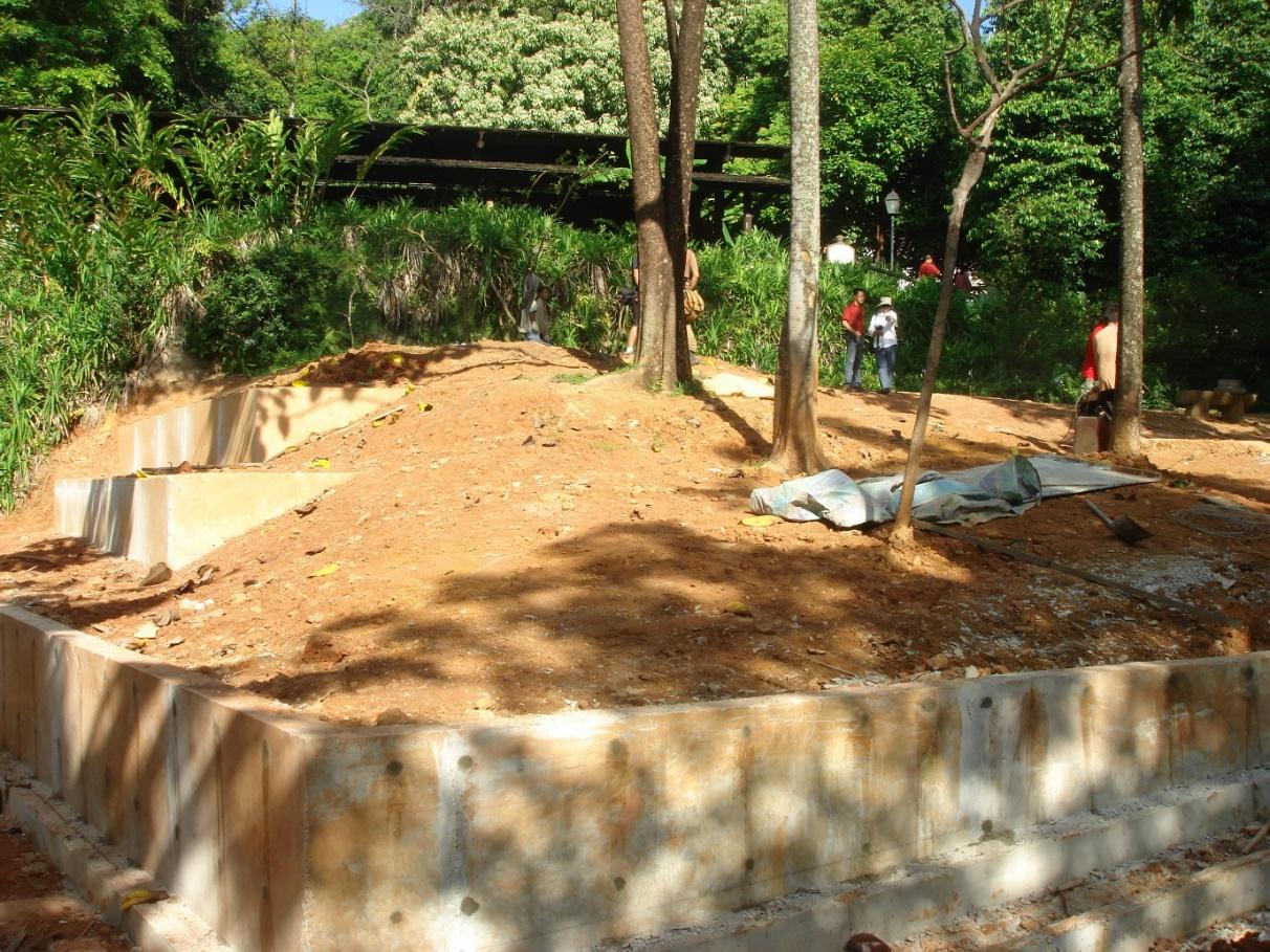
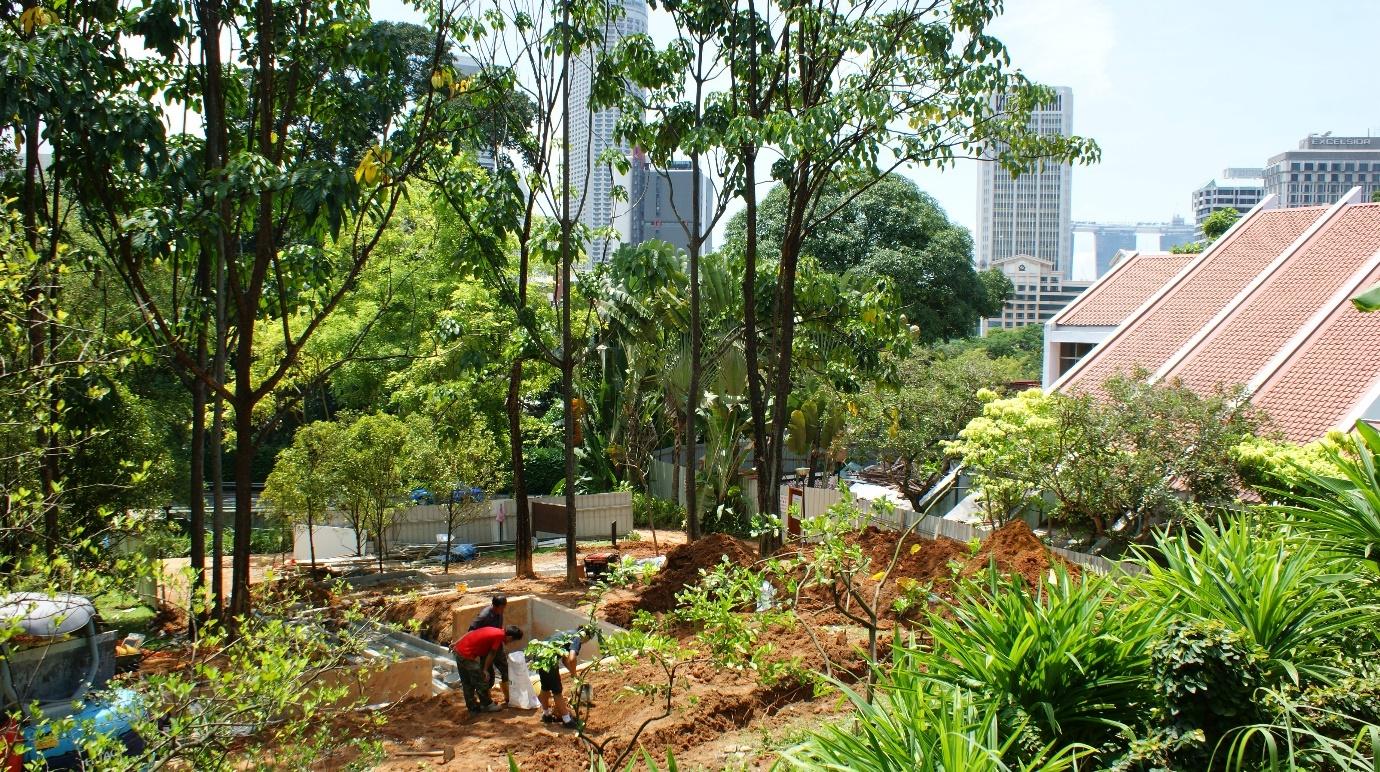
The excavation site is now flanked by the Registry of Marriage on its south side, the Fort Green to its north, Canning Rise to its east, and the Keramat Iskandar Shah and the Fort Canning Archaeological Dig site (now called “Artisan’s Garden”) on the west. The Primary Investigators (PIs; the authors of this report), Goh Geok Yian and John Miksic, were invited by the National Parks Board (NParks) in April 2010 to conduct a quick assessment of the site at the Fort Canning Spice Garden location to determine whether there was any evidence of 14th-century remains in situ. The Spice Garden location had been identified as a location where a ramp was to be constructed to provide access to the hill and its attractions such as the archaeological dig site for the handicapped.
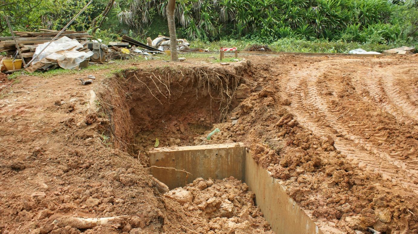
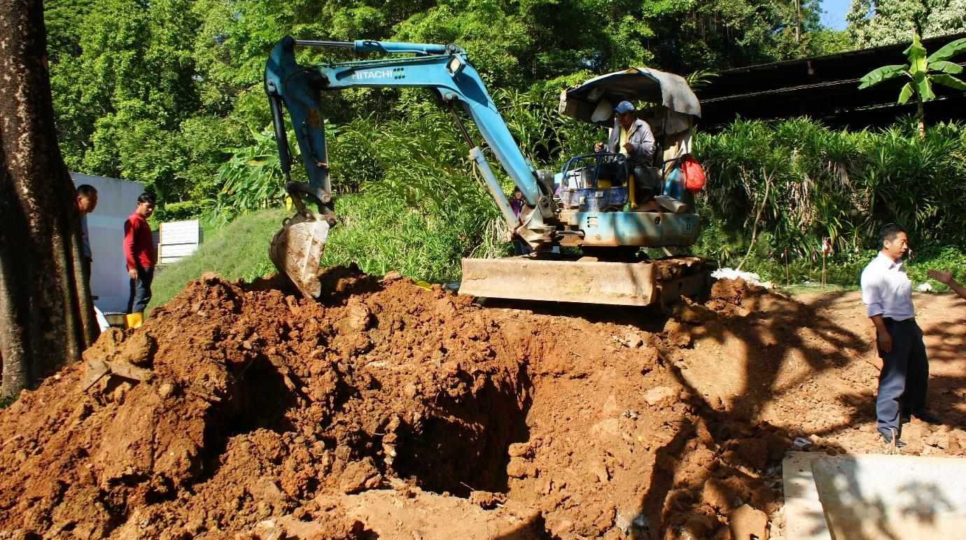
During the preliminary phase of the ramp’s construction, the profile of the hillside was exposed by a trench dug into the hill with a mechanical digger. This trench revealed a soil profile which indicated the presence of an undisturbed 14th-century soil layer (see Figures 4 and 5). John Miksic extricated a few 14th-century artifacts exposed in the layer. Following this confirmation that the site possessed archaeological potential, NParks and the two PIs agreed that an archaeological excavation should be undertaken. The initial layout of the excavation was conducted on the same day, April 7, 2010.
Excavation Procedure
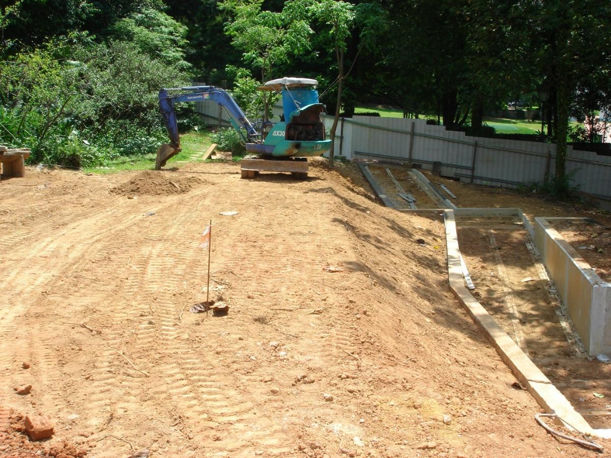
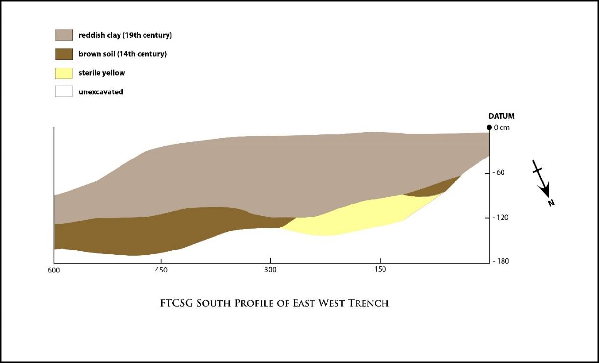
A backhoe provided by the contractor for NParks dug two trenches, one oriented east-west (EW) and the other north-south (NS) approximately 30 cm wide and 10 m long (see Figure 8). The NS trench was oriented about 10–20 degrees NE. The EW trench showed that the 14th-century layer was thicker on the downhill slope and tapered to a thin strip, then widened on the uphill side. A stratigraphic profile of this trench indicated the presence of an ancient terrace (14th-century) (see Figure 9).
The 14th-century layer was a thin layer ranging from 20cm to 40–60cm below the modern surface. It was decided that the archaeological team should proceed to excavate the site by hand using a combination of cangkul, beliung, and trowels.
The topsoil was excavated to reveal the 19th-century layer using a combination of cangkul and trowels. Once the 14th-century layer was revealed, the layer was excavated by spits (arbitrary 10 cm layers: 0–10cm = Spit 1, 11–20cm = Spit 2) using trowels for the most part except when fragile artifacts were revealed; ice-picks or dental picks were then used to dislodge the artifacts. All artifacts excavated in a single spit were bagged and tagged. The tags contained information such as the date of excavation, square unit, lot, and spit, as well as remarks on the artifacts and the excavator’s name. A logbook was kept that contained information on the work carried out and completed each day, such as whether the excavators had completed excavating a spit.
Excavation Site Plan
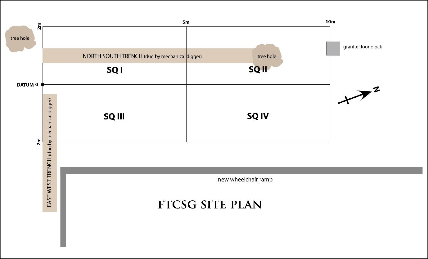
The diagram below shows the Fort Canning Spice Garden site plan with its four excavation units: Squares I–IV. Each unit measured 2 x 5 m. In all, 40 m2 were excavated.
Excavation Units
Two of the excavation units: Squares I and II were laid out on April 8, 2010. The excavation was further extended to Squares III and IV subsequently on April 23, 2010 following confirmation from NParks that the excavation deadline had been extended.
Description of soil layers at the FTCSG site
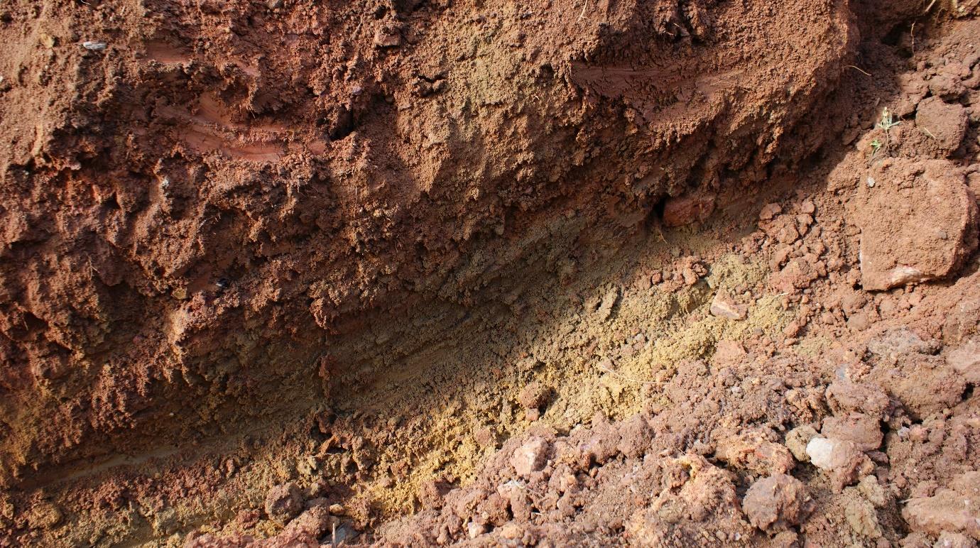
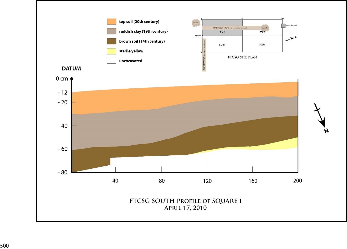
The stratigraphy at the FTCSG site comprised four layers: topsoil (20th-century humus layer), reddish-clay layer (19th-century) consisting of a mixture of compact red clay, rocks, and stones; a brown-colored soil layer of compact clay and soil (14th-century); and a yellow compact soil layer which is sterile (pre-14th-century). No human activity was detected on the site prior to the 14th century.
East–West Trench
The EW trench diagram shows three distinct layers: reddish clay 19th-century layer, brown soil 14th-century layer, and yellow sterile layer. The topsoil layer had been removed earlier.
Square I
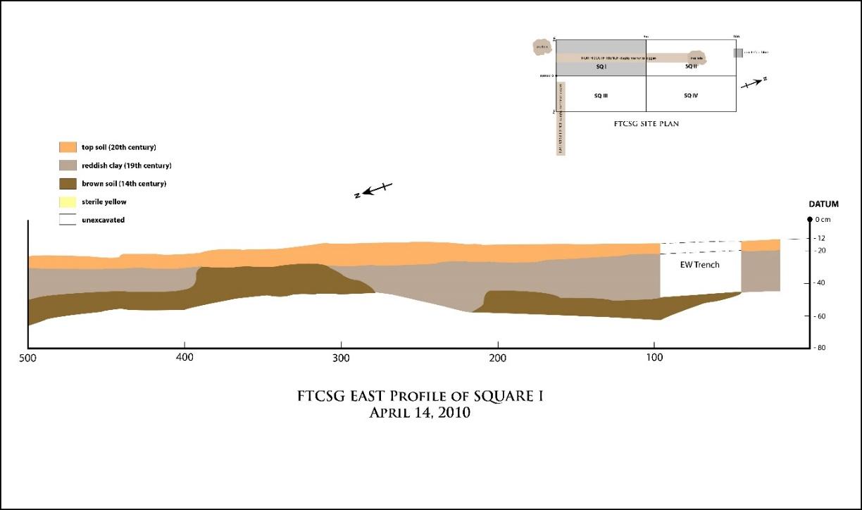
The east profile of Square I clearly indicates the uneven surface area of Fort Canning Hill. The gap in the middle of the profile of the unit also reveals the presence of a feature, flanked by deposit layers on both sides containing 14th-century soil and artifacts. Upon further excavation, the feature was hypothesized to have formed part of a footpath which would have been used as one of the routes by which people could have gained access to the terraces on the upper slope of Fort Canning Hill in the 14th century. Fort Canning Hill was described in a 14th-century account by Chinese merchant traveller, Wang Dayuan, as “similar to a convoluted coil and inhabitants lived on the encircling connected terraces” (see Miksic 2013: 177).
The above image shows the angle of the slope of the terrace where the FTCSG site is located during different periods.
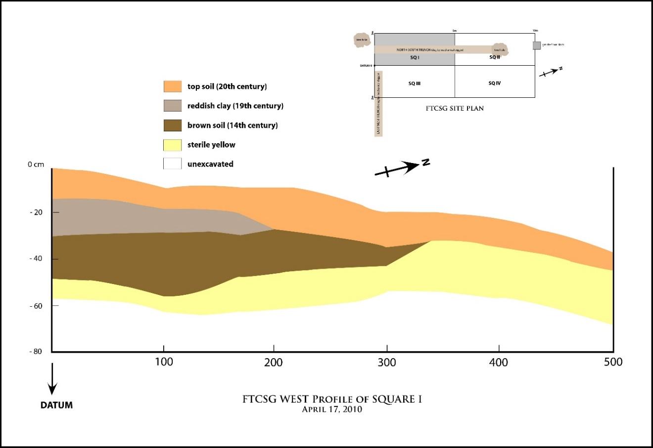
This diagram shows the west side of Square I, indicating the continuation of the hypothesized footpath which was first noted in Figure 10. See Figure 31 for the site plan and the bird’s-eye view of the hypothesized footpath.
Square II
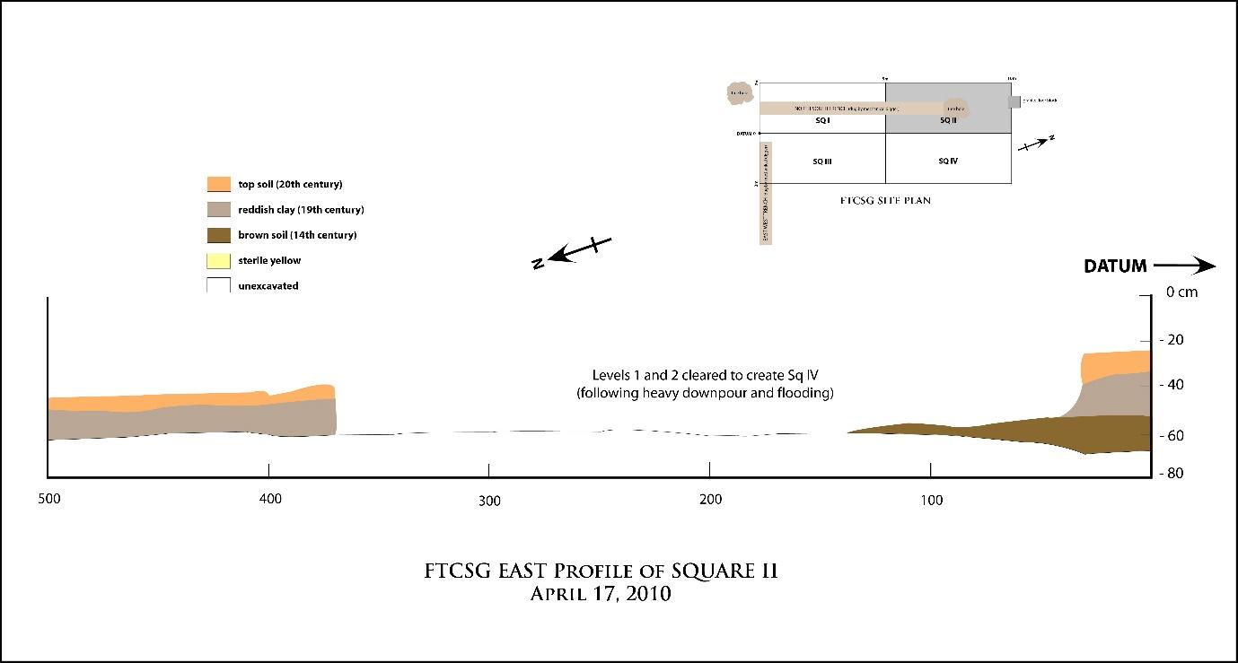
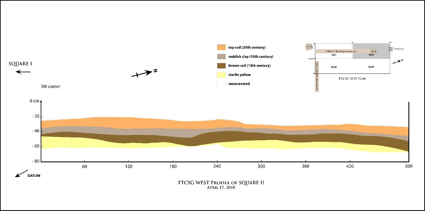
Both the west and east profiles of Square II show the relatively thin layer of the 14th-century period. Few artifacts were excavated from this unit.