Summary of the Site: Finds and Stratigraphy
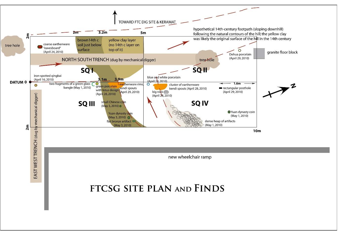
The figure below summarizes some of the unique finds excavated. It also presents an interpretation of the function of the site: a hypothesized 14th-century footpath with depressions resembling ditches on either side of the path, contemporaneous with the workshop located at the Fort Canning Dig Site approximately 20 m to the west, as well as for accessing other sites on Bukit Larangan (Fort Canning Hill). This proposed function of the site is based on two sets of data: 1) the stratigraphic profiles (see Figures 10 and 12), and 2) the distribution of artifacts (see Figure 31) strewn on the two sides of a sterile zone interpreted as the footpath.